Old Maps of Grant County, Kentucky
Explore 98 old maps of Grant County, spanning from 1930 to today. These high-resolution historic maps reveal how streets, neighborhoods, landmarks, and natural features evolved over time — perfect for genealogy, metal detecting, research, and local history exploration.
What you can do with these maps:
- See how Grant County changed over time: Compare historical maps to modern-day views to trace roads, homesites, rail lines & more.
- View detailed metadata: Each map includes creators, publishers, year, scale, and archive source.
- Overlay maps with satellite & LiDAR: Visualize the past alongside modern tools to explore terrain & human change.
- Trusted historical sources: Maps sourced from the USGS, Library of Congress, and other archives.
- Access maps your way: View online, download high-res files, or order prints for personal or research use.
Start exploring old maps of Grant County to uncover forgotten places, hidden landmarks, and the deep history beneath your feet.
Grant County, KY maps
(98)- 1930 Map of Falmouth
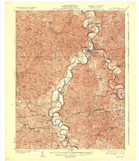
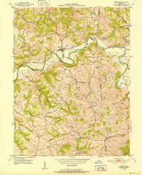
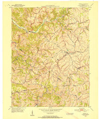
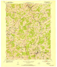
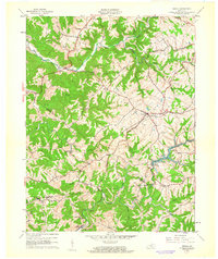
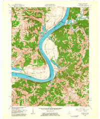
 1930 Falmouth1930 Print · USGSPendleton and Harrison counties are shown here in the early thirties, centered on the river-and-rail hub of Falmouth. Genealogists and historians can locate dozens of country institutions like Bunker Hill Sch, Mt Carmel Ch, and the riverside station at Catawba.
 - 1936 Map of Falmouth
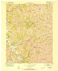
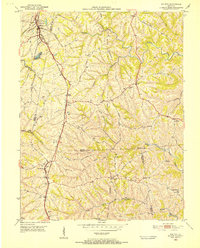
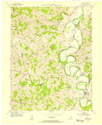
 1936 Falmouth1936 Print · USGSPendleton and Harrison counties come to life in this mid-depression era survey of the Licking River valley. Genealogists can trace family footprints across a landscape dotted with dozens of rural landmarks like Beagle Sch, Morgan, and Mt Carmel Ch.2 unique versions available
 - 1939 Map of Sadieville
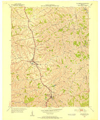
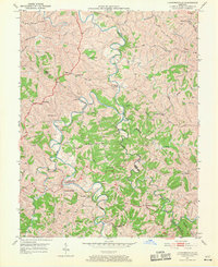
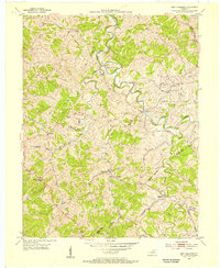
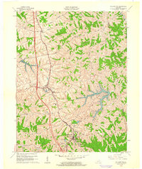
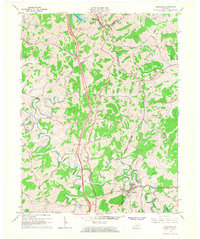
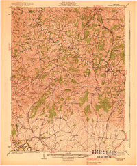 1939 Sadieville1939 Print · USGSScott and Owen Counties are captured in the late 1930s as agricultural life centered on the Southern Railway and a dense network of country schools. Genealogists can locate family landmarks like Stamping Ground, Burroak Sch, and the Pleasant Hill Ch.2 unique versions available
 - 1943 Map of Patriot
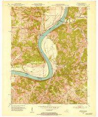
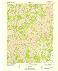
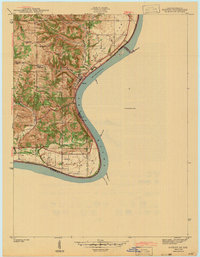 1943 Patriot1943 Print · USGSThe river town of Patriot and the winding Indiana shoreline appear here as they were in the early 1940s. Genealogists can trace family names through several rural landmarks, including Mc Nutt Cem, Wigal Cem, and Concord Ch.
 - 1950 Map of Mason, 1952 Print
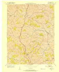 1950 Mason1952 Print · USGSThe Southern Railway and Dixie Highway corridor defines this mid-century look at Grant County. Genealogists can trace family names at Clark Cem and Morgan Cem or locate old community centers like Mason Sch and Mt Olivet Ch.
 - 1950 Map of Glencoe, 1952 Print
 1950 Glencoe1952 Print · USGSThe rural borders of Gallatin, Owen, and Grant Counties come alive in the early fifties, centered on the railroad hub of Glencoe. Genealogists can trace family roots through numerous local sites like the I O O F Cem, Slab Lick Sch, and Pleasant Home Ch.2 unique versions available
 - 1950 Map of Elliston, 1952 Print
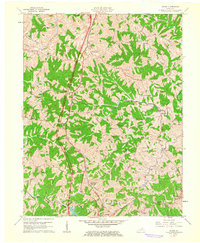
 1950 Elliston1952 Print · USGSGrant County is captured in the early fifties, a landscape of winding creek valleys and isolated northern Kentucky hamlets. Researchers can trace rural lineages through family-named sites like Sipple Cem, visit old church sites at Vine Run Ch, and locate fords like Eagle Mill Ford.2 unique versions available
 - 1950 Map of Williamstown, 1952 Print
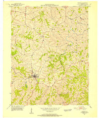
 1950 Williamstown1952 Print · USGSGrant County is captured in the early fifties as the rural landscape began to transition around established transit hubs. Genealogists can trace family names through numerous hilltop burial sites like Dickerson Cem and McGuinnis Cem or explore the settlements of Dry Ridge and Sherman.
 - 1950 Map of Owenton, 1952 Print
 1950 Owenton1952 Print · USGSMid-century Owen County is a landscape of ridge-top settlements and deep creek valleys during the height of its rural post-war era. Genealogists can trace family lines through numerous landmarks like the Duvall and Steger Cem, Sweet Owen, and Mt Carmel Ch.4 unique versions available
 - 1950 Map of Verona, 1952 Print
 1950 Verona1952 Print · USGSNorthern Kentucky’s rolling hills come alive in this mid-century survey, showcasing the rural intersections where Boone, Gallatin, and Grant Counties meet. Genealogists can trace family names at St Patricks Cem or locate the old rail-stop at Zion Station.
 - 1950 Map of Walton, 1952 Print
 1950 Walton1952 Print · USGSNorthern Kentucky's rail-dependent landscape is captured here at mid-century, centered on the busy junction at Walton. Genealogists can trace family heritage through dozens of small burial grounds like Cook-Smith Cem and Grayson Cem or rural stops at Bracht Station.
 - 1950 Map of Lawrenceville, 1970 Print
 1950 Lawrenceville1970 Print · USGSThe Grant and Owen County line follows the deep meanders of the river in the 1950s. Genealogists can trace family landmarks and rural life at Lusbys Mill, the Lingenfelter Cemetery, and small country congregations like Musselshoals Church.
 - 1951 Map of Patriot, 1953 Print
 1951 Patriot1953 Print · USGSThe Indiana-Kentucky border along the Ohio River is captured here in the early fifties, showing a landscape of fertile river bottoms and upland farms. Genealogists can trace family roots at Patriot or locate rural landmarks like Searcy Crossroads, Concord Ch, and McNutt Cem.
 - 1953 Map of Sadieville, 1954 Print
 1953 Sadieville1954 Print · USGSNorthern Scott County during the early 1950s was a landscape of deep creek valleys and ridgeline roads centered on the Southern rail line. Researchers can locate family landmarks such as Odd Fellows Cem and rural centers like Stonewall or Hinton.
 - 1953 Map of Berry, 1955 Print
 1953 Berry1955 Print · USGSHarrison and Pendleton counties come alive in the 1950s as the river and rail lines shape local life. Researchers can trace the winding South Fork Licking River to find riverside stops at Morgan, Boyd, and the church at Boyer Ch.
 - 1953 Map of New Columbus, 1955 Print
 1953 New Columbus1955 Print · USGSOwen County in the early fifties is mapped here in detail, showing a landscape defined by the winding Eagle Creek and rural hamlets. Researchers can trace family history through numerous remote sites like Hudson Abbot Cem, New Columbus, and Caney Creek Ch.3 unique versions available
 - 1953 Map of Goforth, 1955 Print
 1953 Goforth1955 Print · USGSPendleton and Grant counties in the early fifties reveal a landscape defined by small ridge-top settlements and creek-bottom farms. Genealogists can trace family footprints through numerous sites like Mt Moriah Ch, Portland Sch, and McMillan Cem.2 unique versions available
 - 1956 Map of Louisville, 1971 Print
 1956 Louisville1971 Print · USGSThe Ohio River valley and the Kentucky Bluegrass are captured here during a period of rapid mid-century growth and industrial activity. Genealogists and historians can trace rail-centered towns and military land use at Fort Knox and the Jefferson Proving Ground.2 unique versions available
 - 1961 Map of Verona, 1962 Print
 1961 Verona1962 Print · USGSNorthern Kentucky's ridge-and-hollow farm country is captured here in the early sixties as the railroad era still shaped local life. Genealogists and historians can trace family land via Powers Cem, St Patricks Cem, and the old rail siding at Zion Station.
 - 1961 Map of Williamstown, 1962 Print
 1961 Williamstown1962 Print · USGSGrant County is captured in the early sixties as the landscape around Williamstown and Dry Ridge began to modernize. Researchers can trace family history through numerous rural burial sites like Baton Rouge Cem and Day Cem, or follow the path of the Southern railroad.2 unique versions available
 - 1961 Map of Walton, 1962 Print
 1961 Walton1962 Print · USGSNorthern Kentucky's ridge-and-hollow farming country is captured here in the early sixties at the junction of three counties. Genealogists can trace family lines through numerous rural burial sites like Byland Cem and Fishback Cem or locate the community hubs of Piner and Crittenden.2 unique versions available
 - 1961 Map of Mason, 1962 Print
 1961 Mason1962 Print · USGSThis rural portion of northern Kentucky was documented just as the modern interstate era began to reach its hills and hollows. Genealogists and historians can trace family ties through numerous landmarks like the Mason Sch, Cordova, and the Clark Cem.2 unique versions available
 - 1961 Map of Patriot, 1963 Print
 1961 Patriot1963 Print · USGSThe Ohio River oxbow between Indiana and Kentucky is documented here in the early 1960s, showing the fertile bottomlands and rural ridge settlements. Genealogists can locate numerous family burial sites such as Warner Cem and Conley Cem, or trace early congregations at Concord Ch.
 - 1964 Map of Louisville
 1964 Louisville1964 Print · USGSThe Ohio River valley and Kentucky Bluegrass are captured in the mid-1960s, showing a region balanced between industrial growth and its agrarian roots. Genealogists and historians can trace the development of county seats like Shelbyville and Paris, or locate established institutions such as Georgetown College and Bernheim Forest.
 - 1965 Map of Sadieville, 1966 Print
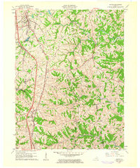
 1965 Sadieville1966 Print · USGSNorth Central Kentucky sits at a crossroads in the mid-sixties as the newly built Interstate 75 carves through the rural landscape. Researchers can trace historic family sites and early infrastructure including the Southern Railway, Zion Hill Ch, and Sadieville.2 unique versions available
Showing maps 1-25 of 98
Top cities of Grant County
Frequently asked questions
- What are the different types of historical maps available for Grant County?
- What is the oldest map of Grant County?
- Where can I purchase historical maps of Grant County for my home or office?
- Where can I download high-res historical maps of Grant County?
- Are there historical topographic maps available for Grant County?
- Is there historical aerial imagery available for Grant County?
- Where are historical maps of Grant County sourced from?