Old Maps of Moutardier, Kentucky for Hiking & Exploration
Hike through history with 12 historic maps of Moutardier. Explore old trails, ghost towns, and forgotten backroads — perfect for outdoor adventurers and local explorers.
- Rediscover forgotten places: Map out old mining camps, roads, and footpaths that no longer exist on modern maps.
- Layer with modern tools: Combine with LiDAR or satellite views to plan hikes through historical terrain.
- Made for exploration: Popular among hikers, overlanders, and local history lovers.
Use these maps to find adventure and explore the hidden past of Moutardier.
Moutardier, KY maps
(12)- 1925 Map of Cub Run
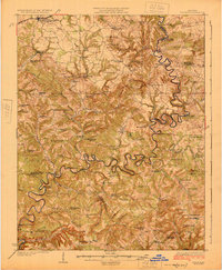 1925 Cub Run1925 Print · USGSCentral Kentucky's rural landscape is captured here in the mid-1920s, dominated by the intricate loops of the Nolin River. Genealogists and historians can locate numerous family-named landmarks like Dickeys Mills, Sanders Store, and Hester School.3 unique versions available
 - 1954 Map of Evansville
 1954 Evansville1954 Print · USGSThe Ohio River borderlands between Indiana and Kentucky appear here during a period of robust industrial and military growth. Genealogists and researchers can trace the rail corridors of the Illinois Central and find landmarks like US Lock and Dam No 48 or Camp Breckinridge.
 - 1954 Map of Dickeys Mills, 1955 Print
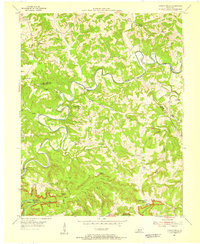 1954 Dickeys Mills1955 Print · USGSThe Nolin River loops through the Kentucky karst country in the mid-fifties, just north of the legendary cave system. Trace family roots at Demunbruns Store, Temple Hill Ch, and cemeteries like Washington Meredith Cem.2 unique versions available
 - 1957 Map of Evansville, 1969 Print
 1957 Evansville1969 Print · USGSIndiana and Kentucky meet along the Ohio River in this mid-century survey of a vital industrial and transport corridor. Genealogists and historians can trace the development of river towns like Owensboro and Newburgh or locate old rail lines like the Southern Ry.3 unique versions available
 - 1961 Map of Evansville
 1961 Evansville1961 Print · USGSThe Ohio River valley and its surrounding coalfields are captured here during the late fifties and early sixties. Trace the industrial rail networks of the Illinois Central RR and explore regional landmarks like Mammoth Cave National Park and Angel Mounds State Memorial.2 unique versions available
 - 1966 Map of Nolin Reservoir, 1968 Print
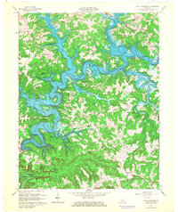 1966 Nolin Reservoir1968 Print · USGSEdmonson County landscape changed forever in the mid-1960s as the reservoir waters filled the deep valleys of the Nolin River. Genealogists and hikers can locate the Lincoln Sch, trace the Mammoth Cave National Park boundary near Ollie, and find the remote Demunbruns Store.3 unique versions available
 - 1981 Map of Beaver Dam, 1984 Print
 1981 Beaver Dam1984 Print · USGSThe Western Kentucky coal and river country comes into focus in the early 1980s as industry and recreation reshape the land. Researchers can trace family roots and old routes through Morgantown, Beaver Dam, and the early footprints of Mammoth Cave National Park.
 - 2010 Map of Nolin Lake, 2010 Print
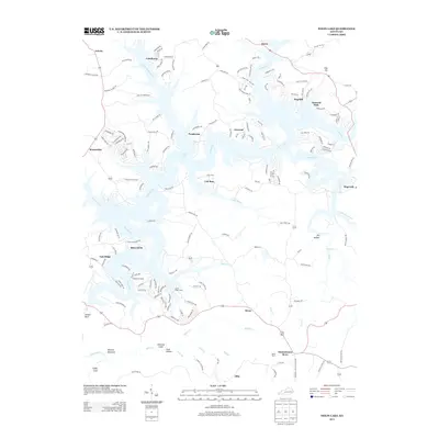
 2010 Nolin Lake2010 Print · USGSCovers Moutardier, including Hillview, Anneta, and other nearby areas
 - 2013 Map of Nolin Lake, 2013 Print
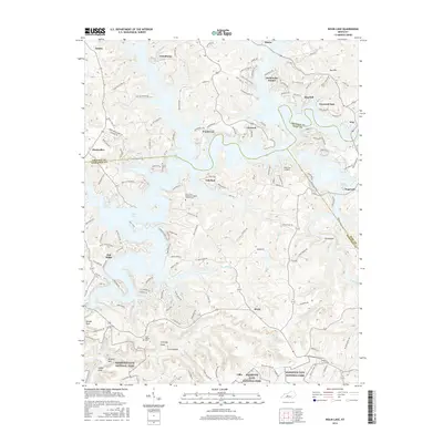
 2013 Nolin Lake2013 Print · USGSCovers Moutardier, including Hillview, Anneta, and other nearby areas
 - 2016 Map of Nolin Lake, 2016 Print
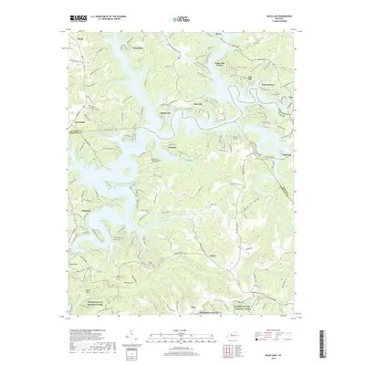
 2016 Nolin Lake2016 Print · USGSCovers Moutardier, including Hillview, Anneta, and other nearby areas
 - 2019 Map of Nolin Lake, 2019 Print
 2019 Nolin Lake2019 Print · USGSCovers Moutardier, including Hillview, Anneta, and other nearby areas
 - 2022 Map of Nolin Lake, 2022 Print
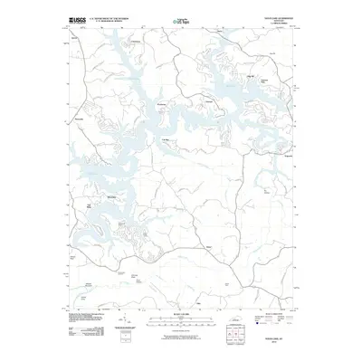
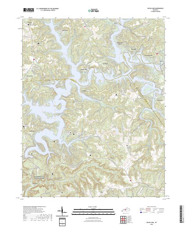 2022 Nolin Lake2022 Print · USGSThe Edmonson County hills meet the waters of the Nolin River in this detailed study of the area just north of the national park. Researchers can locate many family burial sites and rural steeples, including the Thompson Family Cem and the Union Light Missionary Baptist Cem.
End of results
Showing maps 1-12 of 12
Top cities near Moutardier
- Leitchfield historical maps
- Brownsville historical maps
- Clarkson historical maps
- Caneyville historical maps
Frequently asked questions
- What are the different types of historical maps available for Moutardier?
- What is the oldest map of Moutardier?
- Where can I purchase historical maps of Moutardier for my home or office?
- Where can I download high-res historical maps of Moutardier?
- Are there historical topographic maps available for Moutardier?
- Is there historical aerial imagery available for Moutardier?
- Where are historical maps of Moutardier sourced from?