Old Maps of Wheelers Mill, Kentucky for Academic Research
Study the evolution of Wheelers Mill with 12 high-resolution historic maps. Whether you're teaching, researching, or modeling changes in land use, these maps provide essential visual documentation of urban, environmental, and geographic change.
- Analyze long-term change: Track patterns in development, transportation, and natural features.
- Ideal for environmental or urban studies: Support academic projects with primary historical map data.
- Use in the classroom or lab: Educators and researchers rely on these maps to bring historical context to life.
These maps are a powerful tool for teaching, research, and visualizing how Wheelers Mill has changed over the decades.
Wheelers Mill, KY maps
(12)- 1925 Map of Cub Run
 1925 Cub Run1925 Print · USGSCentral Kentucky's rural landscape is captured here in the mid-1920s, dominated by the intricate loops of the Nolin River. Genealogists and historians can locate numerous family-named landmarks like Dickeys Mills, Sanders Store, and Hester School.3 unique versions available
 - 1954 Map of Evansville
 1954 Evansville1954 Print · USGSThe Ohio River borderlands between Indiana and Kentucky appear here during a period of robust industrial and military growth. Genealogists and researchers can trace the rail corridors of the Illinois Central and find landmarks like US Lock and Dam No 48 or Camp Breckinridge.
 - 1954 Map of Millerstown, 1955 Print
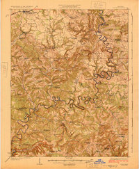
 1954 Millerstown1955 Print · USGSThe Nolin River meanders through the central Kentucky highlands during the mid-fifties, bordering Hardin and Grayson counties. Researchers can trace old river crossings at Broad Ford or locate rural landmarks like Wheelers Mill and Little Clifty Ch.
 - 1957 Map of Evansville, 1969 Print
 1957 Evansville1969 Print · USGSIndiana and Kentucky meet along the Ohio River in this mid-century survey of a vital industrial and transport corridor. Genealogists and historians can trace the development of river towns like Owensboro and Newburgh or locate old rail lines like the Southern Ry.3 unique versions available
 - 1961 Map of Evansville
 1961 Evansville1961 Print · USGSThe Ohio River valley and its surrounding coalfields are captured here during the late fifties and early sixties. Trace the industrial rail networks of the Illinois Central RR and explore regional landmarks like Mammoth Cave National Park and Angel Mounds State Memorial.2 unique versions available
 - 1967 Map of Millerstown, 1971 Print
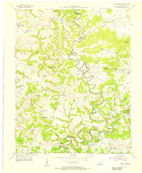
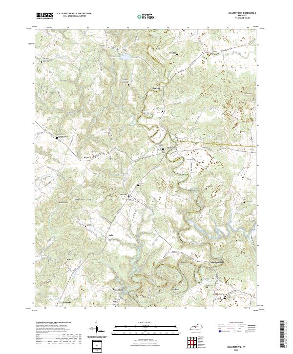
 1967 Millerstown1971 Print · USGSKentucky's Nolin River valley is captured here in the late sixties as the new reservoir began to alter the local landscape. Researchers can trace ancestral locations across three counties, locating old landmarks like Riders Mill, Broad Ford Ch, and Mt Zion Cem.3 unique versions available
 - 1981 Map of Beaver Dam, 1984 Print
 1981 Beaver Dam1984 Print · USGSThe Western Kentucky coal and river country comes into focus in the early 1980s as industry and recreation reshape the land. Researchers can trace family roots and old routes through Morgantown, Beaver Dam, and the early footprints of Mammoth Cave National Park.
 - 2010 Map of Millerstown, 2010 Print
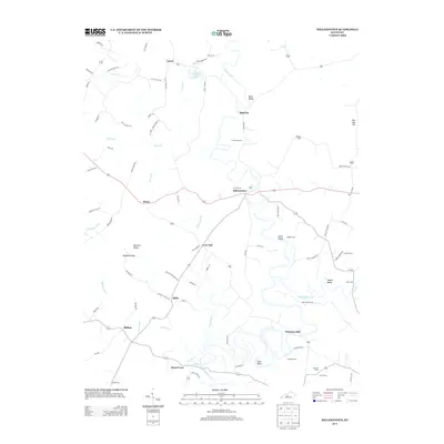
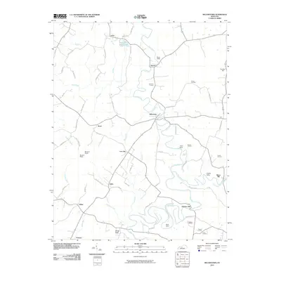 2010 Millerstown2010 Print · USGSCovers Wheelers Mill, including Lacon, Spurrier, and other nearby areas
 - 2013 Map of Millerstown, 2013 Print
 2013 Millerstown2013 Print · USGSCovers Wheelers Mill, including Lacon, Spurrier, and other nearby areas
 - 2016 Map of Millerstown, 2016 Print
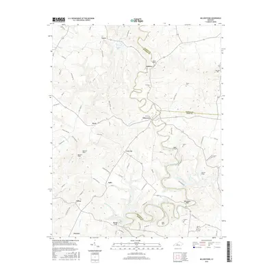 2016 Millerstown2016 Print · USGSCovers Wheelers Mill, including Lacon, Spurrier, and other nearby areas
 - 2019 Map of Millerstown, 2019 Print
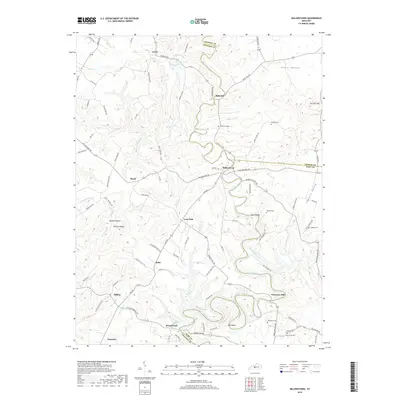 2019 Millerstown2019 Print · USGSCovers Wheelers Mill, including Lacon, Spurrier, and other nearby areas
 - 2022 Map of Millerstown, 2022 Print
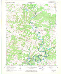
 2022 Millerstown2022 Print · USGSThe Nolin River valley at the Grayson and Hart County borders is shown here in the 2020s, revealing a landscape of winding river bends and historic family cemeteries. Researchers can trace rural lineages at Mount Zion Christian Church Cem, Wheelers Mill, and Broad Ford.
End of results
Showing maps 1-12 of 12
Top cities near Wheelers Mill
- Leitchfield historical maps
- Horse Cave historical maps
- Munfordville historical maps
- Brownsville historical maps
- Clarkson historical maps
- Bonnieville historical maps
See more
Frequently asked questions
- What are the different types of historical maps available for Wheelers Mill?
- What is the oldest map of Wheelers Mill?
- Where can I purchase historical maps of Wheelers Mill for my home or office?
- Where can I download high-res historical maps of Wheelers Mill?
- Are there historical topographic maps available for Wheelers Mill?
- Is there historical aerial imagery available for Wheelers Mill?
- Where are historical maps of Wheelers Mill sourced from?