1910s Maps of Greenup County, Kentucky
Explore 5 historic maps of Greenup County from the 1910s. These maps offer a rare glimpse into what life looked like during the 1910s — showing old roads, neighborhoods, homes, and landmarks that have changed or disappeared over time.
Whether you're researching your family's past, planning a metal detecting trip, or studying how Greenup County's landscape evolved across the 1910s, these high-resolution maps are a powerful tool for exploring the history of this region.
- Focus on a specific era: All maps on this page are from the 1910s, giving you a focused view of this time period.
- See what’s changed: Compare century-old streets, trails, and buildings to today's modern landscape using overlays and satellite layers.
- Research with precision: Use these maps for genealogy, historical research, land use analysis, or educational projects.
- View, download, or print: Maps are fully viewable online in high resolution, and can be downloaded or printed for your own records.
Start exploring Greenup County's history through authentic maps from the 1910s. This is your window into the past.
Greenup County, KY maps
(5)- 1911 Map of Sciotoville, 1952 Print
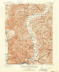 1911 Sciotoville1952 Print · USGSThe industrial riverfronts and rural hollows of southern Ohio are shown here in the early twentieth century before modern development. Genealogists and historians can trace numerous rural landmarks like Davis Sta George PO, Harrison Furnace School, and the brickyards near New Boston.2 unique versions available
 - 1913 Map of Ceredo
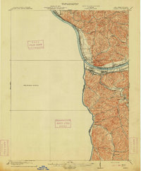 1913 Ceredo1913 Print · USGSThe confluence of the Ohio and Big Sandy rivers comes alive in this pre-war survey of the West Virginia-Ohio borderlands. Genealogists and rail historians can trace the early footprints of Kenova, Ceredo, and the winding path of Twelvepole Creek.4 unique versions available
 - 1913 Map of Sciotoville, 1924 Print
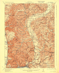 1913 Sciotoville1924 Print · USGSScioto County during the early twentieth century shows a landscape of river-front industry and deep-hollow settlements. Genealogists can trace family footprints across dozens of local school sites like Noel School and early industrial markers such as Scioto Furnace and Star Brickyard.2 unique versions available
 - 1915 Map of Garrison, 1952 Print
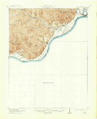
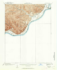 1915 Garrison1952 Print · USGSThe riverfront and uplands of the Ohio Valley come alive in this mid-century publication of a Great War-era survey. Genealogists and local historians can trace the many rural schoolhouses like Elmtree School and Leatherwood School or find the early footprint of Portsmouth.
 - 1918 Map of Garrison, 1932 Print
 1918 Garrison1932 Print · USGSThe river valley at the Ohio and Kentucky border was a landscape of small schools and isolated runs during the mid-1910s. Researchers can trace the placement of local institutions like the Scioto County Infirmary and rural schools including Pond Run School and Carey Run School.
End of results
Showing maps 1-5 of 5
Top cities of Greenup County
- Flatwoods historical maps
- Russell historical maps
- Raceland historical maps
- Worthington historical maps
- Greenup historical maps
- Wurtland historical maps
See more
Frequently asked questions
- What are the different types of historical maps available for Greenup County?
- What is the oldest map of Greenup County?
- Where can I purchase historical maps of Greenup County for my home or office?
- Where can I download high-res historical maps of Greenup County?
- Are there historical topographic maps available for Greenup County?
- Is there historical aerial imagery available for Greenup County?
- Where are historical maps of Greenup County sourced from?