Old Maps of Summit, Kentucky for Academic Research
Study the evolution of Summit with 16 high-resolution historic maps. Whether you're teaching, researching, or modeling changes in land use, these maps provide essential visual documentation of urban, environmental, and geographic change.
- Analyze long-term change: Track patterns in development, transportation, and natural features.
- Ideal for environmental or urban studies: Support academic projects with primary historical map data.
- Use in the classroom or lab: Educators and researchers rely on these maps to bring historical context to life.
These maps are a powerful tool for teaching, research, and visualizing how Summit has changed over the decades.
Summit, KY maps
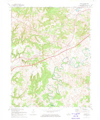
(16)- 1932 Map of Big Clifty
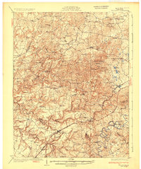 1932 Big Clifty1932 Print · USGSGrayson and Hardin Counties are captured here between the World Wars, showing a rural landscape defined by the Illinois Central Railroad and the Dixie Highway. Genealogists and historians can locate dozens of small community centers like Big Clifty, White Mills, and the Asphalt Mine.5 unique versions available
 - 1949 Map of Summit, 1952 Print
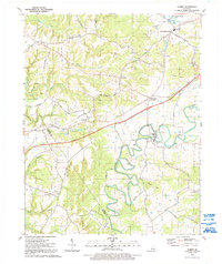
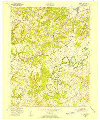 1949 Summit1952 Print · USGSHardin and Grayson Counties are seen here in the late Forties, defined by the winding Nolin River and the rural railroad corridor. Genealogists and local historians can trace family-named sites like Horns Place, the Duncan Cem, and Webb Mills.
 - 1949 Map of Big Clifty, 1959 Print
 1949 Big Clifty1959 Print · USGSThe rural communities of Grayson and Hardin counties are captured in the late 1940s, a time when small schoolhouses and country churches still anchored local life. Researchers can trace family roots at St Elizabeth Cem or locate long-standing landmarks like Pierce Mill and the Needham Chapel Ch along the Rough River.
 - 1954 Map of Evansville
 1954 Evansville1954 Print · USGSThe Ohio River borderlands between Indiana and Kentucky appear here during a period of robust industrial and military growth. Genealogists and researchers can trace the rail corridors of the Illinois Central and find landmarks like US Lock and Dam No 48 or Camp Breckinridge.
 - 1957 Map of Evansville, 1969 Print
 1957 Evansville1969 Print · USGSIndiana and Kentucky meet along the Ohio River in this mid-century survey of a vital industrial and transport corridor. Genealogists and historians can trace the development of river towns like Owensboro and Newburgh or locate old rail lines like the Southern Ry.3 unique versions available
 - 1960 Map of Summit, 1962 Print
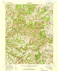
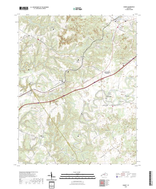
 1960 Summit1962 Print · USGSHardin County is captured in the early sixties as a rural landscape shaped by the Illinois Central railroad and the twisting Nolin River. Researchers can trace ancestral roots through the Duncan Cem or locate community centers like White Mills and Antioch Ch.
 - 1961 Map of Evansville
 1961 Evansville1961 Print · USGSThe Ohio River valley and its surrounding coalfields are captured here during the late fifties and early sixties. Trace the industrial rail networks of the Illinois Central RR and explore regional landmarks like Mammoth Cave National Park and Angel Mounds State Memorial.2 unique versions available
 - 1972 Map of Summit, 1974 Print
 1972 Summit1974 Print · USGSHardin County's karst landscape and river valleys are captured here in the early seventies, showing a rural community balanced between rail history and new parkway development. Researchers can trace family roots at Duncan Cem and locate landmarks like White Mills or the Wonderland Cavern.
 - 1986 Map of Tell City
 1986 Tell City1986 Print · USGSThe Ohio River valley and the Kentucky interior come alive in this mid-eighties record of industry and recreation. Genealogists and historians can trace small rural settlements like Victoria Crossroads, local landmarks such as St Rose, and the extensive shoreline of Rough River Lake.
 - 1991 Map of Tell City
 1991 Tell City1991 Print · USGSThe Ohio River valley at the start of the nineties reveals a landscape of riverfront industry and sprawling conservation lands. Genealogists can locate family landmarks like Wesley Chapel and rural communities such as Reynolds Station and Maceo.
 - 1991 Map of Summit, 1992 Print
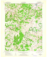
 1991 Summit1992 Print · USGSThe Nolin River valley in the early nineties reveals a landscape of winding river bends and rural crossroads. Researchers can trace family sites like Meeting Creek Ch, Duncan Cem, and the historic White Mills settlement near Stephensburg Lake.
 - 2010 Map of Summit, 2010 Print
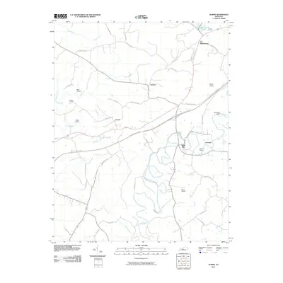 2010 Summit2010 Print · USGSCovers Summit, including White Mills, Old Stephensburg, and other nearby areas
 - 2013 Map of Summit, 2013 Print
 2013 Summit2013 Print · USGSCovers Summit, including White Mills, Old Stephensburg, and other nearby areas
 - 2016 Map of Summit, 2016 Print
 2016 Summit2016 Print · USGSCovers Summit, including White Mills, Old Stephensburg, and other nearby areas
 - 2019 Map of Summit, 2019 Print
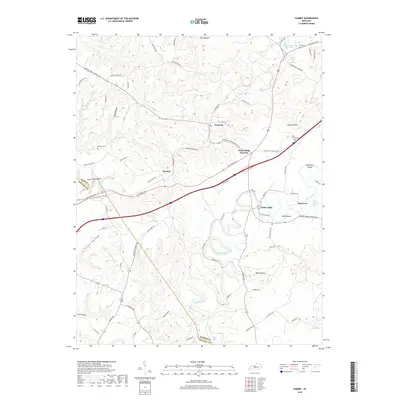 2019 Summit2019 Print · USGSCovers Summit, including White Mills, Old Stephensburg, and other nearby areas
 - 2022 Map of Summit, 2022 Print
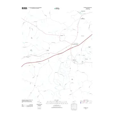
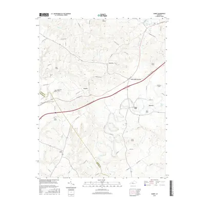
 2022 Summit2022 Print · USGSHardin and Grayson counties appear at the start of the 2020s, showing a landscape defined by the winding Nolin River. Genealogists can trace family sites like the Richardson Woolridge Cem or visit local landmarks like Saint Ignatius Spring.
End of results
Showing maps 1-16 of 16
Top cities near Summit
- Elizabethtown historical maps
- Radcliff historical maps
- Leitchfield historical maps
- Vine Grove historical maps
- Rineyville historical maps
- Clarkson historical maps
See more
Frequently asked questions
- What are the different types of historical maps available for Summit?
- What is the oldest map of Summit?
- Where can I purchase historical maps of Summit for my home or office?
- Where can I download high-res historical maps of Summit?
- Are there historical topographic maps available for Summit?
- Is there historical aerial imagery available for Summit?
- Where are historical maps of Summit sourced from?