Old Maps of Layman, Kentucky
Explore 17 old maps of Layman, spanning from 1887 to today. These high-resolution historic maps reveal how streets, neighborhoods, landmarks, and natural features evolved over time — perfect for genealogy, metal detecting, research, and local history exploration.
What you can do with these maps:
- See how Layman changed over time: Compare historical maps to modern-day views to trace roads, homesites, rail lines & more.
- View detailed metadata: Each map includes creators, publishers, year, scale, and archive source.
- Overlay maps with satellite & LiDAR: Visualize the past alongside modern tools to explore terrain & human change.
- Trusted historical sources: Maps sourced from the USGS, Library of Congress, and other archives.
- Access maps your way: View online, download high-res files, or order prints for personal or research use.
Start exploring old maps of Layman to uncover forgotten places, hidden landmarks, and the deep history beneath your feet.
Layman, KY maps
(17)- 1887 Map of Jonesville
 1887 Jonesville1887 Print · USGSThe rugged borderlands of Virginia, Kentucky, and Tennessee are captured in the late nineteenth century during a time of isolated valley settlements. Genealogists and historians can trace family locations near Jonesville, Sneedville, and the remote Kyle's Ford along the Powell River.
 - 1891 Map of Jonesville
 1891 Jonesville1891 Print · USGSThe tri-state borderlands of Virginia, Kentucky, and Tennessee are captured here in the late nineteenth century. Researchers can trace early river crossings and mountain settlements like Poteet Ford, Shafers P.O., and Mt Pleasant.9 unique versions available
 - 1903 Map of Harlan
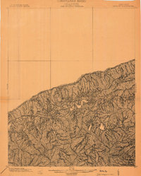 1903 Harlan1903 Print · USGSThe Harlan highlands are captured at the start of the twentieth century, showing the mountain landscape before industrial mining changed the region. Genealogists can trace early homesteads and drainage ways in the valleys near Harlan, Gray, and Puckett Creek.
 - 1916 Map of Harlan
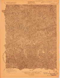 1916 Harlan1916 Print · USGSHarlan and the Cumberland River valley are captured here in the years before the coal boom fully reshaped the landscape. Researchers can trace early settlements like White Star and Black Joe, find the Pine Branch School, and locate mountain inclines.
 - 1919 Map of Harlan
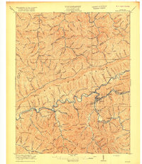 1919 Harlan1919 Print · USGSHarlan County's coal country is captured here during the expansion of the rail-and-river economy. Genealogists and historians can trace the foundations of mountain communities along the Cumberland River, locating early sites like Wallins Creek, Kentenia, and the Wood Sta Blackjoe PO.4 unique versions available
 - 1954 Map of Wallins Creek, 1956 Print
 1954 Wallins Creek1956 Print · USGSHarlan County's mountain hollows and river settlements are captured here in the mid-fifties, during the height of the rail-and-river economy. Genealogists can trace family homes near Wallins Creek or locate old school sites like Toggle Sch and Jesses Creek Sch.2 unique versions available
 - 1955 Map of Johnson City
 1955 Johnson City1955 Print · USGSEast Tennessee and the bordering highlands of Virginia and Kentucky appear here during the post-war industrial boom. You can trace the complex network of mountain ridges and new TVA lakes, from Johnson City to the coalfields near Middlesboro and Lynch.
 - 1957 Map of Johnson City, 1966 Print
 1957 Johnson City1966 Print · USGSUpper East Tennessee and Southwest Virginia are shown here during the mid-sixties transition of the Appalachians. Researchers can trace the industrial rail hubs of Kingsport, the sprawling waters of Cherokee Lake, and the historic Cumberland Gap.
 - 1960 Map of Johnson City
 1960 Johnson City1960 Print · USGSUpper East Tennessee and the surrounding tri-state area are shown in the mid-fifties during the height of the TVA reservoir era. Trace the industrial rail lines of the Southern and Louisville and Nashville between Kingsport and Johnson City.
 - 1963 Map of Johnson City
 1963 Johnson City1963 Print · USGSThe Tri-Cities and the surrounding Appalachian ridges are shown in detail during the early sixties, highlighting the era's vital rail and river networks. Genealogists and historians can trace the routes of the Clinchfield RR and locate settlements from Rogersville to Elizabethton.
 - 1974 Map of Wallins Creek, 1975 Print
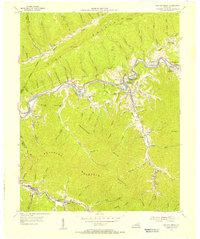
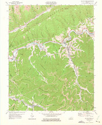 1974 Wallins Creek1975 Print · USGSThe coal valleys of Harlan County are in full production in the 1970s, as the railroad follows the river through deep mountain gaps. Genealogists and historians can trace family locations and mine sites near Wallins Creek, Tacky Town, and Wilhoit.
 - 1977 Map of Middlesboro, 1983 Print
 1977 Middlesboro1983 Print · USGSThe tri-state border region of Kentucky, Tennessee, and Virginia is shown here in the late seventies as the rail-and-river economy hummed through the gaps. Trace local family roots and transit routes through Middlesboro, Harlan, and Cumberland Gap National Historical Park.
 - 2010 Map of Wallins Creek, 2010 Print
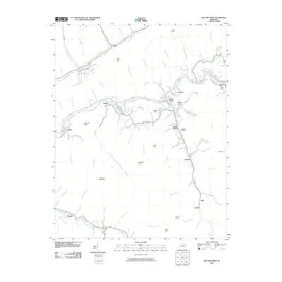 2010 Wallins Creek2010 Print · USGSCovers Layman, including Wallins Creek, Creech, and other nearby areas
 - 2013 Map of Wallins Creek, 2013 Print
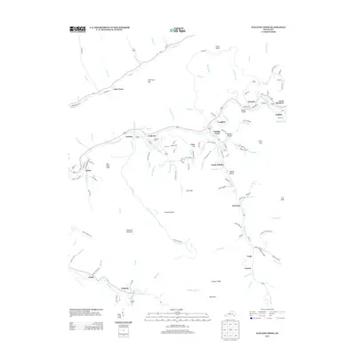 2013 Wallins Creek2013 Print · USGSCovers Layman, including Wallins Creek, Creech, and other nearby areas
 - 2016 Map of Wallins Creek, 2016 Print
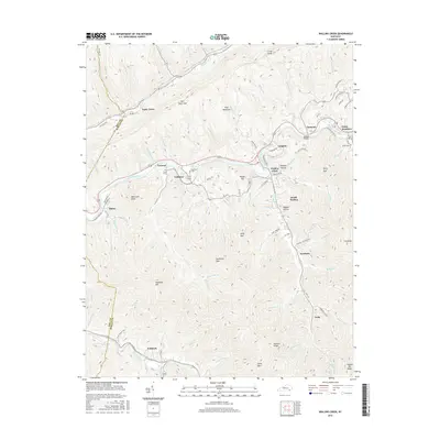 2016 Wallins Creek2016 Print · USGSCovers Layman, including Wallins Creek, Creech, and other nearby areas
 - 2019 Map of Wallins Creek, 2019 Print
 2019 Wallins Creek2019 Print · USGSCovers Layman, including Wallins Creek, Creech, and other nearby areas
 - 2022 Map of Wallins Creek, 2022 Print
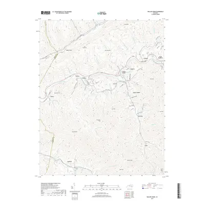
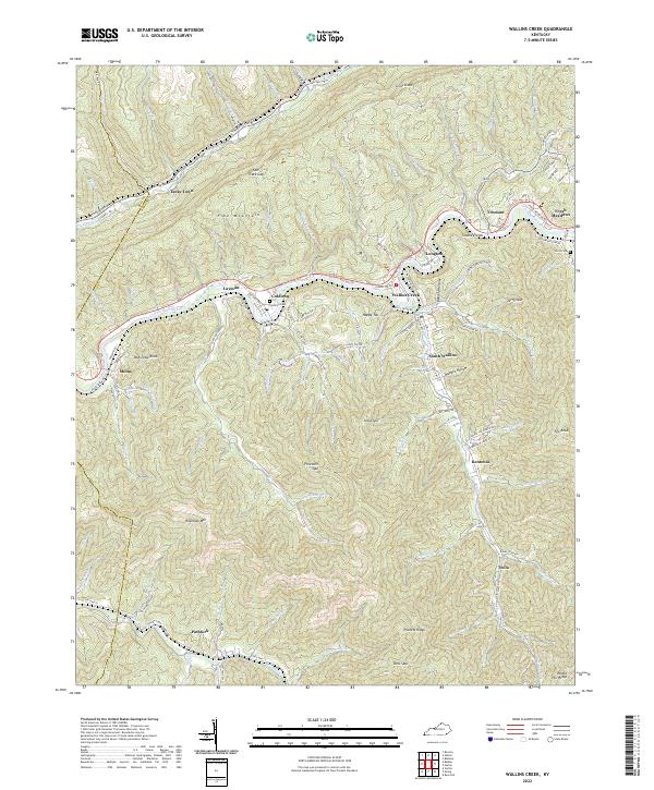 2022 Wallins Creek2022 Print · USGSThe Harlan County coalfields come into sharp focus in this recent survey of the Cumberland River valley. Genealogists and local historians can trace family locations through Coldiron Cem, explore the winding Old Pike Hwy, and locate communities from Pathfork to Wallins Creek.
End of results
Showing maps 1-17 of 17
Top cities near Layman
- Pineville historical maps
- Harlan historical maps
- Rose Hill historical maps
- Loyall historical maps
- Ewing historical maps
- Wallins Creek historical maps
Frequently asked questions
- What are the different types of historical maps available for Layman?
- What is the oldest map of Layman?
- Where can I purchase historical maps of Layman for my home or office?
- Where can I download high-res historical maps of Layman?
- Are there historical topographic maps available for Layman?
- Is there historical aerial imagery available for Layman?
- Where are historical maps of Layman sourced from?