Old Maps of Rio, Kentucky for Genealogy
Trace your family roots with 11 historic maps of Rio. These high-res maps reveal old neighborhoods, homesites, landmarks, and streets — helping you uncover where your ancestors lived and how the area evolved over time.
- Explore historic neighborhoods: Identify where your relatives may have lived in the 1800s or 1900s.
- Compare maps over time: Trace the changes in streets, buildings, and landmarks for multi-generational research.
- Perfect for genealogy & ancestry research: Used by family historians and researchers to map out lineage and migration.
These maps are an incredible resource for exploring your personal connection to Rio's past.
Rio, KY maps
(11)- 1934 Map of Munfordville
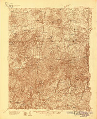 1934 Munfordville1934 Print · USGSHart County communities line the corridor of the Green River and the Nashville Road during the mid-1930s. Genealogists can trace family footprints through dozens of local landmarks like Poundstone Roller Mill, Big Springs Cem, and Priceville.
 - 1937 Map of Munfordville
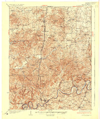 1937 Munfordville1937 Print · USGSThe Green River valley in the 1930s was a landscape of river fords and knob-country schools. Genealogists can trace family footprints across dozens of local sites like Falling Springs Ch, Big Springs Cem, and the old Rider Mill.
 - 1953 Map of Canmer, 1955 Print
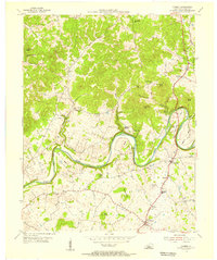 1953 Canmer1955 Print · USGSHart County communities thrived along the winding Green River corridor during the mid-fifties. Genealogists and local historians can trace rural family life through landmarks like Memorial Sch, Crump Cem, and the village of Hardyville.4 unique versions available
 - 1957 Map of Winchester, 1968 Print
 1957 Winchester1968 Print · USGSCentral Kentucky's landscape in the mid-twentieth century features the sprawling Fort Knox and the early parkway system. Genealogists and historians can trace rail lines like the Southern Railway and find landmarks from Bernheim Forest to Pilot Knob.3 unique versions available
 - 1960 Map of Winchester
 1960 Winchester1960 Print · USGSCentral Kentucky's diverse landscape is shown here at mid-century, from the bluegrass plains to the rugged Pottsville Escarpment. Genealogists and historians can trace the rail-and-river network connecting towns like Bardstown and Stanford alongside landmarks like Lake Cumberland.
 - 1986 Map of Campbellsville
 1986 Campbellsville1986 Print · USGSCentral Kentucky in the mid-eighties was a landscape of deep river valleys and high ridges. Genealogists can trace family holdings near rural settlements like Phillipsburg or locate landmarks such as Mt Gilead Ch and the Magnolia Gas Storage Field.2 unique versions available
 - 2010 Map of Canmer, 2010 Print
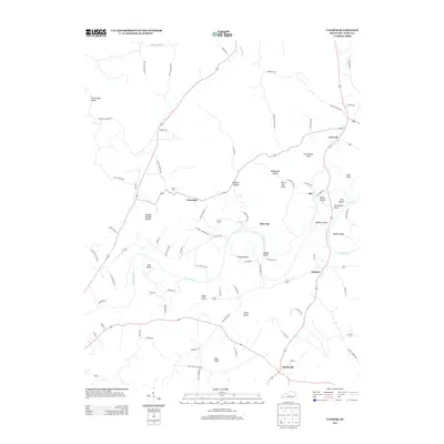
 2010 Canmer2010 Print · USGSCovers Rio, including Glen Lily, Hinesdale, and other nearby areas
 - 2013 Map of Canmer, 2013 Print
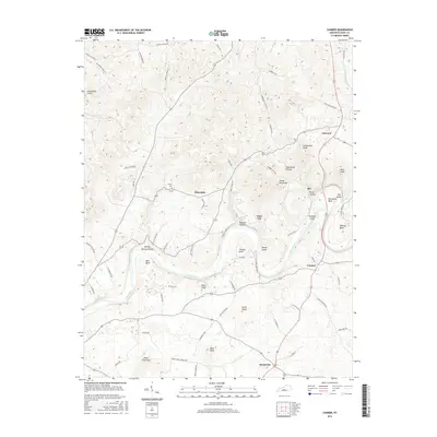
 2013 Canmer2013 Print · USGSCovers Rio, including Glen Lily, Hinesdale, and other nearby areas
 - 2016 Map of Canmer, 2016 Print
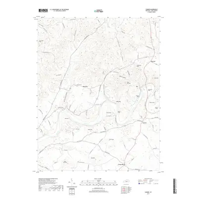
 2016 Canmer2016 Print · USGSCovers Rio, including Glen Lily, Hinesdale, and other nearby areas
 - 2019 Map of Canmer, 2019 Print
 2019 Canmer2019 Print · USGSCovers Rio, including Glen Lily, Hinesdale, and other nearby areas
 - 2022 Map of Canmer, 2022 Print
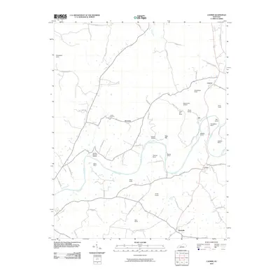
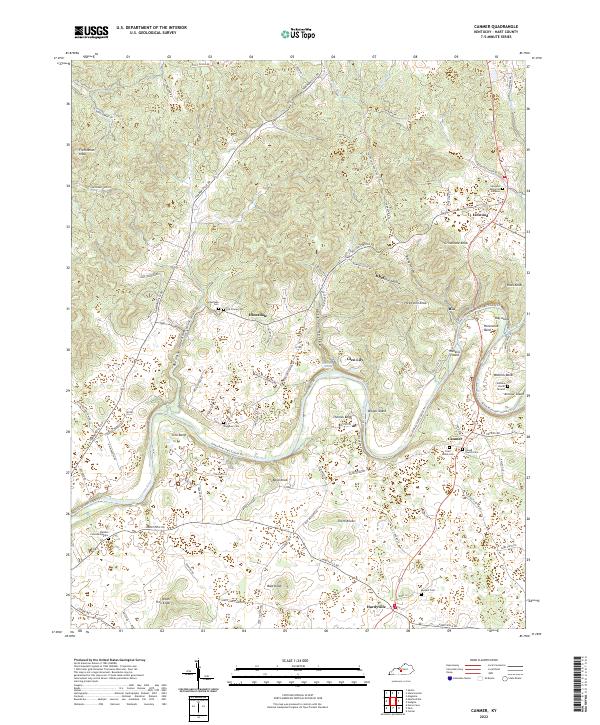 2022 Canmer2022 Print · USGSHart County's rural landscape is captured here along the serpentine bends of the Green River. Researchers can trace old family roots at Gilead Church Cem, Waggener Cem, and the community of Canmer in this river-and-ridge environment.
End of results
Showing maps 1-11 of 11
Top cities near Rio
- Cave City historical maps
- Horse Cave historical maps
- Munfordville historical maps
- Bonnieville historical maps
- Sonora historical maps
Frequently asked questions
- What are the different types of historical maps available for Rio?
- What is the oldest map of Rio?
- Where can I purchase historical maps of Rio for my home or office?
- Where can I download high-res historical maps of Rio?
- Are there historical topographic maps available for Rio?
- Is there historical aerial imagery available for Rio?
- Where are historical maps of Rio sourced from?