2020s Maps of Leslie County, Kentucky
Explore 14 historic maps of Leslie County from the 2020s. These maps offer a rare glimpse into what life looked like during the 2020s — showing old roads, neighborhoods, homes, and landmarks that have changed or disappeared over time.
Whether you're researching your family's past, planning a metal detecting trip, or studying how Leslie County's landscape evolved across the 2020s, these high-resolution maps are a powerful tool for exploring the history of this region.
- Focus on a specific era: All maps on this page are from the 2020s, giving you a focused view of this time period.
- See what’s changed: Compare century-old streets, trails, and buildings to today's modern landscape using overlays and satellite layers.
- Research with precision: Use these maps for genealogy, historical research, land use analysis, or educational projects.
- View, download, or print: Maps are fully viewable online in high resolution, and can be downloaded or printed for your own records.
Start exploring Leslie County's history through authentic maps from the 2020s. This is your window into the past.
Leslie County, KY maps
(14)- 2022 Map of Beverly, 2022 Print
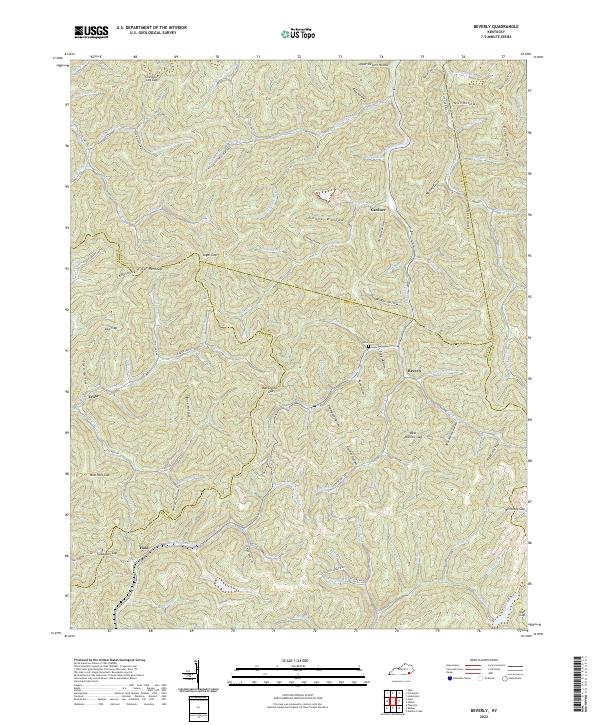 2022 Beverly2022 Print · USGSBell and Clay counties are shown at a high level of detail in the early 2020s, revealing a landscape defined by ridges and remote hollows. Researchers can trace family sites like Asher Cem and the small communities of Beverly and Gardner along the Red Bird Creek.
 - 2022 Map of Bledsoe, 2022 Print
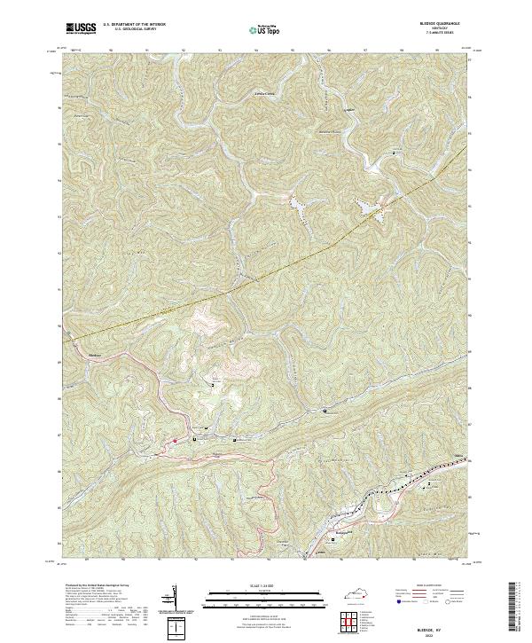 2022 Bledsoe2022 Print · USGSHarlan County's steep ridges and family hollows are captured here in the early twenty-first century. Genealogists and local historians can trace family landmarks and burial sites like Huff Cem, Sergent Cem, and the community of Bledsoe.
 - 2022 Map of Nolansburg, 2022 Print
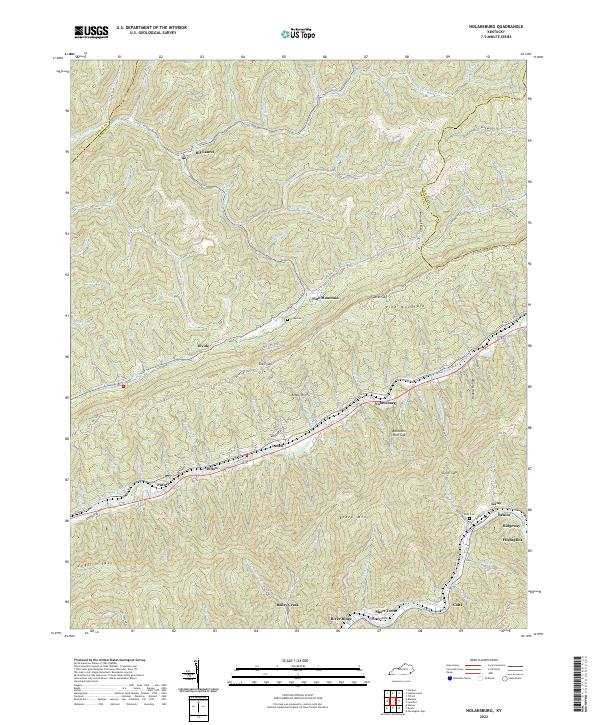 2022 Nolansburg2022 Print · USGSHarlan County's coal-country river valleys are caught in high detail during the early 2020s, showing the dense settlements along the Poor Fork Cumberland River. Local historians can trace family roots at Nolan Cem and locate communities like Nolansburg and Highsplint.
 - 2022 Map of Helton, 2022 Print
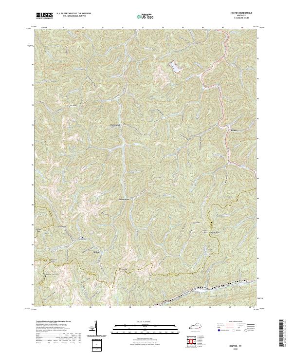 2022 Helton2022 Print · USGSLeslie County mountain life centers on the valleys of the Middle Fork Kentucky River in the early 2020s. Researchers can locate family landmarks such as Honey Branch Cem and trace the paths through Saylor, Warbranch, and Spruce Pine.
 - 2022 Map of Hyden West, 2022 Print
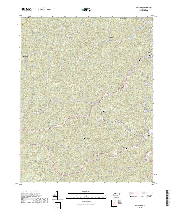 2022 Hyden West2022 Print · USGSLeslie County mountain communities are captured in this modern survey of the Kentucky coalfields. Trace family heritage and local history through numerous family landmarks like Couch Cem, Woods Cem, and the settlement at Thousandsticks.
 - 2022 Map of Hazard South, 2022 Print
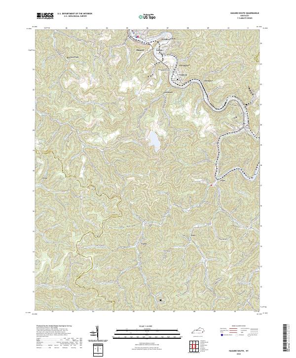 2022 Hazard South2022 Print · USGSPerry County's coal country is on full display in the early 2020s, centered on the river-bend city of Hazard. Genealogists can trace family landmarks like Englewood Cem or locate homesites in Stillhouse Hollow and along the L & N RR corridor near Viper.
 - 2022 Map of Hyden East, 2022 Print
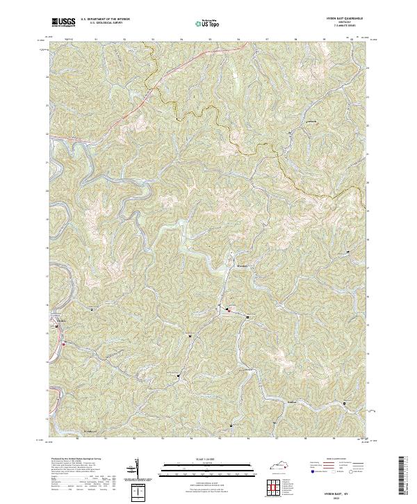 2022 Hyden East2022 Print · USGSLeslie County, Kentucky, in the early 2020s shows a landscape where mountain hollows and winding creeks define the reach of every community. Genealogists can trace family landmarks and burial sites like Hendrix Cem or Hurricane Cem near the banks of Cutshin Creek.
 - 2022 Map of Buckhorn, 2022 Print
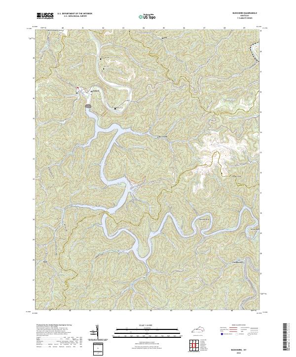 2022 Buckhorn2022 Print · USGSThe Middle Fork of the Kentucky River winds through Perry County in this contemporary study of eastern Kentucky’s ridge-and-hollow terrain. Researchers can identify local burial grounds like Deaton Cem, small communities at Confluence, and landmarks like Courthouse Fort.
 - 2022 Map of Leatherwood, 2022 Print
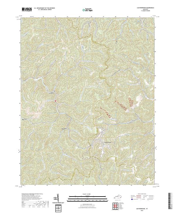 2022 Leatherwood2022 Print · USGSIn the heart of the Kentucky mountains, this 2022 survey captures the enduring settlement patterns of the Leslie and Perry county line. Researchers can trace family roots through sites like Moore Cemetery or follow the winding Cutshin Cr through Leatherwood.
 - 2022 Map of Creekville, 2022 Print
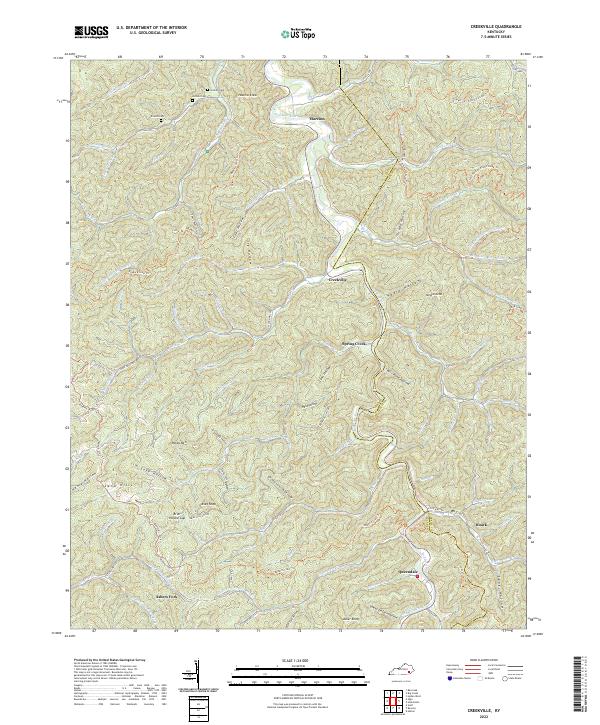 2022 Creekville2022 Print · USGSClay and Leslie Counties are shown in the 2020s, dominated by the winding path of the Red Bird River and deep Appalachian hollows. Genealogists and hikers can trace family sites at Holland Cem and Arnetts Cem or navigate the Redbird Crest Trl.
 - 2022 Map of Krypton, 2022 Print
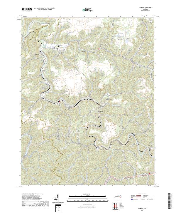 2022 Krypton2022 Print · USGSPerry County in the early 2020s is defined by a dense network of river-valley communities and narrow hollows. Researchers can trace the winding North Fork Kentucky River to find family-named landmarks like McIntosh Mountain, Red Hill Cem, and the unique town of Typo.
 - 2022 Map of Hoskinston, 2022 Print
 2022 Hoskinston2022 Print · USGSLeslie County's river-bottom settlements and high-ridge trails are captured here in the early 2020s. Researchers can locate family landmarks like White Oak School or Halls Rest Haven Cem alongside the Middle Fork Kentucky River.
 - 2022 Map of Cutshin, 2022 Print
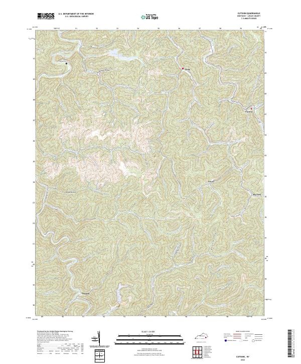 2022 Cutshin2022 Print · USGSLeslie County mountain life in the early 2020s remains deeply rooted in the winding hollows of the Cumberland Plateau. Genealogists and researchers can trace family landmarks like Hardy Bottom Cem and the communities of Cinda, Cutshin, and Causey.
 - 2022 Map of Big Creek, 2022 Print
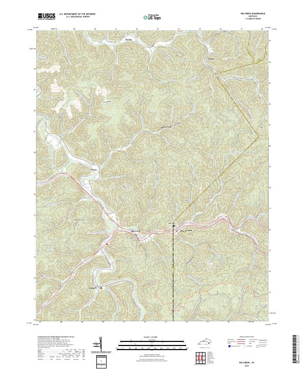 2022 Big Creek2022 Print · USGSClay County at the start of the 2020s is defined by its deep hollows and the enduring settlements of Big Creek and Bear Branch. Genealogists and hikers can trace the Redbird Crest Trl or locate the Roberts Cem near Eriline.
End of results
Showing maps 1-14 of 14
Top cities of Leslie County
Frequently asked questions
- What are the different types of historical maps available for Leslie County?
- What is the oldest map of Leslie County?
- Where can I purchase historical maps of Leslie County for my home or office?
- Where can I download high-res historical maps of Leslie County?
- Are there historical topographic maps available for Leslie County?
- Is there historical aerial imagery available for Leslie County?
- Where are historical maps of Leslie County sourced from?