1980s Maps of Leslie County, Kentucky
Explore 5 historic maps of Leslie County from the 1980s. These maps offer a rare glimpse into what life looked like during the 1980s — showing old roads, neighborhoods, homes, and landmarks that have changed or disappeared over time.
Whether you're researching your family's past, planning a metal detecting trip, or studying how Leslie County's landscape evolved across the 1980s, these high-resolution maps are a powerful tool for exploring the history of this region.
- Focus on a specific era: All maps on this page are from the 1980s, giving you a focused view of this time period.
- See what’s changed: Compare century-old streets, trails, and buildings to today's modern landscape using overlays and satellite layers.
- Research with precision: Use these maps for genealogy, historical research, land use analysis, or educational projects.
- View, download, or print: Maps are fully viewable online in high resolution, and can be downloaded or printed for your own records.
Start exploring Leslie County's history through authentic maps from the 1980s. This is your window into the past.
Leslie County, KY maps
(5)- 1980 Map of Cutshin
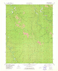 1980 Cutshin1980 Print · USGSLeslie County mountain life and the coal industry meet in this 1980 survey of the Kentucky River's Middle Fork. Genealogists and historians can trace family cemeteries and small settlements like Larkin, Causey, and the Solid Rock Bible Ch.
 - 1980 Map of Hyden East
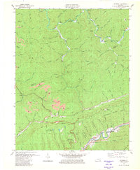
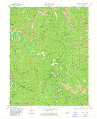 1980 Hyden East1980 Print · USGSThe Leslie County coalfields are captured here in the 1980s, showcasing the intricate relationship between the Middle Fork Kentucky River and the sprawling extractive industry. Researchers can trace family homesteads near Hyden and Wooton, or locate landmarks like the Jacks Point Lookout Tower and Creek Church.
 - 1980 Map of Hoskinston
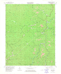 1980 Hoskinston1980 Print · USGSLeslie County during the early 1980s reveals a landscape of coal production and close-knit hollow settlements. Genealogists and historians can trace family locations through Halls Rest Haven, Bowen Creek Ch, and the winding Greasy Creek.
 - 1980 Map of Hyden West
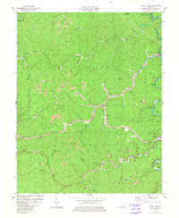 1980 Hyden West1980 Print · USGSThe Kentucky mountains around Hyden are shown during the height of ridge-top coal extraction in the early eighties. Researchers can trace family sites like Sizemore Cem or locate community landmarks including Grace Chapel and the Drive-in Theater.
 - 1980 Map of Bledsoe, 1981 Print
 1980 Bledsoe1981 Print · USGSHarlan County's coal-country landscape is captured here in the early eighties, showing the intersection of industrial extraction and the Kentenia State Forest. Researchers can locate family landmarks like Green Hill Cem, trace the Louisville and Nashville rail line, or find the small community of Bledsoe.
End of results
Showing maps 1-5 of 5
Top cities of Leslie County
Frequently asked questions
- What are the different types of historical maps available for Leslie County?
- What is the oldest map of Leslie County?
- Where can I purchase historical maps of Leslie County for my home or office?
- Where can I download high-res historical maps of Leslie County?
- Are there historical topographic maps available for Leslie County?
- Is there historical aerial imagery available for Leslie County?
- Where are historical maps of Leslie County sourced from?