Old Maps of Fairdealing, Kentucky
Explore 12 old maps of Fairdealing, spanning from 1936 to today. These high-resolution historic maps reveal how streets, neighborhoods, landmarks, and natural features evolved over time — perfect for genealogy, metal detecting, research, and local history exploration.
What you can do with these maps:
- See how Fairdealing changed over time: Compare historical maps to modern-day views to trace roads, homesites, rail lines & more.
- View detailed metadata: Each map includes creators, publishers, year, scale, and archive source.
- Overlay maps with satellite & LiDAR: Visualize the past alongside modern tools to explore terrain & human change.
- Trusted historical sources: Maps sourced from the USGS, Library of Congress, and other archives.
- Access maps your way: View online, download high-res files, or order prints for personal or research use.
Start exploring old maps of Fairdealing to uncover forgotten places, hidden landmarks, and the deep history beneath your feet.
Fairdealing, KY maps
(12)- 1936 Map of Hiatt
 1936 Hiatt1936 Print · USGSThe Tennessee River corridor in the mid-1930s appears here before the formation of Kentucky Lake forever altered the local shoreline. Genealogists can locate family landmarks like Barnett Cem, rural centers like Faughns Store, and schools such as Collie Sch or Aurora Sch.
 - 1936 Map of Golden Pond
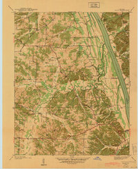
 1936 Golden Pond1936 Print · USGSWestern Kentucky’s river-locked interior is captured here in the mid-1930s, just before the creation of the great lakes. Local researchers can trace family roots at Birmingham or Fenton, and locate industrial landmarks like the Center Furnace and Star Lime Works.
 - 1940 Map of Hiatt
 1940 Hiatt1940 Print · USGSThe Tennessee River valley is shown just before the landscape was transformed by damming. Genealogists can trace family landmarks like Faughn Cem, Inmans Store, and riverfront sites at Ironton Landing.
 - 1955 Map of Fairdealing, 1956 Print
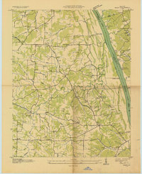
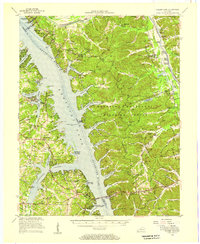
 1955 Fairdealing1956 Print · USGSMarshall County and the Tennessee River shoreline are captured here in the mid-fifties as the region adapted to the new reservoir. Genealogists and local historians can locate many family landmarks, such as Pleasant Hope Church, the Eggner Ferry Bridge, and Fairdealing.3 unique versions available
 - 1955 Map of Golden Pond, 1957 Print
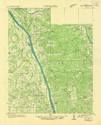
 1955 Golden Pond1957 Print · USGSIn the mid-1950s, the peninsula between the Tennessee and Cumberland rivers was a landscape of deep hollows and new reservoirs. Trace family roots and local history through landmarks like Birmingham Cem, the ruins of Center Furnace, and Paradise Ch.
 - 1956 Map of Dyersburg, 1960 Print
 1956 Dyersburg1960 Print · USGSThe Four Rivers region comes alive in the mid-fifties, capturing the intricate borderlands of Tennessee, Kentucky, and Missouri. Genealogists and historians can trace the rail-and-river networks connecting Dyersburg, Caruthersville, and the shoreline of Reelfoot Lake.4 unique versions available
 - 1986 Map of Murray
 1986 Murray1986 Print · USGSWestern Kentucky in the mid-1980s reveals a landscape defined by the Tennessee and Cumberland rivers. Genealogists and historians can trace rail-town development along the Illinois Central Gulf RR and find family-named locations like Dukedom and Water Valley.2 unique versions available
 - 2011 Map of Fairdealing, 2011 Print
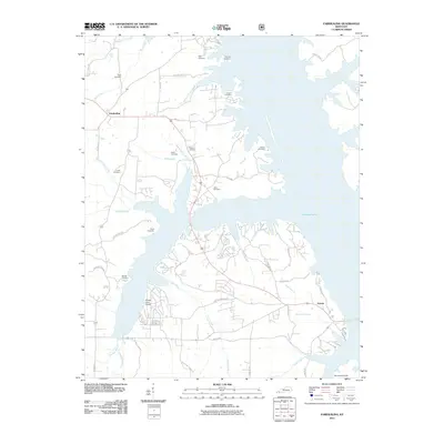 2011 Fairdealing2011 Print · USGSCovers Fairdealing, including Aurora, Marshall County, and other nearby areas
 - 2013 Map of Fairdealing, 2013 Print
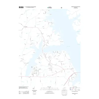 2013 Fairdealing2013 Print · USGSCovers Fairdealing, including Aurora, Marshall County, and other nearby areas
 - 2016 Map of Fairdealing, 2016 Print
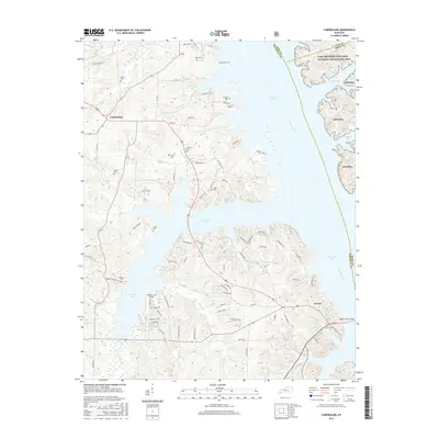 2016 Fairdealing2016 Print · USGSCovers Fairdealing, including Aurora, Marshall County, and other nearby areas
 - 2019 Map of Fairdealing, 2019 Print
 2019 Fairdealing2019 Print · USGSCovers Fairdealing, including Aurora, Marshall County, and other nearby areas
 - 2022 Map of Fairdealing, 2022 Print
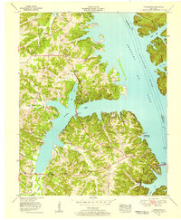
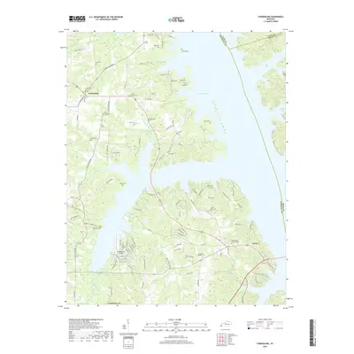
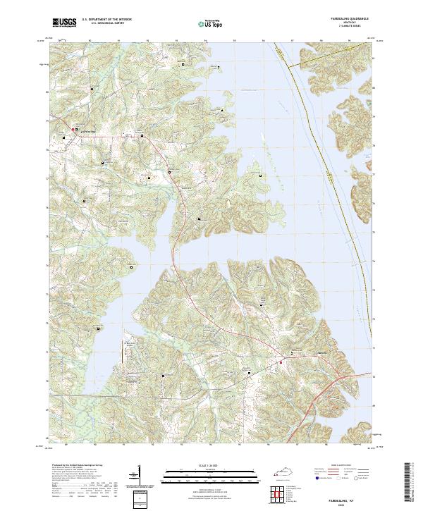 2022 Fairdealing2022 Print · USGSIn the early twenty-first century, the shoreline of Kentucky Lake reveals a landscape of quiet peninsulas and sheltered bays. Researchers can trace decades of local heritage through landmarks like Pirates Cove Airport and numerous family burial sites such as Maple Spring Cem and Fairdealing Cem.
End of results
Showing maps 1-12 of 12
Top cities near Fairdealing
- Murray historical maps
- Benton historical maps
- Calvert City historical maps
- Eddyville historical maps
- Kuttawa historical maps
- Hardin historical maps
See more
Frequently asked questions
- What are the different types of historical maps available for Fairdealing?
- What is the oldest map of Fairdealing?
- Where can I purchase historical maps of Fairdealing for my home or office?
- Where can I download high-res historical maps of Fairdealing?
- Are there historical topographic maps available for Fairdealing?
- Is there historical aerial imagery available for Fairdealing?
- Where are historical maps of Fairdealing sourced from?