Old Maps of Marshall County, Kentucky
Explore 125 old maps of Marshall County, spanning from 1929 to today. These high-resolution historic maps reveal how streets, neighborhoods, landmarks, and natural features evolved over time — perfect for genealogy, metal detecting, research, and local history exploration.
What you can do with these maps:
- See how Marshall County changed over time: Compare historical maps to modern-day views to trace roads, homesites, rail lines & more.
- View detailed metadata: Each map includes creators, publishers, year, scale, and archive source.
- Overlay maps with satellite & LiDAR: Visualize the past alongside modern tools to explore terrain & human change.
- Trusted historical sources: Maps sourced from the USGS, Library of Congress, and other archives.
- Access maps your way: View online, download high-res files, or order prints for personal or research use.
Start exploring old maps of Marshall County to uncover forgotten places, hidden landmarks, and the deep history beneath your feet.
Marshall County, KY maps
(125)- 1929 Map of Smithland
 1929 Smithland1929 Print · USGSThe convergence of the Ohio, Tennessee, and Cumberland Rivers defines this late 1920s survey of the Kentucky-Illinois border. Genealogists and researchers can trace riverside life through Haddox Ferry, Smithland, and vanished schoolhouses like Yellowbird Sch.3 unique versions available
 - 1936 Map of Oak Level
 1936 Oak Level1936 Print · USGSIn the mid-thirties, this corner of Kentucky was a patchwork of family farms and rural schools. Genealogists can trace family names through landmarks like Riley Cem, Hale Spring, and many country schools such as Oak Level Sch.
 - 1936 Map of Elva
 1936 Elva1936 Print · USGSMarshall and McCracken Counties were deeply agricultural and river-dependent in the mid-1930s. Researchers can trace family homesteads near Mt Moriah Ch, navigate the rail stops at Elva, or locate vanished crossings like Harris Hill Ford.
 - 1936 Map of Fenton
 1936 Fenton1936 Print · USGSTrigg County sits at a crossroads of river and road in the mid-1930s, before modern reservoirs reshaped the landscape. Trace the old communities of Golden Pond and Fenton, and locate rural landmarks like Joycetown Cem and Oak Ridge Sch.
 - 1936 Map of Hardin
 1936 Hardin1936 Print · USGSMarshall County in the mid-1930s shows a landscape of river-crossings and small rural schoolhouses. Genealogists can trace family landmarks like Palmer Cem, the CCC Camp No 508, and the community at Rose Crossroads.
 - 1936 Map of Smithland
 1936 Smithland1936 Print · USGSThe confluence of the Ohio and Tennessee Rivers is captured here in the mid-1930s, documenting a landscape of river-dependent towns and rural school districts. Genealogists can locate family sites like Sleeper Cemetery or Thompson Chapel and trace the original path of the Illinois Central Railroad.
 - 1936 Map of Hiatt
 1936 Hiatt1936 Print · USGSThe Tennessee River corridor in the mid-1930s appears here before the formation of Kentucky Lake forever altered the local shoreline. Genealogists can locate family landmarks like Barnett Cem, rural centers like Faughns Store, and schools such as Collie Sch or Aurora Sch.
 - 1936 Map of Benton
 1936 Benton1936 Print · USGSWestern Kentucky's rural Marshall County is captured here in the mid-1930s, showing a landscape defined by river fords and small family settlements. Genealogists can trace hundreds of specific locations, from C C C Camp No 519 to Oak Level and Tatumsville.
 - 1936 Map of Birmingham
 1936 Birmingham1936 Print · USGSThe Tennessee and Cumberland rivers converge in the mid-1930s, showing the riverfront town of Birmingham before the creation of Kentucky Lake. Genealogists and historians can trace numerous family burial sites like Birmingham Cem and rural centers such as Yale Sch and the Birmingham Ferry.
 - 1936 Map of Golden Pond
 1936 Golden Pond1936 Print · USGSWestern Kentucky’s river-locked interior is captured here in the mid-1930s, just before the creation of the great lakes. Local researchers can trace family roots at Birmingham or Fenton, and locate industrial landmarks like the Center Furnace and Star Lime Works.
 - 1936 Map of Rushing
 1936 Rushing1936 Print · USGSLife along the Tennessee River is documented here just before major dam projects reshaped the border of Kentucky and Tennessee. Genealogists and historians can trace old river access points like Dilday Landing and local landmarks such as Futrell Store or the Hendon Cem.
 - 1936 Map of Calvert City
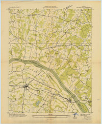 1936 Calvert City1936 Print · USGSMarshall and Livingston counties are captured in the mid-1930s before dam construction permanently altered the Tennessee River valley. Genealogists can locate family landmarks like Cothran Cem, Driskill Sch, and river crossings at Haddox Ferry.
 - 1936 Map of Dexter
 1936 Dexter1936 Print · USGSCalloway County's agricultural heartland is documented here in the mid-1930s, centered on the Nashville Chattanooga and St Louis Railway. Family historians can trace ancestral roots through numerous local landmarks like Coles Camp Ground Ch, Stewart Cem, and Penny.
 - 1936 Map of Hico
 1936 Hico1936 Print · USGSCalloway and Marshall counties are shown here in the mid-thirties during a period of transition under the Tennessee Valley Authority. Researchers can trace deep family roots through numerous cemeteries like Skinner Cem and vanished landmarks such as Vinsons Store or Shady Hill Sch.
 - 1936 Map of Kirksey
 1936 Kirksey1936 Print · USGSCalloway County is captured here in the mid-1930s as the Tennessee Valley Authority began documenting the river basins. Genealogists can locate family-named landmarks like Wyatt Sch, Mt Hebron Cem, and the crossroads at Coldwater.
 - 1936 Map of Little Cypress
 1936 Little Cypress1936 Print · USGSThe Ohio and Tennessee Rivers meet amidst a network of rural settlements in the mid-1930s. Researchers can trace family sites like Little Cypress or locate Kincaid Mounds and early churches like Chestnut Hill Ch.
 - 1936 Map of Briensburg
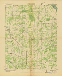 1936 Briensburg1936 Print · USGSWestern Kentucky’s rural landscape comes alive in this mid-1930s survey of Marshall County. Genealogists can trace family roots through numerous country schools and cemeteries like Lone Valley Sch, Stice Sch, and the Dees Cem.
 - 1938 Map of Birmingham
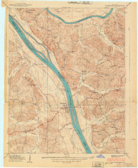 1938 Birmingham1938 Print · USGSThe Tennessee and Cumberland Rivers converge in Lyon County just before the regional landscape was transformed by dam projects. Genealogists can trace family footprints at Birmingham, find rural landmarks like Star Lime Works PO, or locate Harvard Ch and Birmingham Cem.
 - 1938 Map of Briensburg
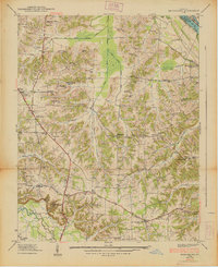 1938 Briensburg1938 Print · USGSBefore the major dams changed the river valley, this 1930s survey captures Marshall County at the height of its rural settlement. Genealogists can trace family names at Wilson Cem or Dees Cem and find local landmarks like Stahl Sch and Provine Chapel.
 - 1940 Map of Hiatt
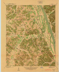 1940 Hiatt1940 Print · USGSThe Tennessee River valley is shown just before the landscape was transformed by damming. Genealogists can trace family landmarks like Faughn Cem, Inmans Store, and riverfront sites at Ironton Landing.
 - 1942 Map of Hico
 1942 Hico1942 Print · USGSCalloway and Marshall counties are shown here just before the war, capturing a rural landscape of ridge-top farms and creek-bottom timber. Researchers can locate family landmarks like Tatums Store, Shiloh Ch, and numerous burial sites including Curd Cem.
 - 1942 Map of Smithland, 1957 Print
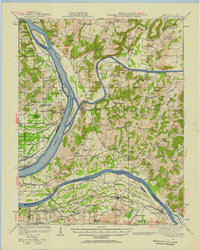 1942 Smithland1957 Print · USGSWestern Kentucky's river-driven economy is on full display during the early 1940s as the Ohio, Cumberland, and Tennessee rivers converge. Researchers can trace historic river crossings like Haddox Ferry and find family landmarks at Kincaid Mounds or the Klondike Mine.
 - 1949 Map of Paducah
 1949 Paducah1949 Print · USGSThe confluence of the Ohio, Mississippi, Tennessee, and Cumberland rivers at the close of the 1940s reveals a region bound by water and rail. Researchers can trace historic river landings, timberlands in the Shawnee National Forest, and the coal-mining infrastructure around West Frankfort and Herrin.2 unique versions available
 - 1950 Map of Paducah
 1950 Paducah1950 Print · USGSThe confluence of the great midwestern rivers defines this mid-century landscape at the intersection of Illinois, Kentucky, and Missouri. Genealogists and historians can trace the rail-and-river economy through the hubs of Paducah, Cairo, and Metropolis or locate family roots near the Wildcat Hills.
 - 1950 Map of Rushing Creek, 1953 Print
 1950 Rushing Creek1953 Print · USGSThe Tennessee and Kentucky borderlands appear here just after the filling of the reservoir, capturing a landscape defined by the new shoreline. Researchers can locate family burial grounds like Rushing Creek Cem and landmarks such as the Lookout Tower and Turkey Creek Ch.5 unique versions available
Showing maps 1-25 of 125
Top cities of Marshall County
Frequently asked questions
- What are the different types of historical maps available for Marshall County?
- What is the oldest map of Marshall County?
- Where can I purchase historical maps of Marshall County for my home or office?
- Where can I download high-res historical maps of Marshall County?
- Are there historical topographic maps available for Marshall County?
- Is there historical aerial imagery available for Marshall County?
- Where are historical maps of Marshall County sourced from?