
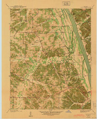
1936 Map of Rushing
USGS Topo · Published 1936About this map
The Tennessee River serves as the dominant artery of this 1930s landscape, bordering Calloway County, Kentucky, and Stewart County, Tennessee. This pre-impoundment survey, compiled from aerial photographs and field examinations by the Tennessee Valley Authority and USGS, reveals a riverine economy defined by numerous active river access points such as Newburg Landing, Dilday Landing, and Boatyard Landing. These landings provided essential transport for rural communities like Newburg and Redden before the creation of Kentucky Lake.
Find a feature on this map
57 named features on this map. Tap any name to fly to it.
Don’t see what you’re looking for? This feature index may not catch every label — zoom into the map to look around manually.
Map Details
Editions of this 1936 Rushing Map
This is the sole edition of this map. No revisions or reprints were ever made.
Other maps of this area

1936 · Tharpe
USGS Topo · 1:24,000

1936 · New Concord
USGS Topo · 1:24,000

1936 · Hamlin
USGS Topo · 1:24,000

1936 · Fenton
USGS Topo · 1:24,000

1936 · Hiatt
USGS Topo · 1:24,000

1936 · Golden Pond
USGS Topo · 1:48,000

1936 · Hico
USGS Topo · 1:24,000
1940 · Hiatt
USGS Topo · 1:24,000

1942 · New Concord
USGS Topo · 1:24,000

1942 · Hico
USGS Topo · 1:24,000