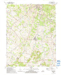
Old Maps of Brandenburg, Kentucky
Explore 30 old maps of Brandenburg, spanning from 1931 to today. These high-resolution historic maps reveal how streets, neighborhoods, landmarks, and natural features evolved over time — perfect for genealogy, metal detecting, research, and local history exploration.
What you can do with these maps:
- See how Brandenburg changed over time: Compare historical maps to modern-day views to trace roads, homesites, rail lines & more.
- View detailed metadata: Each map includes creators, publishers, year, scale, and archive source.
- Overlay maps with satellite & LiDAR: Visualize the past alongside modern tools to explore terrain & human change.
- Trusted historical sources: Maps sourced from the USGS, Library of Congress, and other archives.
- Access maps your way: View online, download high-res files, or order prints for personal or research use.
Start exploring old maps of Brandenburg to uncover forgotten places, hidden landmarks, and the deep history beneath your feet.
Brandenburg, KY maps
(30)- 1931 Map of Corydon
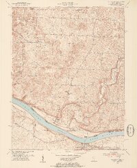
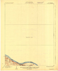 1931 Corydon1931 Print · USGSThe Kentucky-Indiana borderlands along the Ohio River are captured here during the late Prohibition era. Local researchers can trace the riverbank settlement of Brandenburg or locate landmarks like the Oak Grove Sch and Hamilton Hill.4 unique versions available
 - 1941 Map of Ekron
 1941 Ekron1941 Print · USGSNorthern Kentucky and the Ohio River shoreline are captured here in the early 1940s, showing the rural communities of Meade and Hardin Counties. Genealogists can trace family locations near Ekron, Shumate School, and the historic Sherman Landing.
 - 1947 Map of Mauckport
 1947 Mauckport1947 Print · USGSHarrison County's riverfront and rural uplands are shown here in the years following the war, centered on the historic river town of Mauckport. Genealogists and historians can locate vanished local institutions like Hillgrove Sch, Wesley Chapel, and the landing at Morvins Landing.2 unique versions available
 - 1947 Map of Ekron, 1959 Print
 1947 Ekron1959 Print · USGSMeade County and the riverfronts of the Ohio Valley come alive in this late 1940s survey. Genealogists and historians can trace the foundations of Garnettsville, locate rural landmarks like Doe Run Mill, or search for family connections at Cedar Farm Cem and St Martins Sch.
 - 1948 Map of Guston
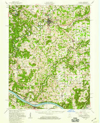
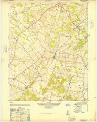 1948 Guston1948 Print · USGSMeade County's rural heartland is captured here just after the war, showing the railroad-centered life of the late 1940s. Genealogists can trace family footprints at the Meade County Farm, Smith School, and Salem Church Cemetery.
 - 1950 Map of Mauckport, 1954 Print
 1950 Mauckport1954 Print · USGSAlong the Indiana-Kentucky border at the start of the fifties, the Ohio River connects bustling towns and quiet forest ridges. Researchers can trace historic river access at Morvin Landing, visit family sites like Atwell Cem, or locate landmarks such as Wesley Chapel and the Oak Grove Sch.3 unique versions available
 - 1950 Map of Corydon, 1959 Print
 1950 Corydon1959 Print · USGSSouthern Indiana and northern Kentucky are captured here in the mid-fifties, centered on the historic town of Corydon and the banks of the Ohio River. Researchers can trace rural life through sites like Sky Park Airport, St Peters Ch, and the river crossing at Mauckport.
 - 1954 Map of Evansville
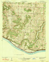
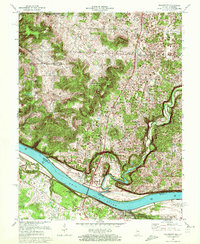
 1954 Evansville1954 Print · USGSThe Ohio River borderlands between Indiana and Kentucky appear here during a period of robust industrial and military growth. Genealogists and researchers can trace the rail corridors of the Illinois Central and find landmarks like US Lock and Dam No 48 or Camp Breckinridge.
 - 1956 Map of Vincennes, 1967 Print
 1956 Vincennes1967 Print · USGSSouthern Indiana and the Illinois borderlands are captured here in the mid-fifties, showing the region's dense network of river towns and rail lines. Researchers can trace historic river crossings along the Wabash River or locate landmarks like Wyandotte Cave and Lincoln State Park.4 unique versions available
 - 1957 Map of Vincennes
 1957 Vincennes1957 Print · USGSSouthwest Indiana and the Illinois borderlands come alive in the late 1950s, a period of heavy rail traffic and expanding state forests. Genealogists and historians can trace the riverfronts and rail lines of Vincennes, New Harmony, and the vast Crane Naval Ammunition Depot.
 - 1957 Map of Evansville, 1969 Print
 1957 Evansville1969 Print · USGSIndiana and Kentucky meet along the Ohio River in this mid-century survey of a vital industrial and transport corridor. Genealogists and historians can trace the development of river towns like Owensboro and Newburgh or locate old rail lines like the Southern Ry.3 unique versions available
 - 1958 Map of Vincennes
 1958 Vincennes1958 Print · USGSSouthern Indiana and the Illinois borderlands are captured during a mid-century period of heavy rail traffic and military activity. Researchers can trace the sprawling bounds of the Crane Naval Ammunition Depot or locate historic settlements like New Harmony and French Lick.2 unique versions available
 - 1961 Map of Evansville
 1961 Evansville1961 Print · USGSThe Ohio River valley and its surrounding coalfields are captured here during the late fifties and early sixties. Trace the industrial rail networks of the Illinois Central RR and explore regional landmarks like Mammoth Cave National Park and Angel Mounds State Memorial.2 unique versions available
 - 1961 Map of Guston, 1962 Print
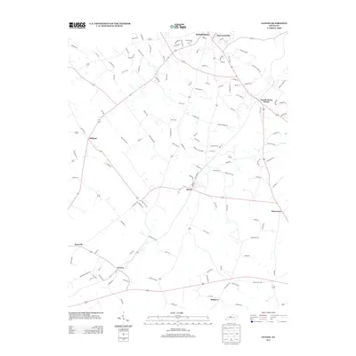
 1961 Guston1962 Print · USGSMeade County during the early sixties shows a landscape of rural communities and karst topography just south of the Ohio River. Researchers can trace the legacy of local life through landmarks like Brandenburg Station, the County Fairground, and New Highland Ch.2 unique versions available
 - 1970 Map of Mauckport, 1972 Print
 1970 Mauckport1972 Print · USGSThe Ohio River valley at the start of the 1970s reveals a landscape of riverfront towns and steep timbered ridges. Genealogists and historians can locate riverside landmarks like Mauckport and Morvins Landing or inland sites like Mt Zion Ch.2 unique versions available
 - 1986 Map of Tell City
 1986 Tell City1986 Print · USGSThe Ohio River valley and the Kentucky interior come alive in this mid-eighties record of industry and recreation. Genealogists and historians can trace small rural settlements like Victoria Crossroads, local landmarks such as St Rose, and the extensive shoreline of Rough River Lake.
 - 1986 Map of Jasper
 1986 Jasper1986 Print · USGSSouthern Indiana in the 1980s is defined by the expansive Patoka Lake and the dense timber of the Hoosier National Forest. Researchers can trace the Southern RR through the hills or locate historic sites like Saint Meinrad and Sulphur Springs.
 - 1991 Map of Tell City
 1991 Tell City1991 Print · USGSThe Ohio River valley at the start of the nineties reveals a landscape of riverfront industry and sprawling conservation lands. Genealogists can locate family landmarks like Wesley Chapel and rural communities such as Reynolds Station and Maceo.
 - 1991 Map of Guston, 1992 Print
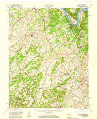
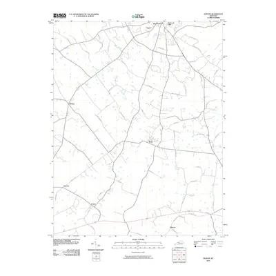
 1991 Guston1992 Print · USGSMeade County at the start of the nineties reveals a landscape of plateau settlements and rural crossroads. Local historians can trace family roots at Cap Anderson Cem or explore the community centers at Ekron, Guston, and Weldon Ch.
 - 1994 Map of Jasper
 1994 Jasper1994 Print · USGSSouthern Indiana and the Kentucky borderlands are captured here in the mid-nineties, showing a landscape defined by the Ohio River and dense state forests. Genealogists can locate family landmarks like Saint Meinrad Archabbey, Saint Anthony, and the historic Lincoln Boyhood National Memorial.
 - 2010 Map of Guston, 2010 Print
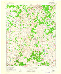
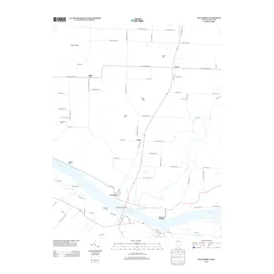
 2010 Guston2010 Print · USGSCovers Brandenburg, including Ekron, Guston, and other nearby areas
 - 2010 Map of Mauckport, 2010 Print
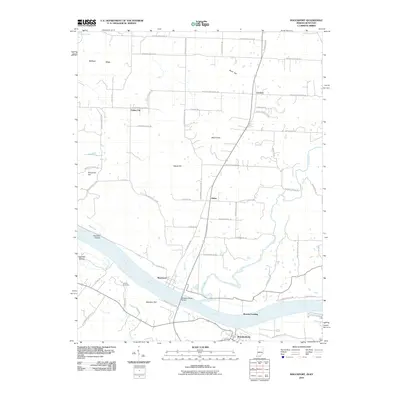 2010 Mauckport2010 Print · USGSCovers Brandenburg, including Mauckport, Morvins Landing, and other nearby areas
 - 2013 Map of Guston, 2013 Print
 2013 Guston2013 Print · USGSCovers Brandenburg, including Ekron, Guston, and other nearby areas
 - 2013 Map of Mauckport, 2013 Print
 2013 Mauckport2013 Print · USGSCovers Brandenburg, including Mauckport, Morvins Landing, and other nearby areas
 - 2016 Map of Guston, 2016 Print
 2016 Guston2016 Print · USGSCovers Brandenburg, including Ekron, Guston, and other nearby areas
Showing maps 1-25 of 30
Top cities near Brandenburg
- Radcliff historical maps
- Vine Grove historical maps
- Corydon historical maps
- Irvington historical maps
- Leavenworth historical maps
- Ekron historical maps
See more
Top neighborhoods of Brandenburg
Frequently asked questions
- What are the different types of historical maps available for Brandenburg?
- What is the oldest map of Brandenburg?
- Where can I purchase historical maps of Brandenburg for my home or office?
- Where can I download high-res historical maps of Brandenburg?
- Are there historical topographic maps available for Brandenburg?
- Is there historical aerial imagery available for Brandenburg?
- Where are historical maps of Brandenburg sourced from?