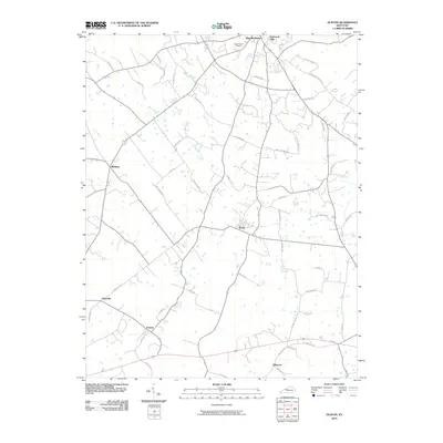
2010 Map of Guston
USGS Topo · Published 2010About this map
Brandenburg and its southeastern surroundings define this Meade County landscape, where traditional rural road networks intersect with growing residential pockets like Eastwood Hills. The topography is characterized by the subtle drainage patterns of Doe Run and numerous sinkholes typical of this karst region. Historic continuity is evident in the naming of thoroughfares such as Molly Brown Rd, Fred Fackler Rd, and Dave Smith Rd, which reflect the area's deep-rooted family lineage. Small settlements like Ekron, Midway, and Guston serve as focal points for the agricultural and residential community. Notable local landmarks include the Cap Anderson Cemetery and religious heritage sites indicated by Christian Church Rd. The network of local roads, such as Seminole Trl and Quail Run Rd, provides a clear view of the land division and development patterns present in the early 21st century.
Find a feature on this map
50 named features on this map. Tap any name to fly to it.
Don’t see what you’re looking for? This feature index may not catch every label — zoom into the map to look around manually.
Map Details
Editions of this 2010 Guston Map
This is the sole edition of this map. No revisions or reprints were ever made.
Other maps of this area

1928 · Hardinsburg
USGS Topo · 1:48,000

1931 · Hardinsburg
USGS Topo · 1:62,500

1931 · Corydon
USGS Topo · 1:62,500

1941 · Ekron
USGS Topo · 1:62,500

1946 · Rock Haven
USGS Topo · 1:24,000

1947 · Irvington
USGS Topo · 1:24,000

1947 · Garfield
USGS Topo · 1:24,000

1947 · Mauckport
USGS Topo · 1:24,000

1947 · Hardinsburg
USGS Topo · 1:62,500

1947 · Ekron
USGS Topo · 1:62,500