
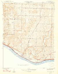
1947 Map of Mauckport
USGS Topo · Published 1947About this map
The Ohio River shoreline in Harrison County defines the southern edge of this landscape, where the river serves as the state boundary between Indiana and Kentucky. Rising from the floodplains, the topography is characterized by a series of prominent elevations including Wolfpen Ridge, Shireman Hill, and Sand Hill. The settlement pattern in the late 1940s is anchored by the river town of Mauckport and the downstream river access at Morvins Landing. Inland, the community is organized around rural hubs like Valley City, Central, and Glidas, connected by the route of State Road 135. Genealogy researchers will find several localized landmarks preserved on this sheet, including Wesley Chapel, Crossroads Ch, and the Hillgrove Sch, which reflect the social infrastructure of these townships before the mid-century shift toward consolidation.
Find a feature on this map
26 named features on this map. Tap any name to fly to it.
Don’t see what you’re looking for? This feature index may not catch every label — zoom into the map to look around manually.
Map Details
Editions of this 1947 Mauckport Map
2 editions found
Other maps of this area

1928 · Hardinsburg
USGS Topo · 1:48,000

1931 · Hardinsburg
USGS Topo · 1:62,500

1931 · Corydon
USGS Topo · 1:62,500

1941 · Ekron
USGS Topo · 1:62,500

1944 · Corydon West
USGS Topo · 1:24,000

1946 · Rock Haven
USGS Topo · 1:24,000

1946 · Leavenworth
USGS Topo · 1:24,000

1947 · Irvington
USGS Topo · 1:24,000

1947 · Leavenworth
USGS Topo · 1:24,000

1947 · Corydon West
USGS Topo · 1:24,000