
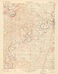
1947 Map of Corydon West
USGS Topo · Published 1947About this map
Corydon anchors the eastern edge of this landscape, where the deeply incised meanders of Indian Creek and the Blue River carve through the limestone terrain of southern Indiana. The topography is defined by high ridges like Devils Backbone and several family-named rises, including Binkley Hill and Windell Hill. This 1944 survey captures a rural network of schoolhouses and country churches that served the agricultural community, with the prominent Harrison Spring appearing in the north. The distribution of small institutions like Whitetop Sch and Perseverance Chapel reflects a settlement pattern of decentralized farming hamlets connected by winding secondary roads. Significant landmarks such as Scout Mtn and the isolated settlement at White Cloud emphasize the rugged isolation of the river valleys before modern infrastructure further altered the corridors.
Find a feature on this map
29 named features on this map. Tap any name to fly to it.
Don’t see what you’re looking for? This feature index may not catch every label — zoom into the map to look around manually.
Map Details
Editions of this 1947 Corydon West Map
2 editions found
Other maps of this area

1931 · Corydon
USGS Topo · 1:62,500

1944 · Corydon West
USGS Topo · 1:24,000

1946 · Leavenworth
USGS Topo · 1:24,000

1946 · Depauw
USGS Topo · 1:24,000

1947 · Leavenworth
USGS Topo · 1:24,000

1947 · Mauckport
USGS Topo · 1:24,000

1948 · Corydon East
USGS Topo · 1:24,000

1948 · Milltown
USGS Topo · 1:24,000

1948 · Laconia
USGS Topo · 1:24,000
1950 · Laconia
USGS Topo · 1:24,000