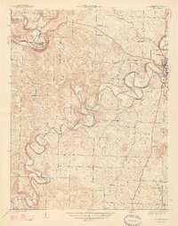
1947 Map of Corydon West
USGS Topo · Published 1947About this map
Corydon sits at the eastern edge of this 1944 survey, where the winding course of Indian Creek carves deep loops into the Harrison County landscape. This mid-century view captures a rural society organized around neighborhood centers, evidenced by the dense distribution of one-room schoolhouses and local meeting houses. Along the southern reaches, family-named landmarks like Mathes Hill, Binkley Hill, and Windell Hill rise above the drainage basins, while the distinctive ridge of Devils Backbone follows the sharp meanders of the creek. To the northwest, the Blue River flows past Scout Mtn, creating a sharp contrast between the broader river valley and the upland ridges. For the genealogist, the map pinpointing of the Jordan Cem and numerous country churches including Perseverance Chapel and Heidelberg Ch provides essential spatial context for 1940s rural life.
Find a feature on this map
28 named features on this map. Tap any name to fly to it.
Don’t see what you’re looking for? This feature index may not catch every label — zoom into the map to look around manually.
Map Details
Editions of this 1947 Corydon West Map
2 editions found
Other maps of this area

1931 · Corydon
USGS Topo · 1:62,500

1944 · Corydon West
USGS Topo · 1:24,000

1946 · Leavenworth
USGS Topo · 1:24,000

1946 · Depauw
USGS Topo · 1:24,000

1947 · Leavenworth
USGS Topo · 1:24,000

1947 · Corydon West
USGS Topo · 1:24,000

1947 · Mauckport
USGS Topo · 1:24,000

1948 · Corydon East
USGS Topo · 1:24,000

1948 · Milltown
USGS Topo · 1:24,000

1948 · Laconia
USGS Topo · 1:24,000