
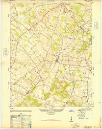
1947 Map of Garfield
USGS Topo · Published 1947About this map
Sinking Creek winds through this post-war Breckinridge County landscape, illustrating a rural community tied to its complex terrain. The topography is defined by prominent elevations such as Somerset Knob and Sinking Creek Hill, which dictate the placement of roads and small settlements. At the center of this 1947 Army Map Service compilation, the village of Garfield serves as a local hub, connected to outlying areas like Hensley and Graysville by a network that includes the primary Route 60 corridor.
Find a feature on this map
13 named features on this map. Tap any name to fly to it.
Don’t see what you’re looking for? This feature index may not catch every label — zoom into the map to look around manually.
Map Details
Editions of this 1947 Garfield Map
This is the sole edition of this map. No revisions or reprints were ever made.
Other maps of this area

1928 · Hardinsburg
USGS Topo · 1:48,000

1931 · Hardinsburg
USGS Topo · 1:62,500

1932 · Big Clifty
USGS Topo · 1:62,500

1941 · Ekron
USGS Topo · 1:62,500

1947 · Irvington
USGS Topo · 1:24,000

1947 · Lodiburg
USGS Topo · 1:24,000

1947 · Hardinsburg
USGS Topo · 1:24,000

1947 · Hardinsburg
USGS Topo · 1:62,500

1947 · Ekron
USGS Topo · 1:62,500
1948 · Guston
USGS Topo · 1:24,000