Old Maps of Breckinridge County, Kentucky
Explore 167 old maps of Breckinridge County, spanning from 1928 to today. These high-resolution historic maps reveal how streets, neighborhoods, landmarks, and natural features evolved over time — perfect for genealogy, metal detecting, research, and local history exploration.
What you can do with these maps:
- See how Breckinridge County changed over time: Compare historical maps to modern-day views to trace roads, homesites, rail lines & more.
- View detailed metadata: Each map includes creators, publishers, year, scale, and archive source.
- Overlay maps with satellite & LiDAR: Visualize the past alongside modern tools to explore terrain & human change.
- Trusted historical sources: Maps sourced from the USGS, Library of Congress, and other archives.
- Access maps your way: View online, download high-res files, or order prints for personal or research use.
Start exploring old maps of Breckinridge County to uncover forgotten places, hidden landmarks, and the deep history beneath your feet.
Breckinridge County, KY maps
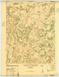
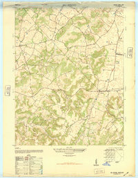
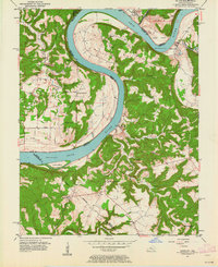
(167)- 1928 Map of Hardinsburg
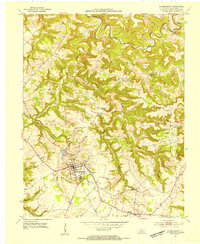
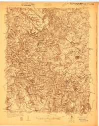 1928 Hardinsburg1928 Print · USGSBreckinridge and Meade counties are captured here in the late twenties as the railroad and the Dixie Highway shaped local commerce. Genealogists can trace family footprints through dozens of rural landmarks like Clifton Mills, Mt Merino Ch, and Argabright Sch.
 - 1931 Map of Hardinsburg
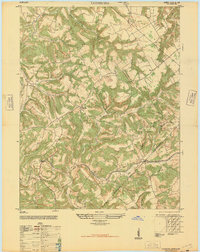
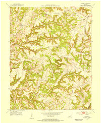
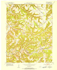
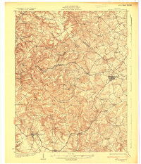 1931 Hardinsburg1931 Print · USGSBreckinridge and Meade Counties are shown in meticulous detail during the late Prohibition era, before modern highways bypassed many rural communities. Researchers can trace dozens of country schools and churches like Giltedge Sch or the Gar Rook Mine along the Louisville and Nashville line.3 unique versions available
 - 1932 Map of Big Clifty
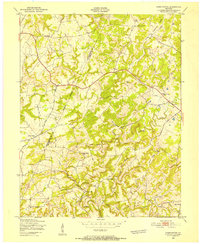
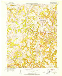
 1932 Big Clifty1932 Print · USGSGrayson and Hardin Counties are captured here between the World Wars, showing a rural landscape defined by the Illinois Central Railroad and the Dixie Highway. Genealogists and historians can locate dozens of small community centers like Big Clifty, White Mills, and the Asphalt Mine.5 unique versions available
 - 1932 Map of Fordsville
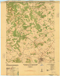
 1932 Fordsville1932 Print · USGSThe hill country of Ohio and Breckinridge Counties is captured here in the early thirties as the railroad age peaked. Researchers can trace family sites at Barretts Ferry PO Davidson Sta, Glen Dean, and the many schools like Fallen Rock Sch.
 - 1934 Map of Cannelton
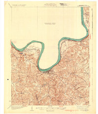 1934 Cannelton1934 Print · USGSThe Ohio River corridor between Indiana and Kentucky comes to life in this mid-1930s survey of the riverfront and its rugged hinterlands. Genealogists can trace family footprints through a dense network of country schools and churches, from St Johns Ch and New Bethel Ch to rural outposts like Mattingly PO.2 unique versions available
 - 1941 Map of Ekron
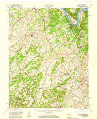
 1941 Ekron1941 Print · USGSNorthern Kentucky and the Ohio River shoreline are captured here in the early 1940s, showing the rural communities of Meade and Hardin Counties. Genealogists can trace family locations near Ekron, Shumate School, and the historic Sherman Landing.
 - 1947 Map of Irvington
 1947 Irvington1947 Print · USGSIn the post-war Kentucky countryside, this survey captures the rural landscape centered on the rail hub of Irvington. Genealogists and historians can trace local farm life and community ties through landmarks like Payneville School, Fairmont School, and Sirocco.
 - 1947 Map of Lodiburg
 1947 Lodiburg1947 Print · USGSBreckinridge County settlements and winding ridgeline roads are captured here just after the war. Local historians can trace old homesteads and community sites like Union Star, Pleasant Valley School, and the Cem markers near Sample.
 - 1947 Map of Hardinsburg
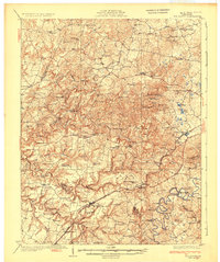
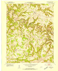
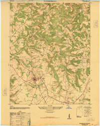 1947 Hardinsburg1947 Print · USGSBreckinridge County is shown just after the war, centered on the historic county seat and its surrounding farmsteads. Trace early rural life through Clifton Mills School, the Dismantled Railroad, and Tate Chapel.
 - 1947 Map of Garfield
 1947 Garfield1947 Print · USGSBreckinridge County is shown just after the war when small farming communities were connected by winding ridge roads. Genealogists and local historians can locate early landmarks like Bethel School, the Old Rock Mine, and the crossroads of Garfield.
 - 1947 Map of Hardinsburg, 1959 Print
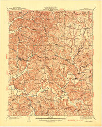
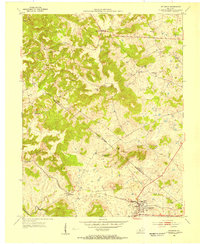
 1947 Hardinsburg1959 Print · USGSBreckinridge and Meade Counties are shown here during the late 1940s, a time when rural life centered on local crossroads and one-room schools. Genealogists can trace family connections to landmarks like Fate Chapel, Clifton Mills, or the Bunker Hill Sch.
 - 1947 Map of Ekron, 1959 Print
 1947 Ekron1959 Print · USGSMeade County and the riverfronts of the Ohio Valley come alive in this late 1940s survey. Genealogists and historians can trace the foundations of Garnettsville, locate rural landmarks like Doe Run Mill, or search for family connections at Cedar Farm Cem and St Martins Sch.
 - 1948 Map of Guston
 1948 Guston1948 Print · USGSMeade County's rural heartland is captured here just after the war, showing the railroad-centered life of the late 1940s. Genealogists can trace family footprints at the Meade County Farm, Smith School, and Salem Church Cemetery.
 - 1948 Map of Big Spring
 1948 Big Spring1948 Print · USGSKentucky's rural interior comes into focus shortly after the war, showing the tight-knit network of country roads and family-named corners. Genealogists can trace property and community life near Bewleyville School, High Plains, and the prominent Big Spring crossing.
 - 1949 Map of Constantine, 1952 Print
 1949 Constantine1952 Print · USGSWestern Hardin County and neighboring Breckinridge County are captured here in the late 1940s, showing a landscape of ridge-top farms and valley schools. Researchers can find family-named landmarks like Pierce Mill, Grandview Ch, and Pole Bridge Sch.
 - 1949 Map of Big Clifty, 1959 Print
 1949 Big Clifty1959 Print · USGSThe rural communities of Grayson and Hardin counties are captured in the late 1940s, a time when small schoolhouses and country churches still anchored local life. Researchers can trace family roots at St Elizabeth Cem or locate long-standing landmarks like Pierce Mill and the Needham Chapel Ch along the Rough River.
 - 1950 Map of Alton, 1959 Print
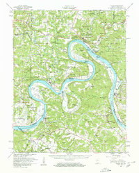 1950 Alton1959 Print · USGSThe Ohio River loops through the Indiana and Kentucky borderlands at mid-century, following the deep curves of Big Bend and Oxbow Bend. Genealogists and local historians can trace family roots through numerous rural landmarks like St Theresa Academy, Beechland Sch, and the historic town of Leavenworth.2 unique versions available
 - 1950 Map of Alton, 1962 Print
 1950 Alton1962 Print · USGSThe Ohio River borderlands between Indiana and Kentucky are captured here in the early fifties, showing a landscape defined by ferries and small river landings. Researchers can trace family roots at St Theresa Academy, the Boyer Ferry, and the remote Stephenson Cem.
 - 1951 Map of Alton
 1951 Alton1951 Print · USGSThe Indiana and Kentucky borderlands meet along the winding Ohio River in the early fifties. Genealogists can trace family names and rural institutions at St Theresa Academy, the Boyer Ferry, and Stony Point Sch.2 unique versions available
 - 1953 Map of Custer, 1954 Print
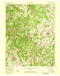
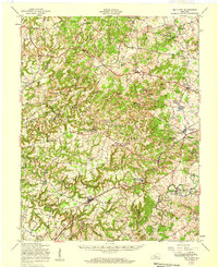
 1953 Custer1954 Print · USGSBreckinridge County in the early 1950s is a landscape of high ridges and deep river forks. Genealogists can trace family roots through rural landmarks like Alexander Chapel, Goodhope Cem, and the old Shrewsbury Sch in the hills near Custer.
 - 1953 Map of Mc Daniels, 1954 Print
 1953 Mc Daniels1954 Print · USGSBreckinridge and Grayson Counties are shown in the early fifties as the rural economy revolved around the winding Rough River. Researchers can trace the locations of family cemeteries like Poole Cem and vanished landmarks such as Johnson Sch and Stones Chapel Sch.
 - 1953 Map of Irvington, 1954 Print
 1953 Irvington1954 Print · USGSIrvington and the borderlands of Meade and Breckinridge counties are shown here in the early fifties, centered on the Louisville and Nashville line. Researchers can locate country schools like Bunker Hill Sch and family burial sites including Mt Merino Cem.
 - 1953 Map of Hardinsburg, 1954 Print
 1953 Hardinsburg1954 Print · USGSBreckinridge County, Kentucky, enters the 1950s with a landscape defined by traditional rural communities and the growing county seat. Local historians can trace family roots at Clifton Mills, St Romuald Sch, and the quiet crossroads of Harned.2 unique versions available
 - 1953 Map of Lodiburg, 1954 Print
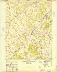
 1953 Lodiburg1954 Print · USGSBreckinridge County during the early fifties reveals a rural landscape of ridge-top schools and creek-side rail stops. Genealogists can trace family landmarks like Shelman Cem, Frymire Sch, and the small community at Union Star.3 unique versions available
 - 1953 Map of Kingswood, 1954 Print
 1953 Kingswood1954 Print · USGSBreckinridge County in the early fifties was a landscape of ridge-top settlements and deep river hollows. Genealogists and local historians can trace family locations near Kingswood, Mt Zion Ch, and rural schoolhouses like St Anthony Sch.
Showing maps 1-25 of 167
Top cities of Breckinridge County
Frequently asked questions
- What are the different types of historical maps available for Breckinridge County?
- What is the oldest map of Breckinridge County?
- Where can I purchase historical maps of Breckinridge County for my home or office?
- Where can I download high-res historical maps of Breckinridge County?
- Are there historical topographic maps available for Breckinridge County?
- Is there historical aerial imagery available for Breckinridge County?
- Where are historical maps of Breckinridge County sourced from?