1960s Maps of Breckinridge County, Kentucky
Explore 10 historic maps of Breckinridge County from the 1960s. These maps offer a rare glimpse into what life looked like during the 1960s — showing old roads, neighborhoods, homes, and landmarks that have changed or disappeared over time.
Whether you're researching your family's past, planning a metal detecting trip, or studying how Breckinridge County's landscape evolved across the 1960s, these high-resolution maps are a powerful tool for exploring the history of this region.
- Focus on a specific era: All maps on this page are from the 1960s, giving you a focused view of this time period.
- See what’s changed: Compare century-old streets, trails, and buildings to today's modern landscape using overlays and satellite layers.
- Research with precision: Use these maps for genealogy, historical research, land use analysis, or educational projects.
- View, download, or print: Maps are fully viewable online in high resolution, and can be downloaded or printed for your own records.
Start exploring Breckinridge County's history through authentic maps from the 1960s. This is your window into the past.
Breckinridge County, KY maps
(10)- 1960 Map of Constantine, 1962 Print
 1960 Constantine1962 Print · USGSHardin and Breckinridge counties are seen here in the early sixties as the landscape responds to the winding Rough River. Researchers can locate community anchors like Constantine and Dyer, along with Pole Bridge Ch and Pierce Mill.2 unique versions available
 - 1961 Map of Evansville
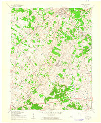
 1961 Evansville1961 Print · USGSThe Ohio River valley and its surrounding coalfields are captured here during the late fifties and early sixties. Trace the industrial rail networks of the Illinois Central RR and explore regional landmarks like Mammoth Cave National Park and Angel Mounds State Memorial.2 unique versions available
 - 1961 Map of Big Spring, 1962 Print
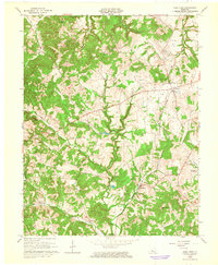
 1961 Big Spring1962 Print · USGSThe three-way border of Meade, Breckinridge, and Hardin counties comes into focus in the early sixties, showing a landscape of small upland settlements and winding valleys. Researchers can trace family sites and local landmarks from Bewleyville and Big Spring to the rural crossroads at Maples Corner.2 unique versions available
 - 1961 Map of Guston, 1962 Print
 1961 Guston1962 Print · USGSMeade County during the early sixties shows a landscape of rural communities and karst topography just south of the Ohio River. Researchers can trace the legacy of local life through landmarks like Brandenburg Station, the County Fairground, and New Highland Ch.2 unique versions available
 - 1963 Map of Kingswood, 1964 Print
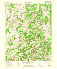
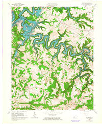
 1963 Kingswood1964 Print · USGSBreckinridge County is shown here in the early sixties during the development of the Rough River Reservoir. Family researchers can locate St Anthony Sch, rural churches like Mt Zion Ch, and old settlements at Harned and Westview.3 unique versions available
 - 1963 Map of Mc Daniels, 1964 Print
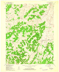
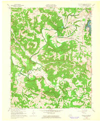
 1963 Mc Daniels1964 Print · USGSBreckinridge and Grayson Counties are shown here during the mid-twentieth century as the newly formed Rough River Reservoir transformed the local valleys. Researchers can locate vanished rural landmarks and family-named sites like Horn Back Mill, Johnson Sch, and Poole Cem.3 unique versions available
 - 1963 Map of Glen Dean, 1965 Print
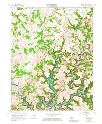
 1963 Glen Dean1965 Print · USGSBreckinridge County during the early sixties shows a landscape of active oil fields and rural rail hubs. Genealogists and historians can trace family locations near St Marys Ch, Rockvale, and the winding Illinois Central railroad line.2 unique versions available
 - 1963 Map of Falls of Rough, 1965 Print
 1963 Falls of Rough1965 Print · USGSThe Rough River region in the early sixties shows a landscape undergoing change as the new reservoir and Rough River Dam State Park take shape. Researchers can trace ancestral roots through remote sites like Iron Ore Hill Cem and Lone Hill Ch.
 - 1963 Map of Custer, 1965 Print
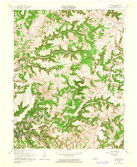 1963 Custer1965 Print · USGSBreckinridge County is captured here in the early sixties as the Rough River Reservoir begins to shape the terrain. Genealogists and local historians can trace family roots through numerous burial sites like Horsley Cem and rural hubs such as Custer or Hudson.2 unique versions available
 - 1963 Map of Madrid, 1976 Print
 1963 Madrid1976 Print · USGSGrayson and Breckinridge Counties are captured here in the early sixties as the reservoir waters of Rough River Lake reshaped the valley. Trace local roots at sites like Antioch Ch, Mullins Cem, and the old Conklin Sch.2 unique versions available
End of results
Showing maps 1-10 of 10
Top cities of Breckinridge County
Frequently asked questions
- What are the different types of historical maps available for Breckinridge County?
- What is the oldest map of Breckinridge County?
- Where can I purchase historical maps of Breckinridge County for my home or office?
- Where can I download high-res historical maps of Breckinridge County?
- Are there historical topographic maps available for Breckinridge County?
- Is there historical aerial imagery available for Breckinridge County?
- Where are historical maps of Breckinridge County sourced from?