1950s Maps of Breckinridge County, Kentucky
Explore 24 historic maps of Breckinridge County from the 1950s. These maps offer a rare glimpse into what life looked like during the 1950s — showing old roads, neighborhoods, homes, and landmarks that have changed or disappeared over time.
Whether you're researching your family's past, planning a metal detecting trip, or studying how Breckinridge County's landscape evolved across the 1950s, these high-resolution maps are a powerful tool for exploring the history of this region.
- Focus on a specific era: All maps on this page are from the 1950s, giving you a focused view of this time period.
- See what’s changed: Compare century-old streets, trails, and buildings to today's modern landscape using overlays and satellite layers.
- Research with precision: Use these maps for genealogy, historical research, land use analysis, or educational projects.
- View, download, or print: Maps are fully viewable online in high resolution, and can be downloaded or printed for your own records.
Start exploring Breckinridge County's history through authentic maps from the 1950s. This is your window into the past.
Breckinridge County, KY maps
(24)- 1950 Map of Alton, 1959 Print
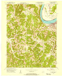
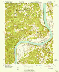
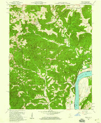
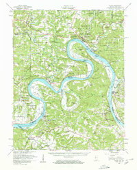 1950 Alton1959 Print · USGSThe Ohio River loops through the Indiana and Kentucky borderlands at mid-century, following the deep curves of Big Bend and Oxbow Bend. Genealogists and local historians can trace family roots through numerous rural landmarks like St Theresa Academy, Beechland Sch, and the historic town of Leavenworth.2 unique versions available
 - 1950 Map of Alton, 1962 Print
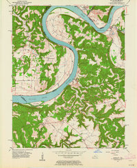 1950 Alton1962 Print · USGSThe Ohio River borderlands between Indiana and Kentucky are captured here in the early fifties, showing a landscape defined by ferries and small river landings. Researchers can trace family roots at St Theresa Academy, the Boyer Ferry, and the remote Stephenson Cem.
 - 1951 Map of Alton
 1951 Alton1951 Print · USGSThe Indiana and Kentucky borderlands meet along the winding Ohio River in the early fifties. Genealogists can trace family names and rural institutions at St Theresa Academy, the Boyer Ferry, and Stony Point Sch.2 unique versions available
 - 1953 Map of Custer, 1954 Print
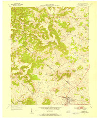
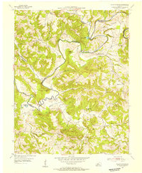
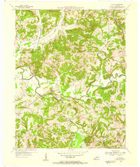
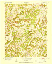 1953 Custer1954 Print · USGSBreckinridge County in the early 1950s is a landscape of high ridges and deep river forks. Genealogists can trace family roots through rural landmarks like Alexander Chapel, Goodhope Cem, and the old Shrewsbury Sch in the hills near Custer.
 - 1953 Map of Mc Daniels, 1954 Print
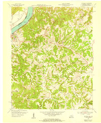
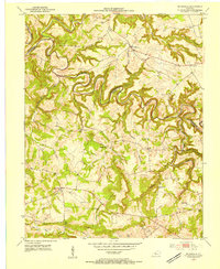 1953 Mc Daniels1954 Print · USGSBreckinridge and Grayson Counties are shown in the early fifties as the rural economy revolved around the winding Rough River. Researchers can trace the locations of family cemeteries like Poole Cem and vanished landmarks such as Johnson Sch and Stones Chapel Sch.
 - 1953 Map of Irvington, 1954 Print
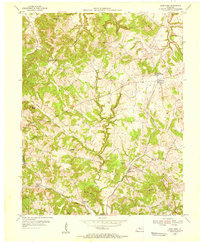
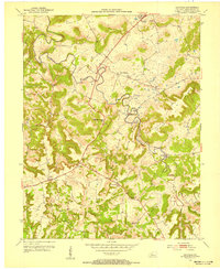
 1953 Irvington1954 Print · USGSIrvington and the borderlands of Meade and Breckinridge counties are shown here in the early fifties, centered on the Louisville and Nashville line. Researchers can locate country schools like Bunker Hill Sch and family burial sites including Mt Merino Cem.
 - 1953 Map of Hardinsburg, 1954 Print
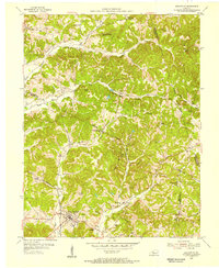
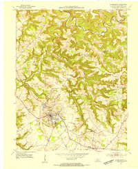 1953 Hardinsburg1954 Print · USGSBreckinridge County, Kentucky, enters the 1950s with a landscape defined by traditional rural communities and the growing county seat. Local historians can trace family roots at Clifton Mills, St Romuald Sch, and the quiet crossroads of Harned.2 unique versions available
 - 1953 Map of Lodiburg, 1954 Print
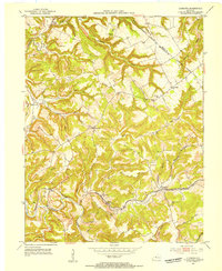 1953 Lodiburg1954 Print · USGSBreckinridge County during the early fifties reveals a rural landscape of ridge-top schools and creek-side rail stops. Genealogists can trace family landmarks like Shelman Cem, Frymire Sch, and the small community at Union Star.3 unique versions available
 - 1953 Map of Kingswood, 1954 Print
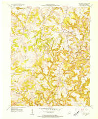 1953 Kingswood1954 Print · USGSBreckinridge County in the early fifties was a landscape of ridge-top settlements and deep river hollows. Genealogists and local historians can trace family locations near Kingswood, Mt Zion Ch, and rural schoolhouses like St Anthony Sch.
 - 1953 Map of Cloverport, 1955 Print
 1953 Cloverport1955 Print · USGSThe Ohio River valley and the rugged interior of Breckinridge County come into focus in the early 1950s. Genealogists and historians can trace family locations near Cloverport, Patesville, and Harris Memorial Ch, or locate old Oil Wells along the ridges.2 unique versions available
 - 1953 Map of Falls Of Rough, 1955 Print
 1953 Falls Of Rough1955 Print · USGSThe Rough River valley in the early fifties shows a landscape of ridge-top schools and secluded family cemeteries. Researchers can trace ancestral locations at Yeaman or Tousey and find rural landmarks like Lone Hill Sch and Shady Grove Ch.
 - 1953 Map of Mattingly, 1955 Print
 1953 Mattingly1955 Print · USGSBreckinridge County, Kentucky, and the Indiana riverfront are captured here in the early 1950s. Genealogists and historians can trace family roots through numerous sites like Calvary Cem, New Bethel Ch, and the rural community of Mattingly.
 - 1953 Map of Glen Dean, 1955 Print
 1953 Glen Dean1955 Print · USGSBreckinridge County in the early fifties shows a landscape of deep creek valleys and rising knobs where oil exploration met rural community life. Genealogists can trace family roots through landmarks like McQuady, the St Marys of the Woods Sch, and Glen Dean.
 - 1953 Map of Rome, 1955 Print
 1953 Rome1955 Print · USGSThe Ohio River oxbow between Perry County, Indiana, and Breckinridge County, Kentucky, reveals a mid-century landscape of riverside settlements and forest ridges. Researchers can trace family history at Brashear Cem, locate the old Tucker Sch, or explore the heights of Rickert Cliffs.2 unique versions available
 - 1953 Map of Garfield, 1955 Print
 1953 Garfield1955 Print · USGSBreckinridge County's rural heartland is shown in detail during the early fifties, where Sinking Creek's loops define the local geography. Researchers can trace historic family burial sites like Turpin Cem and Board Cem or locate the old Louisville and Nashville rail corridor at Irvington.2 unique versions available
 - 1953 Map of Fordsville, 1955 Print
 1953 Fordsville1955 Print · USGSMid-century Kentucky hill country comes alive here as the Illinois Central railroad connects small rural communities and a growing petroleum industry. Genealogists can trace family roots through landmarks like Boiling Chapel, Ellmitch, and the Wedding Cemetery.2 unique versions available
 - 1954 Map of Evansville
 1954 Evansville1954 Print · USGSThe Ohio River borderlands between Indiana and Kentucky appear here during a period of robust industrial and military growth. Genealogists and researchers can trace the rail corridors of the Illinois Central and find landmarks like US Lock and Dam No 48 or Camp Breckinridge.
 - 1954 Map of Derby, 1955 Print
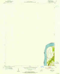 1954 Derby1955 Print · USGSThe Ohio River shoreline at the Indiana-Kentucky border is captured here during the mid-1950s. Genealogists and local historians can trace the small settlement of Chenaultt and its local Chenaultt Sch along the river's eastern bank.
 - 1954 Map of Olaton, 1955 Print
 1954 Olaton1955 Print · USGSOhio County, Kentucky, in the mid-1950s is a landscape of creek-bottom farms and rural rail stops. You can trace the Illinois Central line to Davidson Sta or locate family sites like the Fallen Rock Sch and Huff Creek Ch.3 unique versions available
 - 1956 Map of Vincennes, 1967 Print
 1956 Vincennes1967 Print · USGSSouthern Indiana and the Illinois borderlands are captured here in the mid-fifties, showing the region's dense network of river towns and rail lines. Researchers can trace historic river crossings along the Wabash River or locate landmarks like Wyandotte Cave and Lincoln State Park.4 unique versions available
 - 1957 Map of Vincennes
 1957 Vincennes1957 Print · USGSSouthwest Indiana and the Illinois borderlands come alive in the late 1950s, a period of heavy rail traffic and expanding state forests. Genealogists and historians can trace the riverfronts and rail lines of Vincennes, New Harmony, and the vast Crane Naval Ammunition Depot.
 - 1957 Map of Evansville, 1969 Print
 1957 Evansville1969 Print · USGSIndiana and Kentucky meet along the Ohio River in this mid-century survey of a vital industrial and transport corridor. Genealogists and historians can trace the development of river towns like Owensboro and Newburgh or locate old rail lines like the Southern Ry.3 unique versions available
 - 1958 Map of Vincennes
 1958 Vincennes1958 Print · USGSSouthern Indiana and the Illinois borderlands are captured during a mid-century period of heavy rail traffic and military activity. Researchers can trace the sprawling bounds of the Crane Naval Ammunition Depot or locate historic settlements like New Harmony and French Lick.2 unique versions available
 - 1958 Map of Derby, 1959 Print
 1958 Derby1959 Print · USGSThe Indiana and Kentucky borderlands along the Ohio River appear here in the late fifties, showcasing the remote wooded ridges of the Hoosier National Forest. Genealogists will find a wealth of family history in remote burial grounds like Talley Cem and Badger Cem.5 unique versions available
End of results
Showing maps 1-24 of 24
Top cities of Breckinridge County
Frequently asked questions
- What are the different types of historical maps available for Breckinridge County?
- What is the oldest map of Breckinridge County?
- Where can I purchase historical maps of Breckinridge County for my home or office?
- Where can I download high-res historical maps of Breckinridge County?
- Are there historical topographic maps available for Breckinridge County?
- Is there historical aerial imagery available for Breckinridge County?
- Where are historical maps of Breckinridge County sourced from?