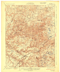
1947 Map of Ekron
USGS Topo · Published 1959About this map
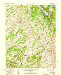
The Ohio River forms the northern boundary of this Kentucky landscape, which includes the river landings of Stephens Landing, Cedar Farm Landing, and Pilcher Landing. The area transitions from the river valley to an upland interior defined by the winding course of Otter Creek and Doe Run. Industrial and social history is grounded in the presence of Doe Run Mill and several early settlements such as Ekron, Brandenburg Station, and Garnettsville. The landscape is dotted with small-scale rural infrastructure, from one-room schoolhouses like Schumate Sch and Rockridge Sch to numerous family burial grounds including the Ditto Cem and Woolrich Cem. This post-war survey preserves the network of primary travel routes, such as the Nashville Road and Brandenburg and Louisville Road, that linked these agrarian communities before the modern expansion of regional infrastructure.
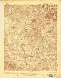
Find a feature on this map
100 named features on this map. Tap any name to fly to it.
Don’t see what you’re looking for? This feature index may not catch every label — zoom into the map to look around manually.
Map Details
Editions of this 1947 Ekron Map
This is the sole edition of this map. No revisions or reprints were ever made.
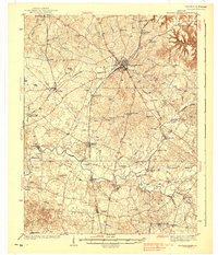
Other maps of this area

1909 · Kosmosdale
USGS Topo · 1:48,000

1912 · Kosmosdale
USGS Topo · 1:62,500
1928 · Hardinsburg
USGS Topo · 1:48,000
1931 · Hardinsburg
USGS Topo · 1:62,500
1931 · Corydon
USGS Topo · 1:62,500
1932 · Big Clifty
USGS Topo · 1:62,500
1935 · Elizabethtown
USGS Topo · 1:48,000

1936 · Vine Grove
USGS Topo · 1:62,500
1938 · Elizabethtown
USGS Topo · 1:62,500

1941 · Ekron
USGS Topo · 1:62,500