1900s (20th Century) Maps of Frenchburg, Kentucky
Explore 7 historic maps of Frenchburg from the 1900s (20th Century). These maps offer a rare glimpse into what life looked like during the 1900s — showing old roads, neighborhoods, homes, and landmarks that have changed or disappeared over time.
Whether you're researching your family's past, planning a metal detecting trip, or studying how Frenchburg's landscape evolved across the 1900s, these high-resolution maps are a powerful tool for exploring the history of this region.
- Focus on a specific era: All maps on this page are from the 1900s, giving you a focused view of this time period.
- See what’s changed: Compare century-old streets, trails, and buildings to today's modern landscape using overlays and satellite layers.
- Research with precision: Use these maps for genealogy, historical research, land use analysis, or educational projects.
- View, download, or print: Maps are fully viewable online in high resolution, and can be downloaded or printed for your own records.
Start exploring Frenchburg's history through authentic maps from the 1900s. This is your window into the past.
Frenchburg, KY maps
(7)- 1952 Map of Scranton, 1953 Print
 1952 Scranton1953 Print · USGSMenifee County was a landscape of remote ridges and narrow hollows in the early fifties, where small settlements like Scranton and Mariba were centers of rural life. Genealogists and historians can locate numerous family-named landmarks, such as the Bashford Cemetery and Mc Causey Ridge School.2 unique versions available
 - 1952 Map of Frenchburg, 1953 Print
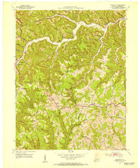
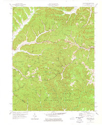
 1952 Frenchburg1953 Print · USGSFrenchburg and the surrounding Menifee County ridges are captured here in the early 1950s during a period of active natural gas and oil extraction. Local historians can trace family roots through numerous remote landmarks like Refitt Cem, Dog Trot Sch, and the community at Goosetown.2 unique versions available
 - 1957 Map of Jenkins, 1974 Print
 1957 Jenkins1974 Print · USGSThe Cumberland Plateau in the mid-twentieth century reveals a complex landscape of winding river valleys and deep-seated industry. Genealogists and historians can trace the development of Hazard, Jenkins, and Pikeville alongside extensive Numerous Oil and Gas Fields and the routes of the Chesapeake & Ohio Railway.
 - 1960 Map of Jenkins
 1960 Jenkins1960 Print · USGSEastern Kentucky and the West Virginia borderlands are captured at a mid-century peak of the coal and rail era. Trace the industrial corridors of the Chesapeake and Ohio RR through mountain hubs like Hazard and Jenkins.
 - 1977 Map of Frenchburg, 1978 Print
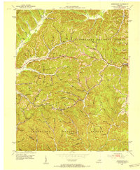
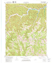
 1977 Frenchburg1978 Print · USGSThe Menifee County seat of Frenchburg and the surrounding national forest are captured here during the late 1970s. Local researchers can trace family roots at the Hatton Cem and Patrick Cem or locate the numerous Gas Wells and mines that defined the local economy.
 - 1979 Map of Scranton
 1979 Scranton1979 Print · USGSMenifee County at the end of the 1970s shows a landscape of deep national forest ridges and the expanding waters of the reservoir. Genealogists and historians can trace family locations through Bashford Cem, the US Weather Station, and small settlements like Frenchburg and Mariba.
 - 1982 Map of Irvine, 1983 Print
 1982 Irvine1983 Print · USGSEastern Kentucky's hill country is mapped here in the early eighties, showcasing the complex river valleys and ridge-top settlements of the Cumberland Plateau. Researchers can trace historic rail lines like the Louisville & Nashville RR or locate rural communities such as Beattyville and Slade.
End of results
Showing maps 1-7 of 7
Top cities near Frenchburg
- Morehead historical maps
- Stanton historical maps
- Jeffersonville historical maps
- Owingsville historical maps
- Campton historical maps
- Salt Lick historical maps
See more
Frequently asked questions
- What are the different types of historical maps available for Frenchburg?
- What is the oldest map of Frenchburg?
- Where can I purchase historical maps of Frenchburg for my home or office?
- Where can I download high-res historical maps of Frenchburg?
- Are there historical topographic maps available for Frenchburg?
- Is there historical aerial imagery available for Frenchburg?
- Where are historical maps of Frenchburg sourced from?