
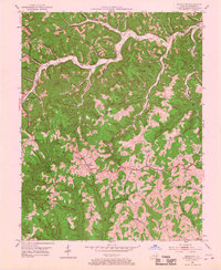
1952 Map of Scranton
USGS Topo · Published 1953About this map
Frenchburg sits at the western edge of this topographic study, where the highland terrain begins to drop toward the deep drainages of Beaver Creek. The landscape is dominated by the heavily dissected plateaus of Kendrick Ridge and Beech Ridge, which harbor a network of rural settlements and family-named landmarks. The mid-century economy of Menifee County is evident through extractive sites like the Strip Mine and Oil Well near Scranton, as well as a Quarry in the southwest corner. The Cumberland National Forest encompasses much of this area, where narrow ridge tops provide space for small communities and public infrastructure. Researchers can identify numerous local institutions serving these isolated hollows, including the Clifton School, Berry Gap School, and the Mariba Church. High points such as Tater Knob are noted alongside a Lookout Tower, indicating the importance of fire surveillance in this timbered region.
Find a feature on this map
98 named features on this map. Tap any name to fly to it.
Don’t see what you’re looking for? This feature index may not catch every label — zoom into the map to look around manually.
Map Details
Editions of this 1952 Scranton Map
2 editions found
Other maps of this area

1889 · Salyersville
USGS Topo · 1:125,000

1891 · Salyersville
USGS Topo · 1:125,000

1892 · Beattyville
USGS Topo · 1:125,000

1899 · Salyersville
USGS Topo · 1:125,000

1929 · Morehead
USGS Topo · 1:48,000

1929 · Salt Lick
USGS Topo · 1:62,500

1934 · Salt Lick
USGS Topo · 1:62,500

1935 · Morehead
USGS Topo · 1:62,500

1951 · Ezel
USGS Topo · 1:24,000

1951 · Hazel Green
USGS Topo · 1:24,000