
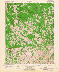
1951 Map of Ezel
USGS Topo · Published 1953About this map
The Licking River and its dense network of tributaries, including Blackwater Creek and Spaws Creek, define the deeply dissected landscape of the Cumberland National Forest in the early 1950s. This survey captures a rural Kentucky society organized around narrow valleys and high ridges like Dan Ridge, where small settlements such as Ezel, Korea, and Artville are connected by winding mountain roads. Family heritage is preserved through numerous rural burial grounds like Cecil Cem, Mann Cem, and Whitaker Cem, which dot the hillsides near local landmarks like Broke Leg Falls.
Find a feature on this map
61 named features on this map. Tap any name to fly to it.
Don’t see what you’re looking for? This feature index may not catch every label — zoom into the map to look around manually.
Map Details
Editions of this 1951 Ezel Map
2 editions found
Other maps of this area

1889 · Salyersville
USGS Topo · 1:125,000

1891 · Salyersville
USGS Topo · 1:125,000

1892 · Beattyville
USGS Topo · 1:125,000

1899 · Salyersville
USGS Topo · 1:125,000

1929 · Morehead
USGS Topo · 1:48,000

1929 · Salt Lick
USGS Topo · 1:62,500

1934 · Salt Lick
USGS Topo · 1:62,500

1935 · Morehead
USGS Topo · 1:62,500

1951 · Cannel City
USGS Topo · 1:24,000

1951 · Hazel Green
USGS Topo · 1:24,000