2020s Maps of Monroe County, Kentucky
Explore 14 historic maps of Monroe County from the 2020s. These maps offer a rare glimpse into what life looked like during the 2020s — showing old roads, neighborhoods, homes, and landmarks that have changed or disappeared over time.
Whether you're researching your family's past, planning a metal detecting trip, or studying how Monroe County's landscape evolved across the 2020s, these high-resolution maps are a powerful tool for exploring the history of this region.
- Focus on a specific era: All maps on this page are from the 2020s, giving you a focused view of this time period.
- See what’s changed: Compare century-old streets, trails, and buildings to today's modern landscape using overlays and satellite layers.
- Research with precision: Use these maps for genealogy, historical research, land use analysis, or educational projects.
- View, download, or print: Maps are fully viewable online in high resolution, and can be downloaded or printed for your own records.
Start exploring Monroe County's history through authentic maps from the 2020s. This is your window into the past.
Monroe County, KY maps
(14)- 2022 Map of Celina, 2022 Print
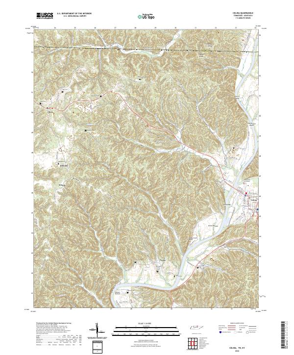 2022 Celina2022 Print · USGSThe Tennessee-Kentucky border comes alive in this contemporary survey of the Clay County highlands. Researchers can trace ancestral roots through dozens of family burial grounds like the McColgan Family Cem or study river navigation at Pine Branch Shoals and Celina Bar.
 - 2022 Map of Union Hill, 2022 Print
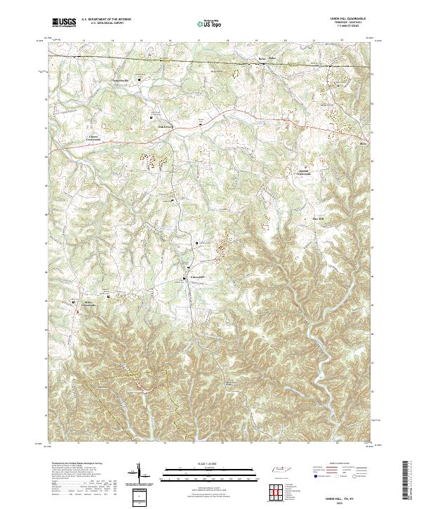 2022 Union Hill2022 Print · USGSThe Tennessee-Kentucky border comes alive in this 2022 survey of Clay County, showing a landscape of deep hollows and high ridges. Trace family history through numerous burial sites like Union Hill Cem and the James H Cherry Family Cem.
 - 2022 Map of Galen, 2022 Print
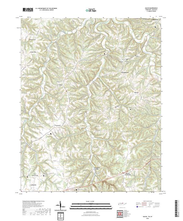 2022 Galen2022 Print · USGSNorthern Macon County and the Tennessee-Kentucky border are shown in this modern survey of rural settlements and family homesteads. Genealogists can trace family burial sites like John Brandon Cem and find crossroads such as Bugtussle, Enon, and Pumpkintown.
 - 2022 Map of Red Boiling Springs, 2022 Print
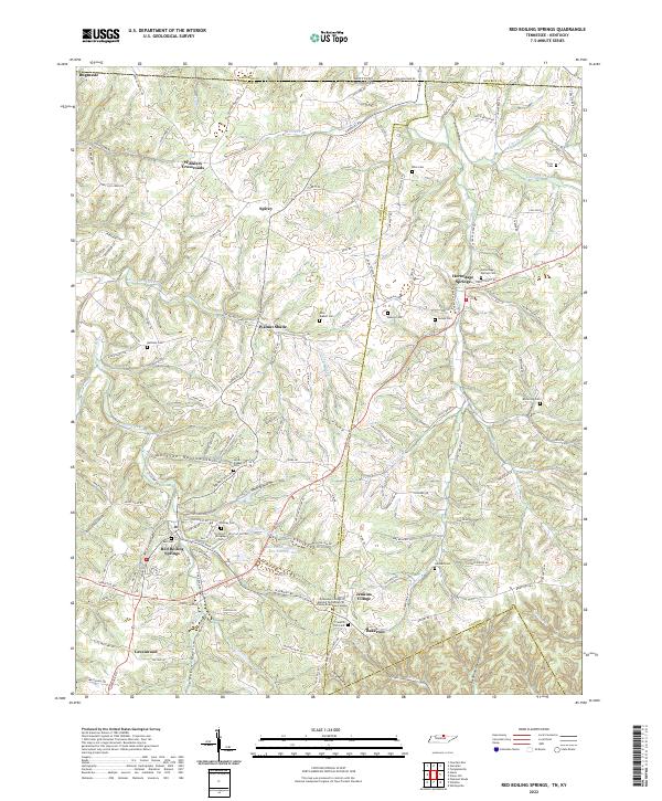 2022 Red Boiling Springs2022 Print · USGSMacon County's mineral spring country and the Tennessee-Kentucky border are shown in detail here. Genealogists can trace family landmarks across the landscape, including Bugtussle, the Cothron-Gregory Cem, and several rural churches like Smith Chapel.
 - 2022 Map of Dale Hollow Dam, 2022 Print
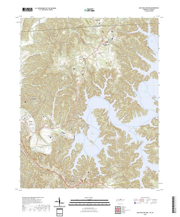 2022 Dale Hollow Dam2022 Print · USGSClay County and the Tennessee-Kentucky border are defined by the winding waters of the Obey River and the plateau ridges. Genealogists can trace family heritage through numerous remote burial sites like Free Hill Cem, Tinsley Cem, and Thompson Webb Cem.
 - 2022 Map of Gamaliel, 2022 Print
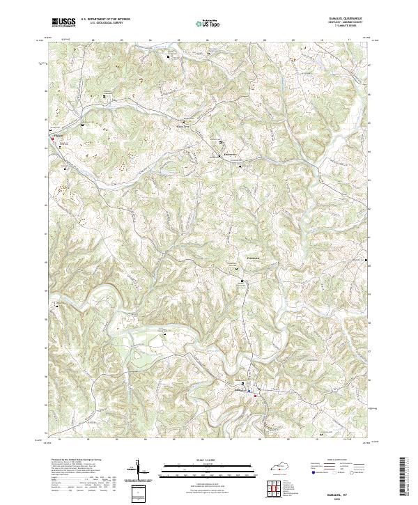 2022 Gamaliel2022 Print · USGSMonroe County’s rural character is on full display in this modern survey of the region surrounding Gamaliel. Researchers can trace generations of local history through numerous burial sites like Simmons Graveyard and smaller settlements such as Flippin and Gum Tree.
 - 2022 Map of Tracy, 2022 Print
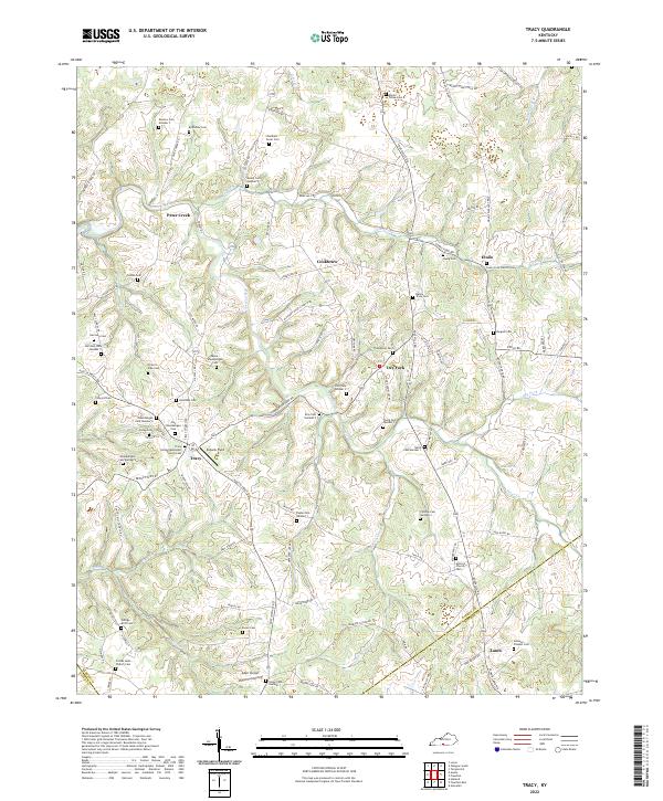 2022 Tracy2022 Print · USGSThe rural uplands of southern Barren County are revealed here in the 2020s, showing a landscape defined by family history and small hamlets. Genealogists can trace hundreds of burial sites, from Kinslow Cem Number 7 to the Johnson - Flowers Cem.
 - 2022 Map of Vernon, 2022 Print
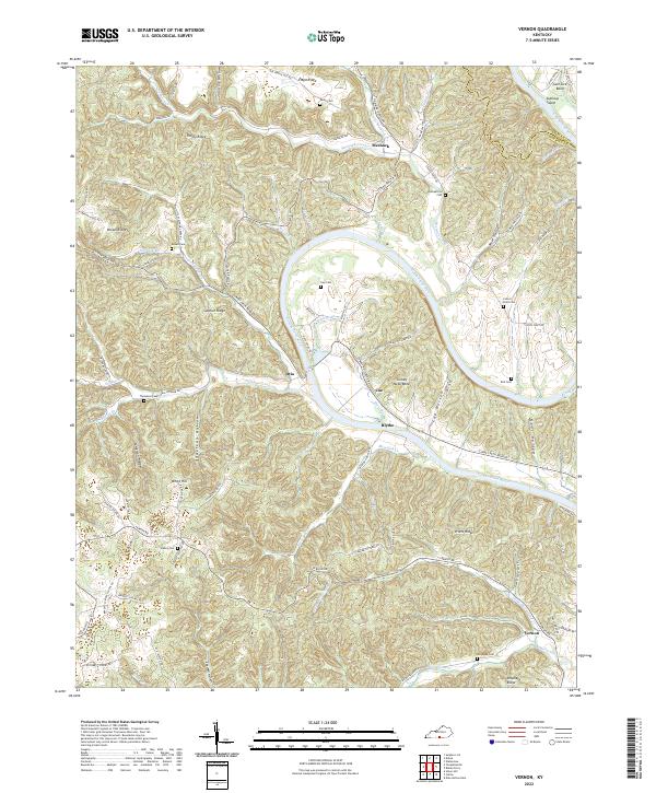 2022 Vernon2022 Print · USGSMonroe County, Kentucky, is defined by the winding path of the Cumberland River in the early twenty-first century. Researchers can trace ancestral locations through numerous family cemeteries like Gee Cem and Thompson Cem or explore riverside locales such as Turkey Neck Bend.
 - 2022 Map of Freedom, 2022 Print
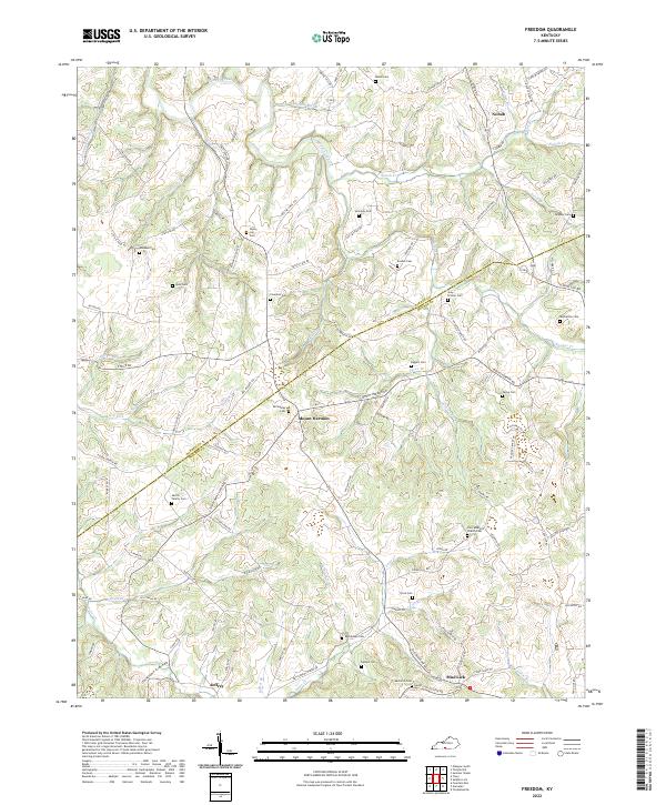 2022 Freedom2022 Print · USGSThe Barren and Monroe County line in south-central Kentucky comes into focus through this recent survey of rural settlements and family landmarks. Genealogists can trace lineage through numerous burial sites including the Martin Family Cem, Poplar Log Cem, and the community at Mount Hermon.
 - 2022 Map of Dubre, 2022 Print
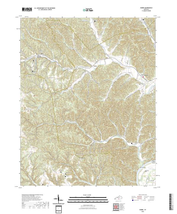 2022 Dubre2022 Print · USGSSouthern Kentucky's ridge-and-hollow country is documented here in the early 2020s, showing where Metcalfe, Cumberland, and Monroe counties meet. Researchers can trace family history through numerous landmarks like Old Temple Hill Cem, Franklin Cem, and the settlement of Willow Shade.
 - 2022 Map of Fountain Run, 2022 Print
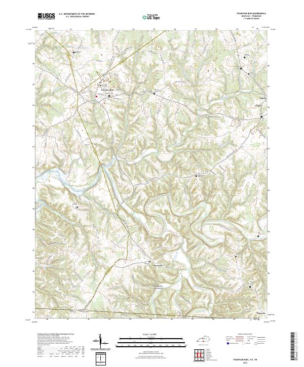 2022 Fountain Run2022 Print · USGSThis rural Kentucky-Tennessee border region at the start of the 2020s shows a landscape of river-bottom farms and small upland communities. Researchers can trace family history through numerous local sites like the Old School Cem in Fountain Run or the Ward - Lewis Cem near Flippin.
 - 2022 Map of Blacks Ferry, 2022 Print
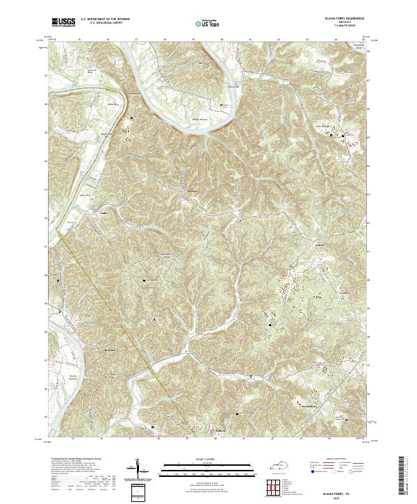 2022 Blacks Ferry2022 Print · USGSThe Cumberland River loops through the Kentucky borderlands of Cumberland and Monroe counties in this recent survey. Local historians and genealogists can trace family footprints across Peytonsburg and Judio, or locate ancestral burial sites like Coe Ridge Cem and Killman Cem.
 - 2022 Map of Sulphur Lick, 2022 Print
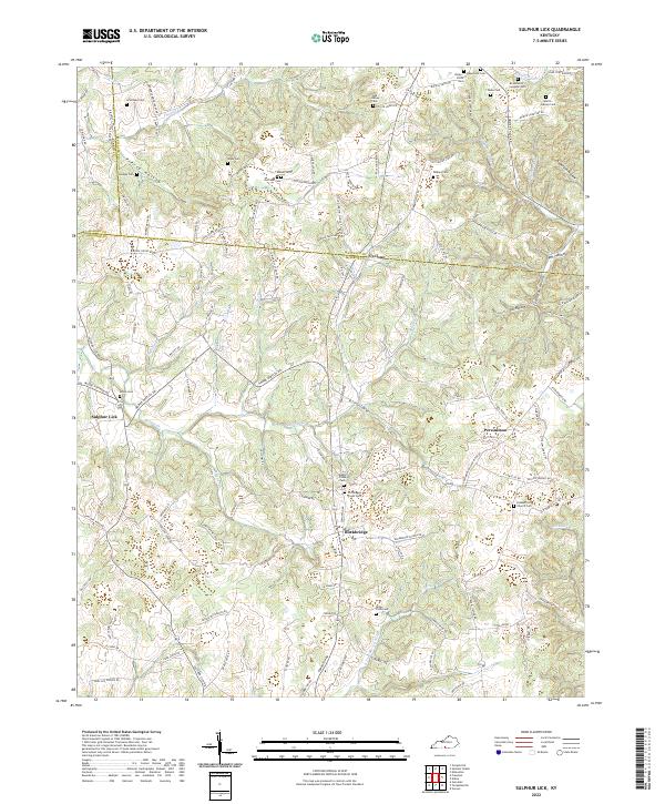 2022 Sulphur Lick2022 Print · USGSMonroe County's ridgelines and hollows are documented here in the early 2020s, showing a rural landscape defined by community crossroads and watercourses. Researchers can locate numerous small family burial grounds like Mosier Cem and White Cem while tracing historic routes through Persimmon and Sulphur Lick.
 - 2022 Map of Tompkinsville, 2022 Print
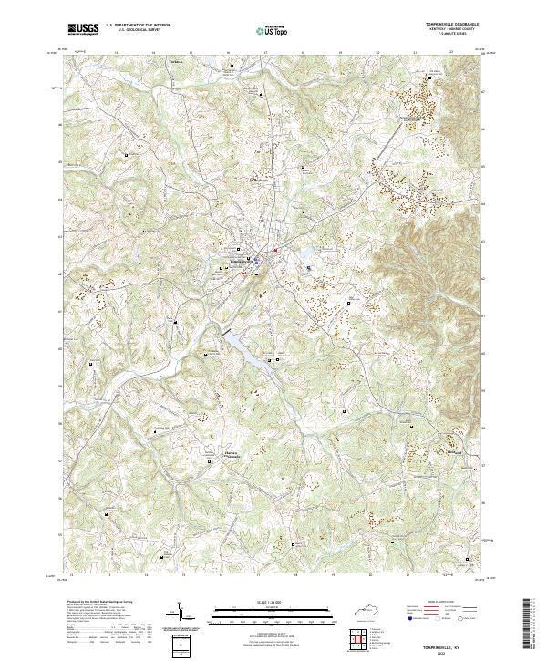 2022 Tompkinsville2022 Print · USGSMonroe County, Kentucky, remains a landscape of deep family roots and rural crossroads in this contemporary survey. Researchers can trace ancestral locations through dozens of named sites like Old Mulkey Church Cem, Harlan Crossroads, and the Beautiful Home Cem.
End of results
Showing maps 1-14 of 14
Top cities of Monroe County
Frequently asked questions
- What are the different types of historical maps available for Monroe County?
- What is the oldest map of Monroe County?
- Where can I purchase historical maps of Monroe County for my home or office?
- Where can I download high-res historical maps of Monroe County?
- Are there historical topographic maps available for Monroe County?
- Is there historical aerial imagery available for Monroe County?
- Where are historical maps of Monroe County sourced from?