Old Maps of Monroe County, Kentucky for Metal Detecting
Plan your next treasure hunt with 94 historic maps of Monroe County. Find old homesites, ghost towns, trails, and gathering spots that may be lost to time — perfect for identifying promising metal detecting locations.
- Locate forgotten sites: Uncover places like long-lost settlements, abandoned rail lines, or gathering spots.
- Plan better hunts: Use map overlays combined with LiDAR or satellite views to narrow in on historically rich areas.
- Made for detectorists: Thousands of hobbyists use these maps to discover relics, coins, and hidden history.
Use these historic maps to boost your research and find new opportunities beneath the surface of Monroe County.
Monroe County, KY maps
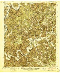
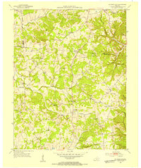
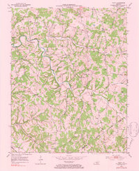
(94)- 1924 Map of Lillydale
 1924 Lillydale1924 Print · USGSThe Tennessee-Kentucky borderlands in the early twenties were defined by tight river bends and isolated ridge-top schools. Genealogists can trace the rural life of Lillydale through landmarks like Thompsons Store, Willow Grove, and the uniquely named Hongkong School.
 - 1926 Map of Lillydale, 1964 Print
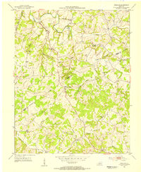
 1926 Lillydale1964 Print · USGSThe Cumberland and Obey Rivers wind through this border region in the mid-twenties, documenting life before the damming of the river valleys. Genealogists can trace family footprints at Lillydale, Carys Ferry, and numerous rural schoolhouses like Greenbrier School.
 - 1929 Map of Lillydale
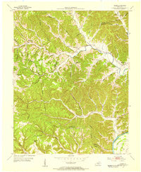
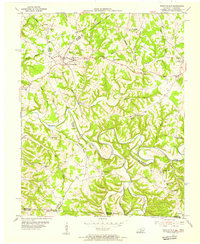
 1929 Lillydale1929 Print · USGSThe Tennessee and Kentucky borderlands are captured here in the 1920s, showing a river-linked landscape of bottomland farms and ridge-top communities. Genealogists can trace family roots through numerous schools and churches like Bearwallow School, Lillydale, and History Grove Church.3 unique versions available
 - 1929 Map of Tompkinsville
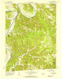
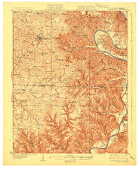 1929 Tompkinsville1929 Print · USGSThe Kentucky-Tennessee borderlands appear here in the late 1920s, showing a river-centered economy before modern infrastructure. Trace family ties through dozens of rural landmarks like Mulkey Meeting House, Bennett Ferry, and Moores Mill.4 unique versions available
 - 1931 Map of Red Boiling Springs
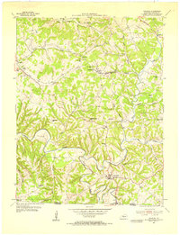
 1931 Red Boiling Springs1931 Print · USGSCrossing the state line during the late twenties, this survey captures a landscape of ridge-top schools and creek-side settlements. Genealogists can trace family footprints through numerous rural landmarks like Sadlers Chapel, Akersville, and Hermitage Springs PO.3 unique versions available
 - 1953 Map of Tracy, 1954 Print
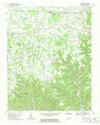
 1953 Tracy1954 Print · USGSThe rural borderlands of Barren and Monroe counties come alive in the early 1950s, showing a landscape of family farms and creek-bottom communities. Researchers can locate local landmarks like Cooktown, Tracy, and numerous schools including Antioch Sch.2 unique versions available
 - 1953 Map of Sulphur Lick, 1954 Print
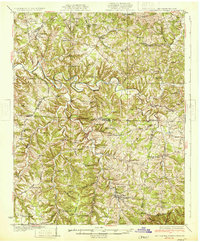
 1953 Sulphur Lick1954 Print · USGSMonroe County and the hills along the Barren River are captured here in the early fifties, before modern consolidation changed the local landscape. Genealogists and historians can trace family roots through numerous small landmarks like Miller Cave, Skaggs Creek Ch, and the Wade Cem.3 unique versions available
 - 1953 Map of Freedom, 1954 Print
 1953 Freedom1954 Print · USGSThe Barren and Monroe County line in the early fifties shows a landscape of rural hamlets and small schoolhouses. Trace family roots at Words Chapel, Freedom, and rural sites like Boyd Sch or the Biggers Cem.2 unique versions available
 - 1953 Map of Dubre, 1955 Print
 1953 Dubre1955 Print · USGSThe rural uplands of Cumberland and Metcalfe counties are captured here in the early fifties, showing a landscape defined by creek-side settlements and ridge-top schools. Genealogists can trace family footprints at Mud Camp, Temple Hill Ch, and the many hollows near Marrowbone Creek.2 unique versions available
 - 1954 Map of Blacks Ferry, 1955 Print
 1954 Blacks Ferry1955 Print · USGSThe Kentucky-Tennessee borderlands in the mid-1950s reveal a landscape of deep river bends and ridge-top hamlets. Genealogists can locate family-named sites such as Zeketown and Peytonsburg, or trace historic schools like Bearwallow Sch and Elbow Sch.3 unique versions available
 - 1954 Map of Fountain Run, 1955 Print
 1954 Fountain Run1955 Print · USGSSouthern Kentucky and northern Tennessee meet along the Barren River in the mid-fifties, showing a rural landscape of ridges and hollows. Genealogists can trace family roots through numerous local landmarks like Fountain Run Sch, Old Rocky Hill Ch, and Akersville.2 unique versions available
 - 1954 Map of Gamaliel, 1955 Print
 1954 Gamaliel1955 Print · USGSMonroe County, Kentucky, is documented here in the mid-1950s as a landscape of rural schoolhouses and tightly-knit crossroads. Researchers can trace the family footprints of the borderlands near Gamaliel, identifying sites like Mud Slash Sch and Emberton.2 unique versions available
 - 1954 Map of Tompkinsville, 1955 Print
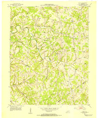
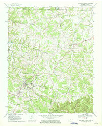
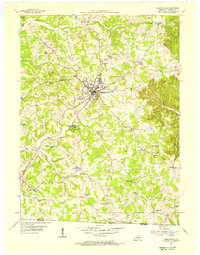 1954 Tompkinsville1955 Print · USGSMonroe County life in the mid-fifties centers on the courthouse town of Tompkinsville and its surrounding agricultural valleys. Genealogists can trace family names at Oak Hill Cem and local landmarks like Old Mulkey Meeting House State Park or Moores Mill.3 unique versions available
 - 1954 Map of Vernon, 1955 Print
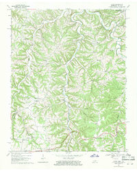
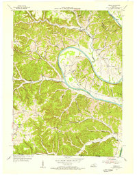 1954 Vernon1955 Print · USGSThe Cumberland River loops through Monroe County during the mid-1950s, revealing a landscape of ridge-top schools and river-bottom farms. Researchers can locate family landmarks like Stephens Cem and McMillans Ferry, or trace the rural communities of Vernon and Meshack.2 unique versions available
 - 1956 Map of Corbin, 1966 Print
 1956 Corbin1966 Print · USGSThe Kentucky and Tennessee borderlands are captured here in the mid-fifties, showing the region's shift toward modern interstate travel and reservoir development. Genealogists and historians can trace old community lines near Albany and Monticello or locate early rail junctions along the Southern and Tennessee Central lines.3 unique versions available
 - 1958 Map of Corbin
 1958 Corbin1958 Print · USGSThe Upper Cumberland borderlands appear in the late 1950s as massive reservoirs and early atomic-era growth reshape the region. Trace family roots and vanished landmarks near Lake Cumberland, Oak Ridge, and the Cumberland National Forest.
 - 1968 Map of Dale Hollow Dam, 1971 Print
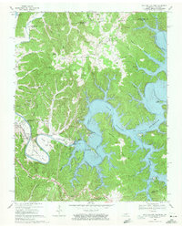 1968 Dale Hollow Dam1971 Print · USGSThe Obey River valley is shown at a pivotal moment in the late sixties as the Dale Hollow and Cordell Hull reservoirs shaped the region. Genealogists can trace family names at Fitzgerald Cem and locate rural hubs like Thompsons Store or Free Hill.3 unique versions available
 - 1968 Map of Red Boiling Springs, 1971 Print
 1968 Red Boiling Springs1971 Print · USGSThe Tennessee and Kentucky borderlands near Red Boiling Springs are captured here in the late sixties, showing a landscape defined by deep hollows and creek-side settlements. Genealogists can locate family landmarks such as Sadlers Chapel, Leonard Cem, and the community of Hermitage Springs.
 - 1968 Map of Celina, 1971 Print
 1968 Celina1971 Print · USGSClay County during the late 1960s shows the winding path of the Cumberland River before its valley was transformed. Trace family roots at Mabry Cem and Odle Cem, or explore old settlements like Richville and Arrott.4 unique versions available
 - 1968 Map of Union Hill, 1971 Print
 1968 Union Hill1971 Print · USGSThe Tennessee and Kentucky borderlands near Clay County come to life in this late-1960s survey of upland settlements and winding creek forks. Researchers can trace family sites and community landmarks like Miles Crossroads, Clementsville, and the Mt Vernon Sch.
 - 1969 Map of Galen, 1971 Print
 1969 Galen1971 Print · USGSThe Tennessee-Kentucky borderlands in the late sixties featured a dense network of hollows and family-named landmarks. Trace the history of rural communities like Sycamore Valley or Bugtussle and locate old sites like Morgan Cem and Enon Sch.2 unique versions available
 - 1979 Map of Tracy, 1984 Print
 1979 Tracy1984 Print · USGSBarren and Monroe Counties remained deeply rural in the mid-twentieth century, centered on small creek-side communities and family homesteads. Genealogists can trace historical family locations through sites like Kinslow Cem and Moore Sch near Tracy and Etoile.
 - 1981 Map of Vernon, 1983 Print
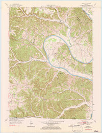 1981 Vernon1983 Print · USGSThe Cumberland River loops through Monroe County at mid-century, shaping a landscape defined by deep bends and ridge-top settlements. Genealogists can trace family locations near McMillans Ferry, Meshack, and rural schools like Beech Grove Sch.
 - 1985 Map of Tompkinsville, 1986 Print
 1985 Tompkinsville1986 Print · USGSThe Kentucky-Tennessee borderlands come into focus in the mid-1980s, showcasing a landscape of river-fed valleys and rural crossroads. Genealogists and local historians can trace family locations from Glasgow and Edmonton to the distinctively named Eighty Eight, Bugtussle, and Akersville.2 unique versions available
 - 2010 Map of Freedom, 2010 Print
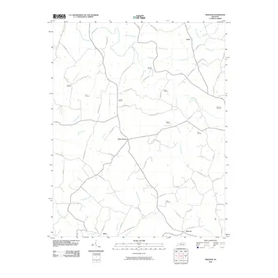 2010 Freedom2010 Print · USGSCovers Monroe County, including Nobob, Jeffrey, and other nearby areas
Showing maps 1-25 of 94
Top cities of Monroe County
Frequently asked questions
- What are the different types of historical maps available for Monroe County?
- What is the oldest map of Monroe County?
- Where can I purchase historical maps of Monroe County for my home or office?
- Where can I download high-res historical maps of Monroe County?
- Are there historical topographic maps available for Monroe County?
- Is there historical aerial imagery available for Monroe County?
- Where are historical maps of Monroe County sourced from?