Old Maps of Center Point, Kentucky for Academic Research
Study the evolution of Center Point with 11 high-resolution historic maps. Whether you're teaching, researching, or modeling changes in land use, these maps provide essential visual documentation of urban, environmental, and geographic change.
- Analyze long-term change: Track patterns in development, transportation, and natural features.
- Ideal for environmental or urban studies: Support academic projects with primary historical map data.
- Use in the classroom or lab: Educators and researchers rely on these maps to bring historical context to life.
These maps are a powerful tool for teaching, research, and visualizing how Center Point has changed over the decades.
Center Point, KY maps
(11)- 1929 Map of Tompkinsville
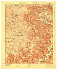 1929 Tompkinsville1929 Print · USGSThe Kentucky-Tennessee borderlands appear here in the late 1920s, showing a river-centered economy before modern infrastructure. Trace family ties through dozens of rural landmarks like Mulkey Meeting House, Bennett Ferry, and Moores Mill.4 unique versions available
 - 1954 Map of Vernon, 1955 Print
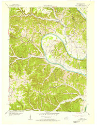 1954 Vernon1955 Print · USGSThe Cumberland River loops through Monroe County during the mid-1950s, revealing a landscape of ridge-top schools and river-bottom farms. Researchers can locate family landmarks like Stephens Cem and McMillans Ferry, or trace the rural communities of Vernon and Meshack.2 unique versions available
 - 1956 Map of Corbin, 1966 Print
 1956 Corbin1966 Print · USGSThe Kentucky and Tennessee borderlands are captured here in the mid-fifties, showing the region's shift toward modern interstate travel and reservoir development. Genealogists and historians can trace old community lines near Albany and Monticello or locate early rail junctions along the Southern and Tennessee Central lines.3 unique versions available
 - 1958 Map of Corbin
 1958 Corbin1958 Print · USGSThe Upper Cumberland borderlands appear in the late 1950s as massive reservoirs and early atomic-era growth reshape the region. Trace family roots and vanished landmarks near Lake Cumberland, Oak Ridge, and the Cumberland National Forest.
 - 1981 Map of Vernon, 1983 Print
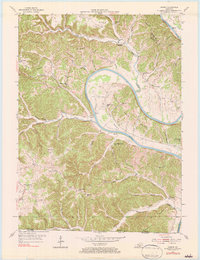 1981 Vernon1983 Print · USGSThe Cumberland River loops through Monroe County at mid-century, shaping a landscape defined by deep bends and ridge-top settlements. Genealogists can trace family locations near McMillans Ferry, Meshack, and rural schools like Beech Grove Sch.
 - 1985 Map of Tompkinsville, 1986 Print
 1985 Tompkinsville1986 Print · USGSThe Kentucky-Tennessee borderlands come into focus in the mid-1980s, showcasing a landscape of river-fed valleys and rural crossroads. Genealogists and local historians can trace family locations from Glasgow and Edmonton to the distinctively named Eighty Eight, Bugtussle, and Akersville.2 unique versions available
 - 2010 Map of Vernon, 2010 Print
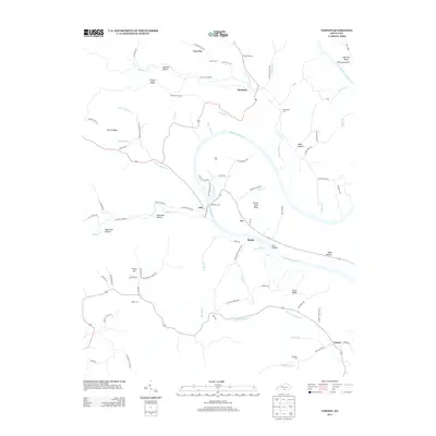
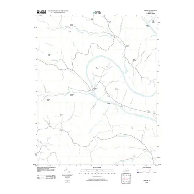 2010 Vernon2010 Print · USGSCovers Center Point, including Meshack, Blythe, and other nearby areas
 - 2013 Map of Vernon, 2013 Print
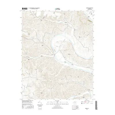
 2013 Vernon2013 Print · USGSCovers Center Point, including Meshack, Blythe, and other nearby areas
 - 2016 Map of Vernon, 2016 Print
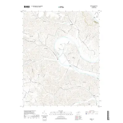
 2016 Vernon2016 Print · USGSCovers Center Point, including Meshack, Blythe, and other nearby areas
 - 2019 Map of Vernon, 2019 Print
 2019 Vernon2019 Print · USGSCovers Center Point, including Meshack, Blythe, and other nearby areas
 - 2022 Map of Vernon, 2022 Print
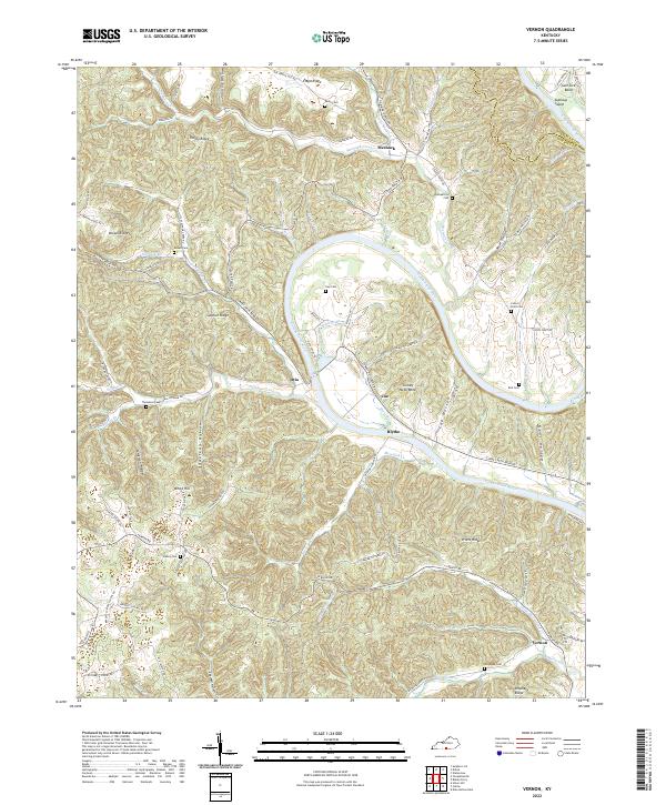 2022 Vernon2022 Print · USGSMonroe County, Kentucky, is defined by the winding path of the Cumberland River in the early twenty-first century. Researchers can trace ancestral locations through numerous family cemeteries like Gee Cem and Thompson Cem or explore riverside locales such as Turkey Neck Bend.
End of results
Showing maps 1-11 of 11
Top cities near Center Point
Frequently asked questions
- What are the different types of historical maps available for Center Point?
- What is the oldest map of Center Point?
- Where can I purchase historical maps of Center Point for my home or office?
- Where can I download high-res historical maps of Center Point?
- Are there historical topographic maps available for Center Point?
- Is there historical aerial imagery available for Center Point?
- Where are historical maps of Center Point sourced from?