Old Maps of Crockett, Kentucky for Hiking & Exploration
Hike through history with 14 historic maps of Crockett. Explore old trails, ghost towns, and forgotten backroads — perfect for outdoor adventurers and local explorers.
- Rediscover forgotten places: Map out old mining camps, roads, and footpaths that no longer exist on modern maps.
- Layer with modern tools: Combine with LiDAR or satellite views to plan hikes through historical terrain.
- Made for exploration: Popular among hikers, overlanders, and local history lovers.
Use these maps to find adventure and explore the hidden past of Crockett.
Crockett, KY maps
(14)- 1889 Map of Salyersville, 1949 Print
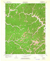
 1889 Salyersville1949 Print · USGSEastern Kentucky at the close of the nineteenth century reveals a complex landscape of river-valley settlements and highland hollows. Genealogists can trace early homesteads and communities like Salyersville, Hazel Green, and Jackson along the winding Licking River and Quicksand Creek.
 - 1891 Map of Salyersville
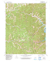
 1891 Salyersville1891 Print · USGSEastern Kentucky's rugged plateau is captured in the late nineteenth century as small river towns and remote hollows defined the region. Genealogists can trace family roots through mountain settlements like Salyersville, Hazel Green, and Maytown along the Licking River.2 unique versions available
 - 1899 Map of Salyersville
 1899 Salyersville1899 Print · USGSEastern Kentucky's mountain communities were well-established along the winding river forks at the turn of the century. Genealogists and local historians can trace family-named landmarks and old settlements like Hazel Green, Ezel, and West Liberty along the Licking River.4 unique versions available
 - 1951 Map of Dingus, 1953 Print
 1951 Dingus1953 Print · USGSThe Morgan County backcountry in the early fifties reveals a network of tight-knit hollows defined by the coal and creek-bottom economy. Researchers can trace family history through numerous rural landmarks like Peddler Gap Sch, Lenton Ch, and the Daniel Cem.
 - 1957 Map of Jenkins, 1974 Print
 1957 Jenkins1974 Print · USGSThe Cumberland Plateau in the mid-twentieth century reveals a complex landscape of winding river valleys and deep-seated industry. Genealogists and historians can trace the development of Hazard, Jenkins, and Pikeville alongside extensive Numerous Oil and Gas Fields and the routes of the Chesapeake & Ohio Railway.
 - 1960 Map of Jenkins
 1960 Jenkins1960 Print · USGSEastern Kentucky and the West Virginia borderlands are captured at a mid-century peak of the coal and rail era. Trace the industrial corridors of the Chesapeake and Ohio RR through mountain hubs like Hazard and Jenkins.
 - 1962 Map of Dingus, 1964 Print
 1962 Dingus1964 Print · USGSMorgan County in the early sixties remains a landscape of deep hollows and ridge-top cemeteries connected by the waters of Paint Creek. Researchers can trace family history through local landmarks like White Oak Sch and the Strip Mine or Oil Well sites.4 unique versions available
 - 1982 Map of Irvine, 1983 Print
 1982 Irvine1983 Print · USGSEastern Kentucky's hill country is mapped here in the early eighties, showcasing the complex river valleys and ridge-top settlements of the Cumberland Plateau. Researchers can trace historic rail lines like the Louisville & Nashville RR or locate rural communities such as Beattyville and Slade.
 - 1992 Map of Dingus
 1992 Dingus1992 Print · USGSMorgan County's rural heartland is captured here in the early nineties, showing a landscape shaped by coal mining and the waters of Paintsville Lake. Researchers can trace remote family cemeteries, mountain churches like New Salem Ch, and old settlements from Crockett to Silverhill.
 - 2010 Map of Dingus, 2010 Print
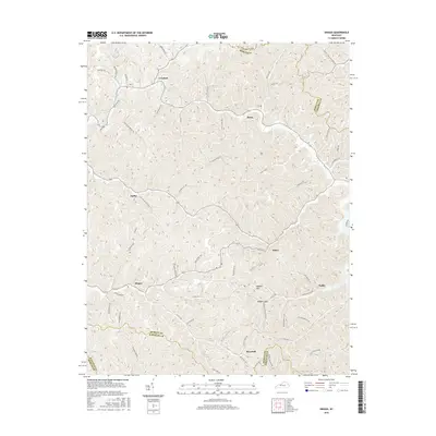
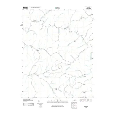 2010 Dingus2010 Print · USGSCovers Crockett, including Dingus, Ophir, and other nearby areas
 - 2013 Map of Dingus, 2013 Print
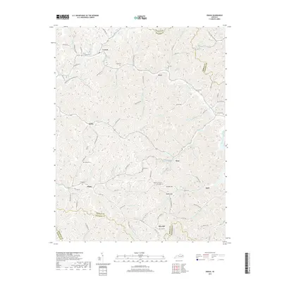
 2013 Dingus2013 Print · USGSCovers Crockett, including Dingus, Ophir, and other nearby areas
 - 2016 Map of Dingus, 2016 Print
 2016 Dingus2016 Print · USGSCovers Crockett, including Dingus, Ophir, and other nearby areas
 - 2019 Map of Dingus, 2019 Print
 2019 Dingus2019 Print · USGSCovers Crockett, including Dingus, Ophir, and other nearby areas
 - 2022 Map of Dingus, 2022 Print
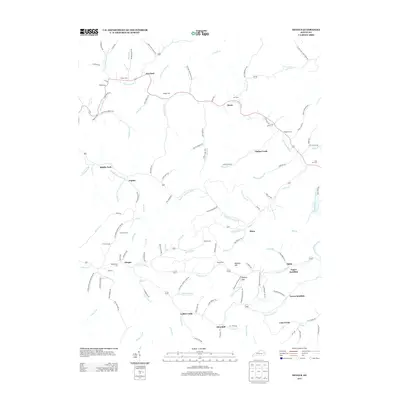
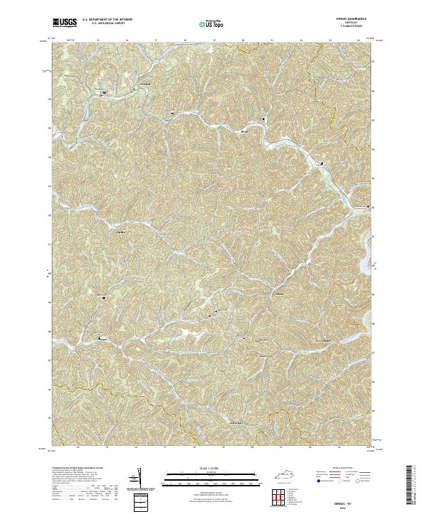 2022 Dingus2022 Print · USGSThe rural communities of Morgan County are documented here in the early twenty-first century, showing the persistent settlement patterns of the eastern Kentucky hills. Researchers can locate family landmarks such as Skaggs Cem, Dingus, and the crossing at Peddler Gap.
End of results
Showing maps 1-14 of 14
Top cities near Crockett
- West Liberty historical maps
- Salyersville historical maps
- Sandy Hook historical maps
- Blaine historical maps
Frequently asked questions
- What are the different types of historical maps available for Crockett?
- What is the oldest map of Crockett?
- Where can I purchase historical maps of Crockett for my home or office?
- Where can I download high-res historical maps of Crockett?
- Are there historical topographic maps available for Crockett?
- Is there historical aerial imagery available for Crockett?
- Where are historical maps of Crockett sourced from?