2020s Maps of Oldham County, Kentucky
Explore 10 historic maps of Oldham County from the 2020s. These maps offer a rare glimpse into what life looked like during the 2020s — showing old roads, neighborhoods, homes, and landmarks that have changed or disappeared over time.
Whether you're researching your family's past, planning a metal detecting trip, or studying how Oldham County's landscape evolved across the 2020s, these high-resolution maps are a powerful tool for exploring the history of this region.
- Focus on a specific era: All maps on this page are from the 2020s, giving you a focused view of this time period.
- See what’s changed: Compare century-old streets, trails, and buildings to today's modern landscape using overlays and satellite layers.
- Research with precision: Use these maps for genealogy, historical research, land use analysis, or educational projects.
- View, download, or print: Maps are fully viewable online in high resolution, and can be downloaded or printed for your own records.
Start exploring Oldham County's history through authentic maps from the 2020s. This is your window into the past.
Oldham County, KY maps
(10)- 2022 Map of Anchorage, 2022 Print
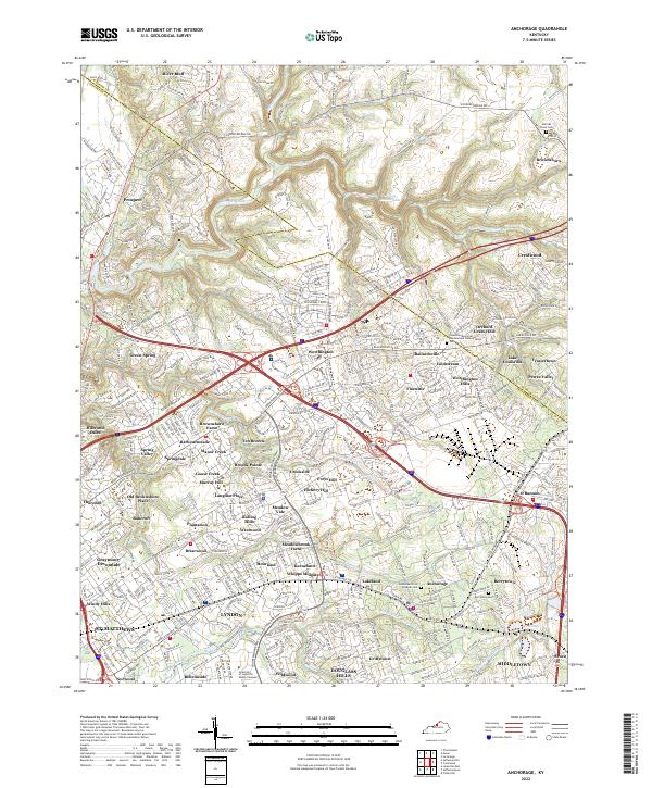 2022 Anchorage2022 Print · USGSThe eastern outskirts of Louisville are seen here in the early 2020s, showing a landscape of established neighborhoods and waterways. Trace family history at Berrytown Cem or explore the developments around Pewee Valley and Harrods Creek.
 - 2022 Map of Smithfield, 2022 Print
 2022 Smithfield2022 Print · USGSThe Henry County countryside near the Oldham border remains a landscape of rail-linked villages and winding river forks in the early 2020s. Genealogists can locate numerous local burial sites including Hendronsville Cem, Sulphur Cem, and Smithfield Cem along the CSX Transportation corridor.
 - 2022 Map of La Grange, 2022 Print
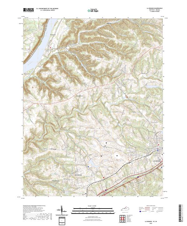 2022 La Grange2022 Print · USGSLa Grange and Buckner anchor this Kentucky landscape as it appeared in recent years, showing the area's mix of civic history and riverfront geography. Researchers can find the Oldham County Courthouse and Valley of Rest Cem, or trace the winding course of Harrods Creek toward the Ohio River.
 - 2022 Map of Charlestown, 2022 Print
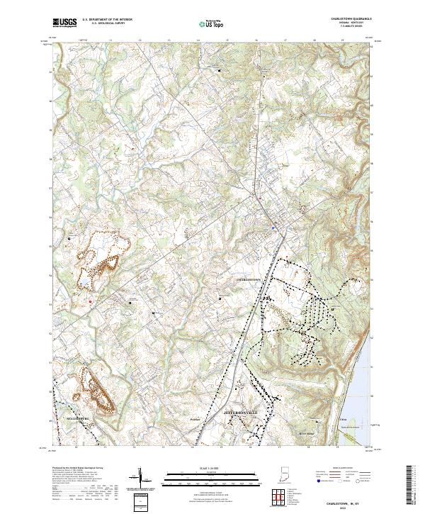 2022 Charlestown2022 Print · USGSSouthern Indiana's riverfront and upland communities come into focus in the early 2020s as suburban growth reaches toward the Ohio River. Genealogists can trace family heritage through numerous burial sites including Saint Michaels Cem, Bottorff Cem, and Friends Cem.
 - 2022 Map of Bedford, 2022 Print
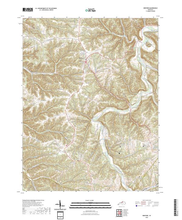 2022 Bedford2022 Print · USGSBedford and the surrounding Trimble County uplands are documented here during the early 2020s. Genealogists and local historians can trace family land via Burrows Cem, find the Trimble County Courthouse, and follow the Little Kentucky River through the ridges.
 - 2022 Map of Jeffersonville, 2022 Print
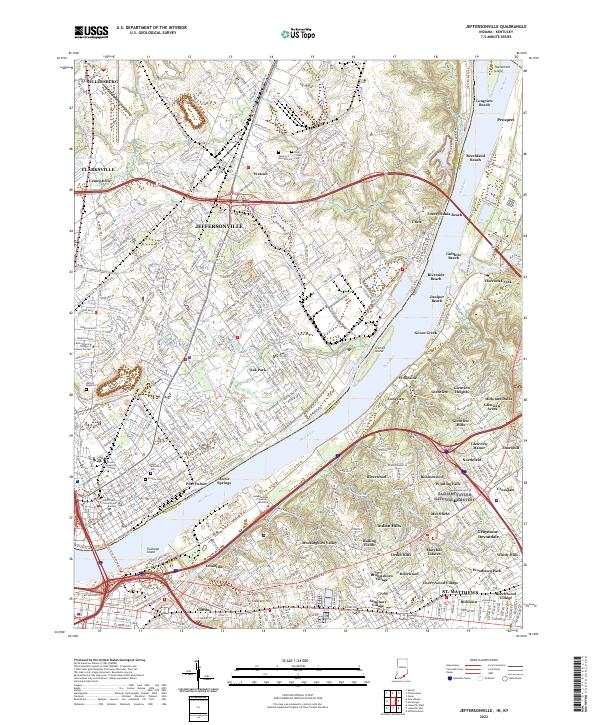 2022 Jeffersonville2022 Print · USGSThe riverfront communities of Indiana and Kentucky are shown here in the early twenty-first century as they flank the Ohio River. Researchers can trace local landmarks and neighborhood growth from the Clark County Government Building to family plots at Walnut Ridge Cem and Saint Anthonys Cem.
 - 2022 Map of Owen, 2022 Print
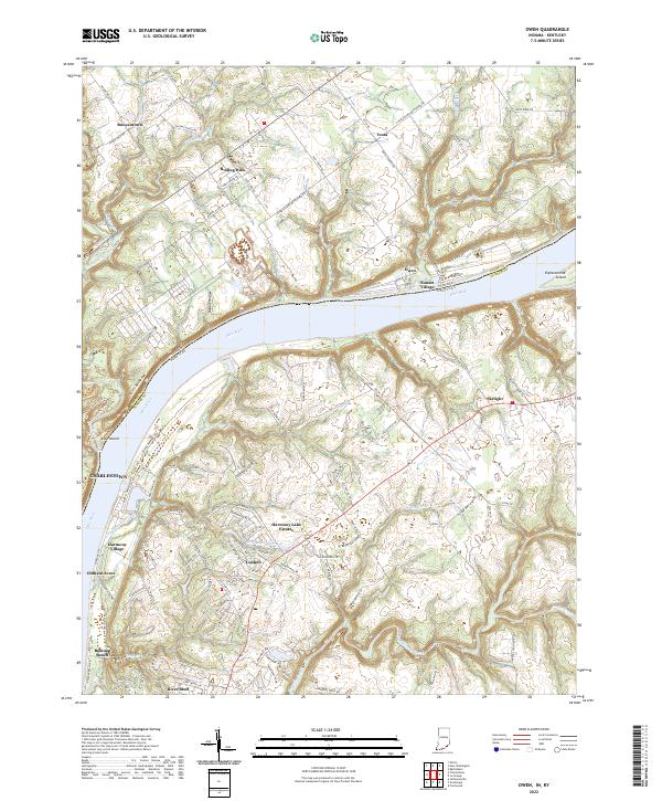 2022 Owen2022 Print · USGSThe riverfront communities along the Ohio River are captured here in the early 2020s, showing the modern layout of both Indiana and Kentucky banks. Researchers can trace the geography of river landmarks like Devils Backbone, Eighteenmile Island, and the residential growth around Goshen.
 - 2022 Map of Crestwood, 2022 Print
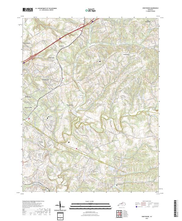 2022 Crestwood2022 Print · USGSCrestwood and Pewee Valley appear at a moment of modern growth where historic crossroads meet suburban expansion. Trace local family history through numerous burial sites like Confederate Cem and Pleasant Hill Cem along the winding Floyds Fork.
 - 2022 Map of Ballardsville, 2022 Print
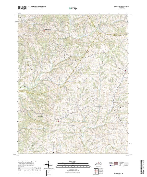 2022 Ballardsville2022 Print · USGSBallardsville and the surrounding Kentucky highlands are captured here in the early twenty-first century, showing a landscape defined by rolling ridges and creek valleys. Researchers can trace rural lineages through local landmarks like Fairview Cem, Todds Point, and the crossroads at Chestnut Grove.
 - 2023 Map of Bethlehem, 2023 Print
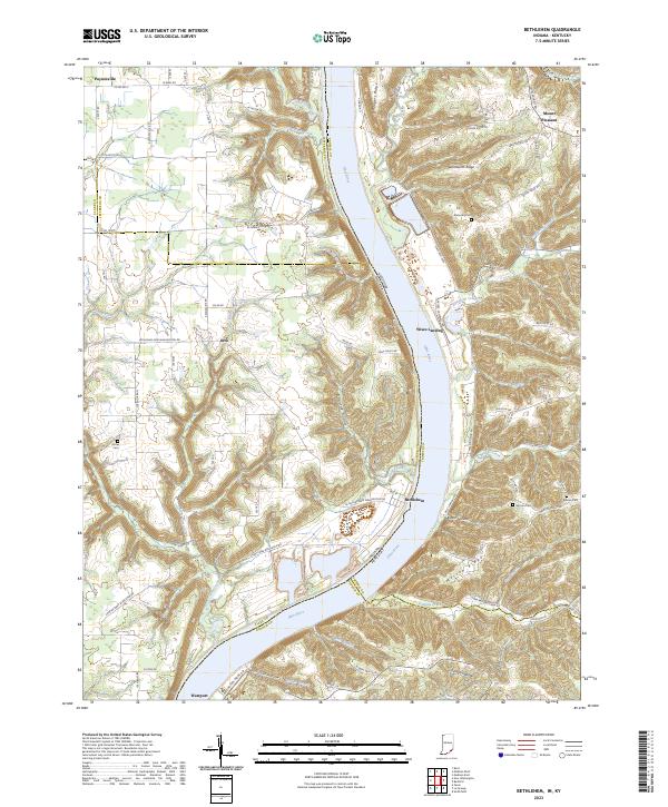 2023 Bethlehem2023 Print · USGSThe riverfront communities of Indiana and Kentucky are documented here in the early twenty-first century as the Ohio River defines the landscape. Genealogists and local historians can trace family-named sites like Mahoney Cem, Morton Ridge, and the settlement of Bethlehem.
End of results
Showing maps 1-10 of 10
Top cities of Oldham County
- La Grange historical maps
- Crestwood historical maps
- Pewee Valley historical maps
- Goshen historical maps
- River Bluff historical maps
Frequently asked questions
- What are the different types of historical maps available for Oldham County?
- What is the oldest map of Oldham County?
- Where can I purchase historical maps of Oldham County for my home or office?
- Where can I download high-res historical maps of Oldham County?
- Are there historical topographic maps available for Oldham County?
- Is there historical aerial imagery available for Oldham County?
- Where are historical maps of Oldham County sourced from?