Old Maps of Oldham County, Kentucky for Hiking & Exploration
Hike through history with 94 historic maps of Oldham County. Explore old trails, ghost towns, and forgotten backroads — perfect for outdoor adventurers and local explorers.
- Rediscover forgotten places: Map out old mining camps, roads, and footpaths that no longer exist on modern maps.
- Layer with modern tools: Combine with LiDAR or satellite views to plan hikes through historical terrain.
- Made for exploration: Popular among hikers, overlanders, and local history lovers.
Use these maps to find adventure and explore the hidden past of Oldham County.
Oldham County, KY maps
(94)- 1905 Map of Prospect, 1962 Print
 1905 Prospect1962 Print · USGSThe Ohio River corridor north of Louisville comes alive in the early 1900s, showing a landscape of river landings and new electric railways. Researchers can find old landmarks like the Lakeland Asylum, the Kentucky Military Institute, and the Antioch Church.
 - 1912 Map of Prospect
 1912 Prospect1912 Print · USGSThe northeastern outskirts of Louisville and the riverbanks of the Ohio River appear here in the early twentieth century. Researchers can trace the development of suburban settlements like Anchorage and St Matthews or locate the sprawling grounds of the Lakeland Asylum.3 unique versions available
 - 1932 Map of La Grange
 1932 La Grange1932 Print · USGSThe Bluegrass region in the early thirties reveals a landscape defined by the Louisville and Nashville Railroad and the Ohio River. Genealogists can locate family landmarks like Henrysville Cemetery and several rural schoolhouses including Sweeney Sch.
 - 1937 Map of Jeffersonville
 1937 Jeffersonville1937 Print · USGSJeffersonville and the northern banks of the Ohio River appear here in the late 1930s, documenting a landscape shaped by early industry and river trade. Researchers can trace the path of the Indiana Railroad (Electric Line) and locate landmarks like Asbury Chapel and Walnut Ridge Cemetery.
 - 1937 Map of Charlestown
 1937 Charlestown1937 Print · USGSClark County during the late thirties shows a landscape of rail-connected towns and rural institutions. Genealogists and historians can trace Crab College, the Clark Co Asylum, and family sites like Bottorff Cem and Tunnel Mill.
 - 1938 Map of Owen
 1938 Owen1938 Print · USGSThe Indiana riverfront near Charlestown in the late thirties is defined by active river landings and the sprawling Clark Military Grant. Genealogists can trace family footprints through community sites like Salem Ch, Rose Island, and the Golden Valley Sch.
 - 1939 Map of Bethlehem
 1939 Bethlehem1939 Print · USGSSouthern Indiana river life and upland farming are frozen in time just before the war. Genealogists and local historians can trace family roots through markers like Turner Cem, Elizabeth Ch, and the rural Fairview Sch.2 unique versions available
 - 1946 Map of Jeffersonville
 1946 Jeffersonville1946 Print · USGSSouthern Indiana sits at a crossroads of river and rail during the mid-1940s, as the industrial grid of Jeffersonville meets the rural Clark Military Grant. Researchers can trace family roots at Walnut Ridge Cem or locate vanished schoolhouses like Lane Sch and Middle Road Sch.2 unique versions available
 - 1948 Map of Bethlehem
 1948 Bethlehem1948 Print · USGSThe Indiana-Kentucky borderlands along the great bend of the Ohio River appear here in the late thirties. Local historians can trace the foundations of riverside life at Bethlehem and Miles Point, or find family-named landmarks like Turner Cem and Elizabeth Ch.2 unique versions available
 - 1948 Map of Owen
 1948 Owen1948 Print · USGSThe Indiana shoreline of the Ohio River is captured here in the late thirties, just as the local landscape was beginning to shift for the war effort. Genealogists can locate family-named landmarks and institutions like Runyantown, Beech Grove Sch, and Rose Island Park.2 unique versions available
 - 1950 Map of Charlestown, 1952 Print
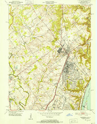 1950 Charlestown1952 Print · USGSSouthern Indiana was undergoing a major industrial and military transformation at mid-century as the Cold War intensified. Local researchers can trace the massive Indiana Arsenal, the path of the Pennsylvania RR, and family history at St Michael Ch or Pleasant Grove Cem.
 - 1951 Map of Anchorage
 1951 Anchorage1951 Print · USGSJefferson and Oldham Counties appear here in the early fifties, showing a landscape defined by institutional campuses and rail-centered towns. Genealogists and historians can trace Ormsby Village, Berrytown, and the Kentucky Military Institute along the Louisville and Nashville Railroad.
 - 1951 Map of Crestwood
 1951 Crestwood1951 Print · USGSThe railroad corridor between Oldham and Jefferson counties is well-established in the early fifties, centering on the growth of Crestwood and Pewee Valley. Researchers can locate historic institutions like the Pewee Valley Sanitarium and State Prison, or trace old family land near Pleasant Hill Cem and Glenarm.
 - 1951 Map of Jeffersonville
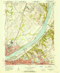 1951 Jeffersonville1951 Print · USGSThe Ohio River corridor near the Falls was a bustling hub of mid-century industry and suburban growth just after the war. Local historians can trace the footprints of the Indiana Arsenal, the Big Four RR Bridge, and old family landmarks from Claysburg to St Matthews.
 - 1953 Map of Bedford, 1954 Print
 1953 Bedford1954 Print · USGSBedford and the surrounding Trimble County hills appear here in the early fifties, showing a landscape shaped by the Little Kentucky River. Researchers can locate family landmarks such as Hickory Grove Ch, Poplar Ridge, and the Louisville and Nashville rail line.3 unique versions available
 - 1953 Map of Bethlehem, 1955 Print
 1953 Bethlehem1955 Print · USGSThe Ohio River border between Indiana and Kentucky is documented here in the early fifties, showing the ferry and landing points of the era. Researchers can locate family landmarks like Elizabeth Ch, Wises Landing, and the Mahoney Cem.6 unique versions available
 - 1954 Map of Ballardsville, 1955 Print
 1954 Ballardsville1955 Print · USGSThe rural borderlands of Shelby and Oldham Counties are shown in the mid-fifties during a period of steady agricultural tradition. Researchers can locate community hubs like Ballardsville, trace family roots at Fairview Cem, and find local landmarks such as Gleneyrie Sch.
 - 1954 Map of Smithfield, 1955 Print
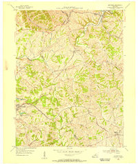 1954 Smithfield1955 Print · USGSThe rural borderlands of Henry and Oldham counties come to life in the mid-1950s as a vital railroad corridor. Researchers can trace family-named landmarks and rail-side settlements from La Grange to Smithfield, including the IOOF Cem and the Little Kentucky River.
 - 1954 Map of La Grange, 1956 Print
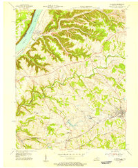 1954 La Grange1956 Print · USGSMid-century Oldham County is captured here as a landscape of rail-connected towns and riverfront settlements. Genealogists and historians can trace the foundations of La Grange and Buckner, alongside landmarks like Valley Rest Cem and the La Grange State Reformatory.
 - 1954 Map of Owen, 1956 Print
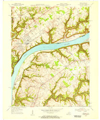 1954 Owen1956 Print · USGSThe Ohio River corridor comes alive in the mid-1950s, bridging the gap between Indiana military sites and Kentucky ridge-top communities. Researchers can locate family landmarks such as Salem Cem, the Tunnel Mill Scout Camp, and Liberty Sch.
 - 1955 Map of Anchorage, 1956 Print
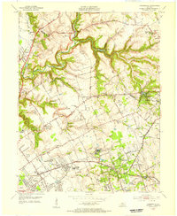 1955 Anchorage1956 Print · USGSEastern Jefferson County and the edge of Oldham County appear in the mid-fifties as a region of institutional campuses and established towns. Genealogists can trace family roots through Anchorage, Lyndon, and Griffytown, or locate landmarks like Central State Hospital and St Thomas Seminary.
 - 1955 Map of Jeffersonville, 1957 Print
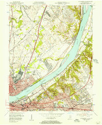 1955 Jeffersonville1957 Print · USGSIn the mid-fifties, the riverfronts of Jeffersonville and Louisville were hubs of industry and suburban expansion. Researchers can trace family sites from Asbury Chapel to the Zachary Taylor National Cemetery, alongside the massive Indiana Arsenal.
 - 1956 Map of Louisville, 1971 Print
 1956 Louisville1971 Print · USGSThe Ohio River valley and the Kentucky Bluegrass are captured here during a period of rapid mid-century growth and industrial activity. Genealogists and historians can trace rail-centered towns and military land use at Fort Knox and the Jefferson Proving Ground.2 unique versions available
 - 1960 Map of Crestwood, 1961 Print
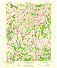 1960 Crestwood1961 Print · USGSThe rail towns of the Louisville and Nashville line prosper in the 1960s along the Oldham and Jefferson county border. Genealogists can trace family names at Pleasant Hill Cem, find the St Aloysius Sch, and locate the Pewee Valley Sanatorium.2 unique versions available
 - 1960 Map of Anchorage, 1961 Print
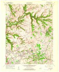 1960 Anchorage1961 Print · USGSEastern Jefferson County is shown at a peak of institutional and suburban growth in the early sixties. Genealogists and historians can trace family locations near the Kentucky Military Institute, Anchorage, and Ormsby Village.
Showing maps 1-25 of 94
Top cities of Oldham County
- La Grange historical maps
- Crestwood historical maps
- Pewee Valley historical maps
- Goshen historical maps
- River Bluff historical maps
Frequently asked questions
- What are the different types of historical maps available for Oldham County?
- What is the oldest map of Oldham County?
- Where can I purchase historical maps of Oldham County for my home or office?
- Where can I download high-res historical maps of Oldham County?
- Are there historical topographic maps available for Oldham County?
- Is there historical aerial imagery available for Oldham County?
- Where are historical maps of Oldham County sourced from?