Old Maps of La Grange, Kentucky for Academic Research
Study the evolution of La Grange with 36 high-resolution historic maps. Whether you're teaching, researching, or modeling changes in land use, these maps provide essential visual documentation of urban, environmental, and geographic change.
- Analyze long-term change: Track patterns in development, transportation, and natural features.
- Ideal for environmental or urban studies: Support academic projects with primary historical map data.
- Use in the classroom or lab: Educators and researchers rely on these maps to bring historical context to life.
These maps are a powerful tool for teaching, research, and visualizing how La Grange has changed over the decades.
La Grange, KY maps
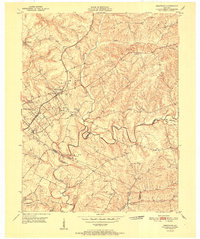
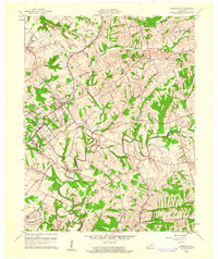
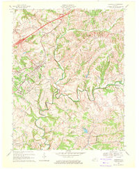
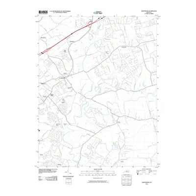
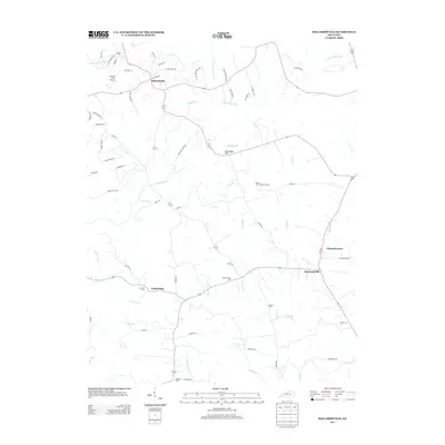
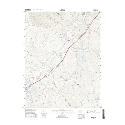
(36)- 1932 Map of La Grange
 1932 La Grange1932 Print · USGSThe Bluegrass region in the early thirties reveals a landscape defined by the Louisville and Nashville Railroad and the Ohio River. Genealogists can locate family landmarks like Henrysville Cemetery and several rural schoolhouses including Sweeney Sch.
 - 1951 Map of Crestwood
 1951 Crestwood1951 Print · USGSThe railroad corridor between Oldham and Jefferson counties is well-established in the early fifties, centering on the growth of Crestwood and Pewee Valley. Researchers can locate historic institutions like the Pewee Valley Sanitarium and State Prison, or trace old family land near Pleasant Hill Cem and Glenarm.
 - 1954 Map of Ballardsville, 1955 Print
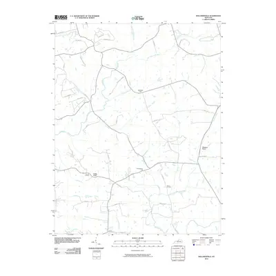
 1954 Ballardsville1955 Print · USGSThe rural borderlands of Shelby and Oldham Counties are shown in the mid-fifties during a period of steady agricultural tradition. Researchers can locate community hubs like Ballardsville, trace family roots at Fairview Cem, and find local landmarks such as Gleneyrie Sch.
 - 1954 Map of Smithfield, 1955 Print
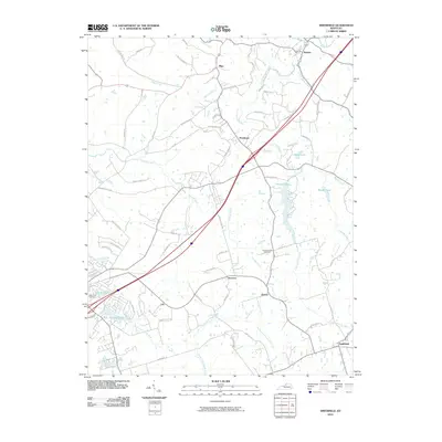
 1954 Smithfield1955 Print · USGSThe rural borderlands of Henry and Oldham counties come to life in the mid-1950s as a vital railroad corridor. Researchers can trace family-named landmarks and rail-side settlements from La Grange to Smithfield, including the IOOF Cem and the Little Kentucky River.
 - 1954 Map of La Grange, 1956 Print
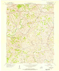
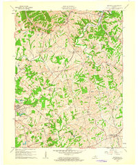
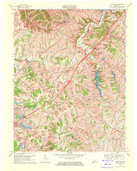
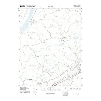
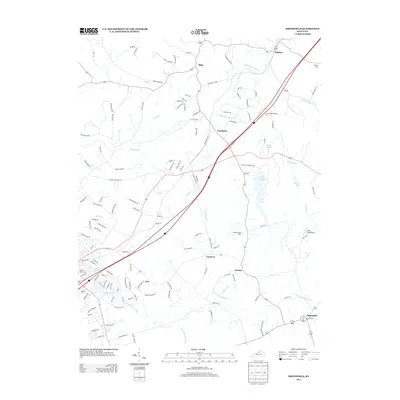
 1954 La Grange1956 Print · USGSMid-century Oldham County is captured here as a landscape of rail-connected towns and riverfront settlements. Genealogists and historians can trace the foundations of La Grange and Buckner, alongside landmarks like Valley Rest Cem and the La Grange State Reformatory.
 - 1956 Map of Louisville, 1971 Print
 1956 Louisville1971 Print · USGSThe Ohio River valley and the Kentucky Bluegrass are captured here during a period of rapid mid-century growth and industrial activity. Genealogists and historians can trace rail-centered towns and military land use at Fort Knox and the Jefferson Proving Ground.2 unique versions available
 - 1960 Map of Crestwood, 1961 Print
 1960 Crestwood1961 Print · USGSThe rail towns of the Louisville and Nashville line prosper in the 1960s along the Oldham and Jefferson county border. Genealogists can trace family names at Pleasant Hill Cem, find the St Aloysius Sch, and locate the Pewee Valley Sanatorium.2 unique versions available
 - 1961 Map of Smithfield, 1962 Print
 1961 Smithfield1962 Print · USGSHenry County in the early sixties remains a landscape of rail-side towns and winding creek valleys. Genealogists and local historians can trace family-named roads and rural settlements like Smithfield, Pendleton, and the Sulphur Cem.
 - 1961 Map of Ballardsville, 1962 Print
 1961 Ballardsville1962 Print · USGSKentucky's rural landscape at the turn of the 1960s reveals a quiet network of farming communities along the Oldham and Shelby county lines. Researchers can trace family sites near Ballardsville School, Hebron Church, and the Olive Branch Cemetery.3 unique versions available
 - 1961 Map of La Grange, 1963 Print
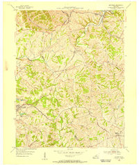
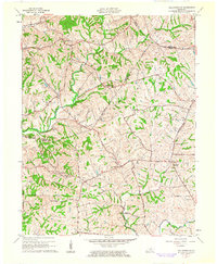
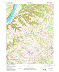
 1961 La Grange1963 Print · USGSThe Kentucky-Indiana border along the Ohio River comes into focus in the early 1960s, showing the sprawl of the State Reformatory Reservation and rural Oldham County. Researchers can trace historic family landmarks from the riverfront at Westport to the Louisville and Nashville rail corridor at Buckner.
 - 1964 Map of Louisville
 1964 Louisville1964 Print · USGSThe Ohio River valley and Kentucky Bluegrass are captured in the mid-1960s, showing a region balanced between industrial growth and its agrarian roots. Genealogists and historians can trace the development of county seats like Shelbyville and Paris, or locate established institutions such as Georgetown College and Bernheim Forest.
 - 1969 Map of Crestwood, 1971 Print
 1969 Crestwood1971 Print · USGSThe rail-and-creek landscape of Oldham and Jefferson Counties is captured here in the late sixties as suburban growth meets established rural institutions. Researchers can trace historic sites like the Confederate Cem, Pewee Valley Sanitarium, and the State Prison near Floyds Fork.
 - 1969 Map of Smithfield, 1971 Print
 1969 Smithfield1971 Print · USGSIn the late sixties, this portion of Kentucky saw the arrival of the interstate era alongside deep-rooted rail towns. Genealogists and historians can trace local landmarks like Sulphur Ch, the Ballard School, and the Louisville and Nashville rail corridor.5 unique versions available
 - 1969 Map of La Grange, 1972 Print
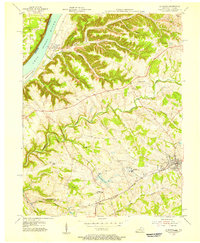
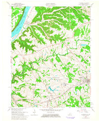
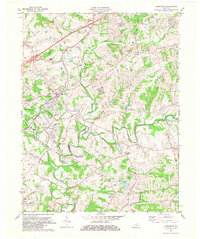
 1969 La Grange1972 Print · USGSOldham County in the late 1960s shows a mix of growing rail towns and deep river history along the Ohio. Trace the development of La Grange and Buckner or locate family roots at Westport and Eighteenmile Ch.4 unique versions available
 - 1981 Map of Crestwood, 1982 Print
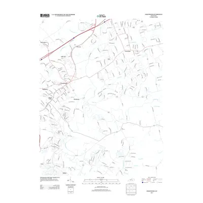
 1981 Crestwood1982 Print · USGSThe rail-corridor towns of Oldham County are seen here in the early eighties as they balanced rural heritage with suburban growth. Genealogists and researchers can trace family landmarks like the Confederate Cem, St Aloysius Sch, and the State Correctional Institute for Women.2 unique versions available
 - 1986 Map of Louisville
 1986 Louisville1986 Print · USGSMid-1980s Louisville and southern Indiana are shown here during a decade of significant suburban growth and infrastructure development. Researchers can trace the layout of Cave Hill Cemetery, the expansion of Standiford Field, and industrial sites like the Indiana Army Ammunition Plant.2 unique versions available
 - 2010 Map of Crestwood, 2010 Print
 2010 Crestwood2010 Print · USGSCovers La Grange, including Louisville, Middletown, and other nearby areas
 - 2010 Map of Ballardsville, 2010 Print
 2010 Ballardsville2010 Print · USGSCovers La Grange, including Chestnut Grove, Raymond Hill, and other nearby areas
 - 2010 Map of Smithfield, 2010 Print
 2010 Smithfield2010 Print · USGSCovers La Grange, including Smithfield, Jericho, and other nearby areas
 - 2010 Map of La Grange, 2010 Print
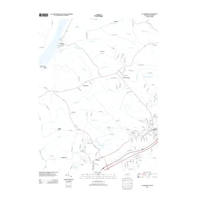
 2010 La Grange2010 Print · USGSCovers La Grange, including Cedar Point, Greenhaven, and other nearby areas
 - 2013 Map of Ballardsville, 2013 Print
 2013 Ballardsville2013 Print · USGSCovers La Grange, including Chestnut Grove, Raymond Hill, and other nearby areas
 - 2013 Map of Smithfield, 2013 Print
 2013 Smithfield2013 Print · USGSCovers La Grange, including Smithfield, Jericho, and other nearby areas
 - 2013 Map of Crestwood, 2013 Print
 2013 Crestwood2013 Print · USGSCovers La Grange, including Louisville, Middletown, and other nearby areas
 - 2013 Map of La Grange, 2013 Print
 2013 La Grange2013 Print · USGSCovers La Grange, including Cedar Point, Greenhaven, and other nearby areas
 - 2016 Map of Smithfield, 2016 Print
 2016 Smithfield2016 Print · USGSCovers La Grange, including Smithfield, Jericho, and other nearby areas
Showing maps 1-25 of 36
Top cities near La Grange
- Louisville historical maps
- Jeffersontown historical maps
- Shelbyville historical maps
- Lyndon historical maps
- Middletown historical maps
- Douglass Hills historical maps
See more
Top neighborhoods of La Grange
Frequently asked questions
- What are the different types of historical maps available for La Grange?
- What is the oldest map of La Grange?
- Where can I purchase historical maps of La Grange for my home or office?
- Where can I download high-res historical maps of La Grange?
- Are there historical topographic maps available for La Grange?
- Is there historical aerial imagery available for La Grange?
- Where are historical maps of La Grange sourced from?