1910s Maps of Stopover, Kentucky
Explore 2 historic maps of Stopover from the 1910s. These maps offer a rare glimpse into what life looked like during the 1910s — showing old roads, neighborhoods, homes, and landmarks that have changed or disappeared over time.
Whether you're researching your family's past, planning a metal detecting trip, or studying how Stopover's landscape evolved across the 1910s, these high-resolution maps are a powerful tool for exploring the history of this region.
- Focus on a specific era: All maps on this page are from the 1910s, giving you a focused view of this time period.
- See what’s changed: Compare century-old streets, trails, and buildings to today's modern landscape using overlays and satellite layers.
- Research with precision: Use these maps for genealogy, historical research, land use analysis, or educational projects.
- View, download, or print: Maps are fully viewable online in high resolution, and can be downloaded or printed for your own records.
Start exploring Stopover's history through authentic maps from the 1910s. This is your window into the past.
Stopover, KY maps
(2)- 1915 Map of Matewan
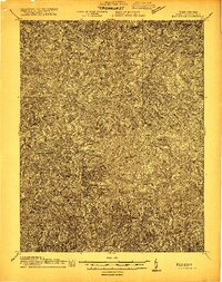 1915 Matewan1915 Print · USGSThe industrial coalfields of Mingo County and the Kentucky border are documented here during the height of the early twentieth-century boom. Genealogists and historians can trace rail-side communities and mining operations like Thacker Mines, Red Jacket, and the Blackberry Fork School.
 - 1917 Map of Matewan
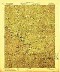 1917 Matewan1917 Print · USGSThe Tug Fork valley in the 1910s was a bustling corridor of coal production and rail activity along the West Virginia and Kentucky border. Genealogists and historians can trace the foundations of coal-camp life at Thacker Mines, the winding Norfolk and Western RR, and local landmarks like the Hatfield School.2 unique versions available
End of results
Showing maps 1-2 of 2
Top cities near Stopover
- Williamson historical maps
- Grundy historical maps
- Man historical maps
- Chattaroy historical maps
- Red Jacket historical maps
- Matewan historical maps
See more
Frequently asked questions
- What are the different types of historical maps available for Stopover?
- What is the oldest map of Stopover?
- Where can I purchase historical maps of Stopover for my home or office?
- Where can I download high-res historical maps of Stopover?
- Are there historical topographic maps available for Stopover?
- Is there historical aerial imagery available for Stopover?
- Where are historical maps of Stopover sourced from?