1910s Maps of Yeager, Kentucky
Explore 2 historic maps of Yeager from the 1910s. These maps offer a rare glimpse into what life looked like during the 1910s — showing old roads, neighborhoods, homes, and landmarks that have changed or disappeared over time.
Whether you're researching your family's past, planning a metal detecting trip, or studying how Yeager's landscape evolved across the 1910s, these high-resolution maps are a powerful tool for exploring the history of this region.
- Focus on a specific era: All maps on this page are from the 1910s, giving you a focused view of this time period.
- See what’s changed: Compare century-old streets, trails, and buildings to today's modern landscape using overlays and satellite layers.
- Research with precision: Use these maps for genealogy, historical research, land use analysis, or educational projects.
- View, download, or print: Maps are fully viewable online in high resolution, and can be downloaded or printed for your own records.
Start exploring Yeager's history through authentic maps from the 1910s. This is your window into the past.
Yeager, KY maps
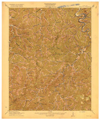
(2)- 1914 Map of Vergie
 1914 Vergie1914 Print · USGSPike County's coal hollows and creek-side settlements are captured here during the rail-driven expansion of the early twentieth century. Genealogists can locate family homesites near numerous numbered schoolhouses, the Sandy Valley & Elkhorn RR, and early post offices at Virgie and McDowell.
 - 1916 Map of Pikeville
 1916 Pikeville1916 Print · USGSEastern Kentucky's coal and river country comes into focus in the mid-1910s as the railroad moves deep into the hollows. Genealogists and local historians can locate early family-named landmarks and mountain communities like Weeksbury, Virgie, and James Chapel.5 unique versions available
End of results
Showing maps 1-2 of 2
Top cities near Yeager
- Pikeville historical maps
- Jenkins historical maps
- Coal Run Village historical maps
- Wheelwright historical maps
- Elkhorn City historical maps
- Fleming-Neon historical maps
See more
Frequently asked questions
- What are the different types of historical maps available for Yeager?
- What is the oldest map of Yeager?
- Where can I purchase historical maps of Yeager for my home or office?
- Where can I download high-res historical maps of Yeager?
- Are there historical topographic maps available for Yeager?
- Is there historical aerial imagery available for Yeager?
- Where are historical maps of Yeager sourced from?