Old Maps of Alpine, Kentucky for Academic Research
Study the evolution of Alpine with 11 high-resolution historic maps. Whether you're teaching, researching, or modeling changes in land use, these maps provide essential visual documentation of urban, environmental, and geographic change.
- Analyze long-term change: Track patterns in development, transportation, and natural features.
- Ideal for environmental or urban studies: Support academic projects with primary historical map data.
- Use in the classroom or lab: Educators and researchers rely on these maps to bring historical context to life.
These maps are a powerful tool for teaching, research, and visualizing how Alpine has changed over the decades.
Alpine, KY maps
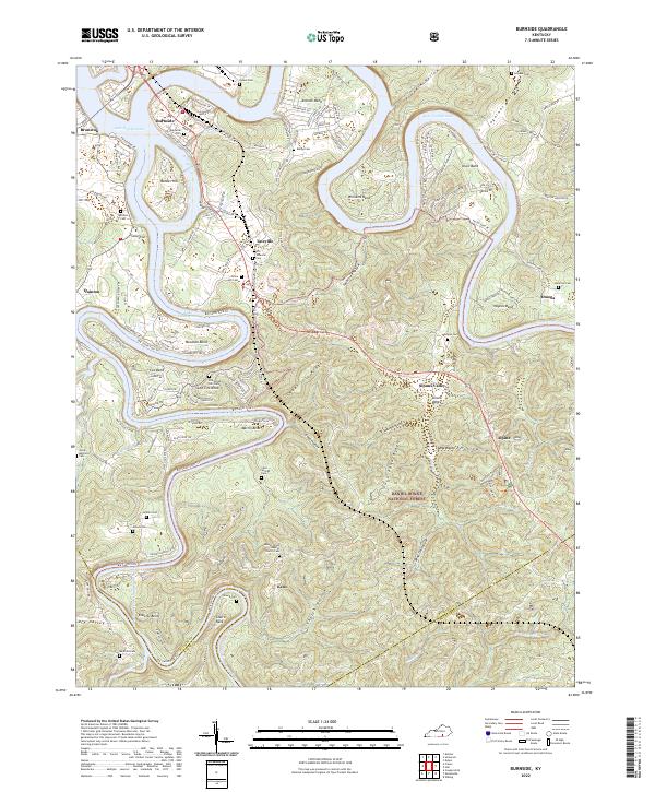
(11)- 1932 Map of Burnside
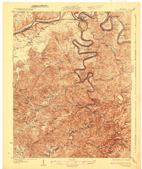 1932 Burnside1932 Print · USGSThe Cumberland River and its South Fork are captured here in the early 1930s, showing the intricate river-and-rail topography of southern Kentucky. Researchers can locate dozens of country landmarks like Roberts Mill, Lovells Chapel, and Pole Bridge Sch.2 unique versions available
 - 1954 Map of Burnside, 1955 Print
 1954 Burnside1955 Print · USGSThe river loops and rugged ridges of Pulaski County are caught here in the mid-fifties, just as the Southern railroad served the timber and coal interests of the region. Researchers can locate vanished landmarks and family sites like Mt Union Sch, Owens Cem, and the old station at Sloans Valley.2 unique versions available
 - 1956 Map of Corbin, 1966 Print
 1956 Corbin1966 Print · USGSThe Kentucky and Tennessee borderlands are captured here in the mid-fifties, showing the region's shift toward modern interstate travel and reservoir development. Genealogists and historians can trace old community lines near Albany and Monticello or locate early rail junctions along the Southern and Tennessee Central lines.3 unique versions available
 - 1958 Map of Corbin
 1958 Corbin1958 Print · USGSThe Upper Cumberland borderlands appear in the late 1950s as massive reservoirs and early atomic-era growth reshape the region. Trace family roots and vanished landmarks near Lake Cumberland, Oak Ridge, and the Cumberland National Forest.
 - 1965 Map of Burnside, 1967 Print
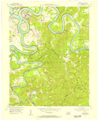
 1965 Burnside1967 Print · USGSMid-century Pulaski County is defined by the winding waters of the Cumberland and South Fork rivers. Genealogists and hikers can locate family landmarks like Grave Hill Cemetery, the community at Sloans Valley, and the Alpine Recreation Area.3 unique versions available
 - 1981 Map of Corbin, 1984 Print
 1981 Corbin1984 Print · USGSThe Kentucky and Tennessee borderlands in the early eighties were characterized by coal towns and deep mountain ridges. Trace family history or rail routes through Stearns, Williamsburg, and the mining settlements near Jellico Mountain along the L & N RR.
 - 2010 Map of Burnside, 2010 Print
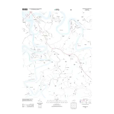
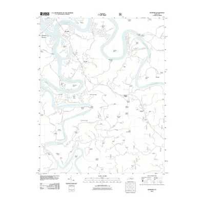 2010 Burnside2010 Print · USGSCovers Alpine, including Burnside, Omega, and other nearby areas
 - 2013 Map of Burnside, 2013 Print
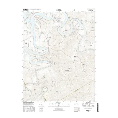
 2013 Burnside2013 Print · USGSCovers Alpine, including Burnside, Omega, and other nearby areas
 - 2016 Map of Burnside, 2016 Print
 2016 Burnside2016 Print · USGSCovers Alpine, including Burnside, Omega, and other nearby areas
 - 2019 Map of Burnside, 2019 Print
 2019 Burnside2019 Print · USGSCovers Alpine, including Burnside, Omega, and other nearby areas
 - 2022 Map of Burnside, 2022 Print
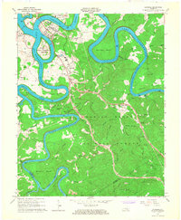
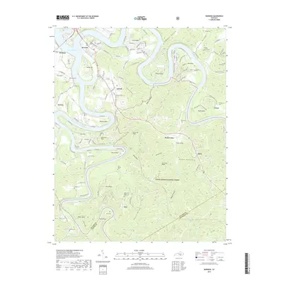
 2022 Burnside2022 Print · USGSThe Cumberland River loops through Pulaski County in the early twenty-first century, revealing a landscape of steep hollows and high ridges. Researchers can trace numerous family burial grounds including Old Tateville and Grave Hill Cem, or locate riverside settlements like Burnside and Sloans Valley.
End of results
Showing maps 1-11 of 11
Top cities near Alpine
Frequently asked questions
- What are the different types of historical maps available for Alpine?
- What is the oldest map of Alpine?
- Where can I purchase historical maps of Alpine for my home or office?
- Where can I download high-res historical maps of Alpine?
- Are there historical topographic maps available for Alpine?
- Is there historical aerial imagery available for Alpine?
- Where are historical maps of Alpine sourced from?