Old Maps of Pokeberry View Estates, Scott County for Genealogy
Trace your family roots with 11 historic maps of Pokeberry View Estates. These high-res maps reveal old neighborhoods, homesites, landmarks, and streets — helping you uncover where your ancestors lived and how the area evolved over time.
- Explore historic neighborhoods: Identify where your relatives may have lived in the 1800s or 1900s.
- Compare maps over time: Trace the changes in streets, buildings, and landmarks for multi-generational research.
- Perfect for genealogy & ancestry research: Used by family historians and researchers to map out lineage and migration.
These maps are an incredible resource for exploring your personal connection to Pokeberry View Estates's past.
Pokeberry View Estates, Scott County maps
(11)- 1939 Map of Sadieville
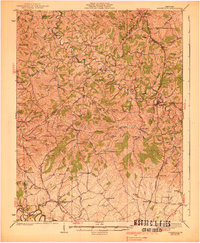 1939 Sadieville1939 Print · USGSScott and Owen Counties are captured in the late 1930s as agricultural life centered on the Southern Railway and a dense network of country schools. Genealogists can locate family landmarks like Stamping Ground, Burroak Sch, and the Pleasant Hill Ch.2 unique versions available
 - 1953 Map of Sadieville, 1954 Print
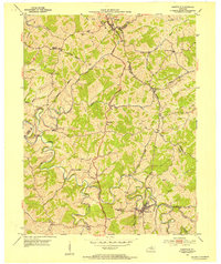 1953 Sadieville1954 Print · USGSNorthern Scott County during the early 1950s was a landscape of deep creek valleys and ridgeline roads centered on the Southern rail line. Researchers can locate family landmarks such as Odd Fellows Cem and rural centers like Stonewall or Hinton.
 - 1956 Map of Louisville, 1971 Print
 1956 Louisville1971 Print · USGSThe Ohio River valley and the Kentucky Bluegrass are captured here during a period of rapid mid-century growth and industrial activity. Genealogists and historians can trace rail-centered towns and military land use at Fort Knox and the Jefferson Proving Ground.2 unique versions available
 - 1964 Map of Louisville
 1964 Louisville1964 Print · USGSThe Ohio River valley and Kentucky Bluegrass are captured in the mid-1960s, showing a region balanced between industrial growth and its agrarian roots. Genealogists and historians can trace the development of county seats like Shelbyville and Paris, or locate established institutions such as Georgetown College and Bernheim Forest.
 - 1965 Map of Sadieville, 1966 Print
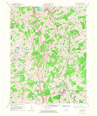 1965 Sadieville1966 Print · USGSNorth Central Kentucky sits at a crossroads in the mid-sixties as the newly built Interstate 75 carves through the rural landscape. Researchers can trace historic family sites and early infrastructure including the Southern Railway, Zion Hill Ch, and Sadieville.2 unique versions available
 - 1986 Map of Lexington
 1986 Lexington1986 Print · USGSCentral Kentucky’s Bluegrass region is captured in the mid-eighties as urban centers like Lexington and Frankfort expand alongside deep-rooted rural hubs. Researchers can trace historic rail lines like the Southern Railway and find landmarks such as the Lexington Blue Grass Army Depot and Tacketts Mill.
 - 2010 Map of Sadieville, 2010 Print
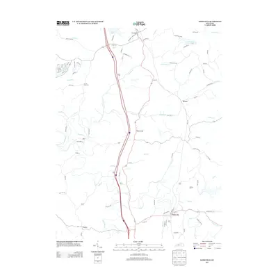
 2010 Sadieville2010 Print · USGSCovers Pokeberry View Estates, including Sadieville, Corinth, and other nearby areas
 - 2013 Map of Sadieville, 2013 Print
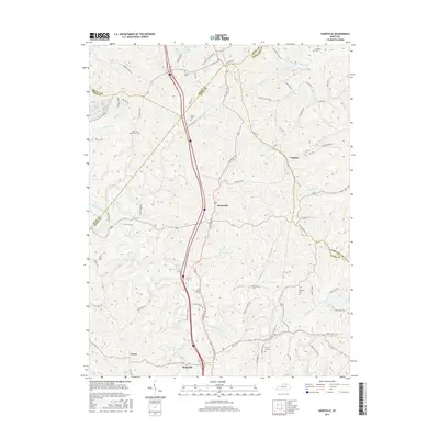
 2013 Sadieville2013 Print · USGSCovers Pokeberry View Estates, including Sadieville, Corinth, and other nearby areas
 - 2016 Map of Sadieville, 2016 Print
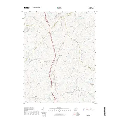
 2016 Sadieville2016 Print · USGSCovers Pokeberry View Estates, including Sadieville, Corinth, and other nearby areas
 - 2019 Map of Sadieville, 2019 Print
 2019 Sadieville2019 Print · USGSCovers Pokeberry View Estates, including Sadieville, Corinth, and other nearby areas
 - 2022 Map of Sadieville, 2022 Print
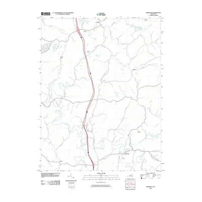
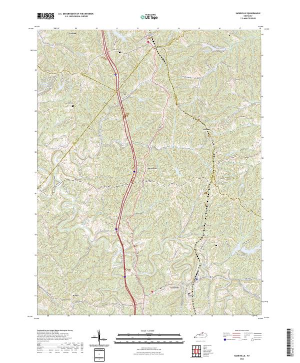 2022 Sadieville2022 Print · USGSThe crossroads of Scott and Grant counties are captured here in the early twenty-first century, centered on the historic rail-and-creek town of Sadieville. Researchers can locate several rural burial sites, including Knights of Pythias Cem and Ecklers Cem, while tracing the waters of Eagle Creek.
End of results
Showing maps 1-11 of 11
Frequently asked questions
- What are the different types of historical maps available for Pokeberry View Estates?
- What is the oldest map of Pokeberry View Estates?
- Where can I purchase historical maps of Pokeberry View Estates for my home or office?
- Where can I download high-res historical maps of Pokeberry View Estates?
- Are there historical topographic maps available for Pokeberry View Estates?
- Is there historical aerial imagery available for Pokeberry View Estates?
- Where are historical maps of Pokeberry View Estates sourced from?