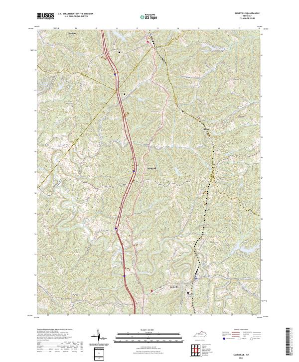
2022 Map of Sadieville
USGS Topo · Published 2022About this map
Sadieville serves as the central hub of this Scott County landscape, where the meandering course of Eagle Creek dictates the local topography. This modern survey illustrates a network of rural communities, including Stonewall and Hinton, connected by historically significant routes such as the Cincinnati Pike and Corinth Rd. For local historians and genealogists, the map provides precise locations for several family and community burial grounds, such as the Knights of Pythias Cem and Gillespie Cem. The rugged transition across county lines is marked by multiple boundaries, including the Grant Co Scott Co line. From the heights of Zion Hill to the banks of Mile Run, the map documents the persistent rural character of this Kentucky region, where small church sites like Zion Hill Church remain as cultural landmarks amid the complex drainage patterns of Little Eagle Creek and Hall Branch.
Find a feature on this map
63 named features on this map. Tap any name to fly to it.
Don’t see what you’re looking for? This feature index may not catch every label — zoom into the map to look around manually.
Map Details
Editions of this 2022 Sadieville Map
This is the sole edition of this map. No revisions or reprints were ever made.
Other maps of this area

1929 · Cynthiana
USGS Topo · 1:48,000

1930 · Falmouth
USGS Topo · 1:48,000

1934 · Cynthiana
USGS Topo · 1:62,500

1936 · Falmouth
USGS Topo · 1:62,500

1939 · Sadieville
USGS Topo · 1:62,500

1950 · Mason
USGS Topo · 1:24,000

1950 · Lawrenceville
USGS Topo · 1:24,000

1953 · Sadieville
USGS Topo · 1:24,000

1953 · Berry
USGS Topo · 1:24,000

1953 · Breckinridge
USGS Topo · 1:24,000