
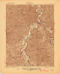
1936 Map of Falmouth
USGS Topo · Published 1936About this map
Licking River and its South Fork dominate this landscape of the Bluegrass region, where the deep meanders of the water dictate the path of the Louisville and Nashville railroad. The town of Falmouth sits at the critical junction of these two river forks, serving as a regional hub for Pendleton County. The map reveals an exceptionally dense network of rural infrastructure typical of the early 20th century, with numerous family-named schools such as Lightfoot Fork Sch and Beagle Sch serving isolated ridge-top communities.
Find a feature on this map
73 named features on this map. Tap any name to fly to it.
Don’t see what you’re looking for? This feature index may not catch every label — zoom into the map to look around manually.
Map Details
Editions of this 1936 Falmouth Map
2 editions found
Other maps of this area

1929 · Cynthiana
USGS Topo · 1:48,000

1929 · Alexandria
USGS Topo · 1:48,000

1930 · Falmouth
USGS Topo · 1:48,000

1931 · Felicity
USGS Topo · 1:62,500

1934 · Cynthiana
USGS Topo · 1:62,500

1936 · Alexandria
USGS Topo · 1:62,500

1939 · Sadieville
USGS Topo · 1:62,500

1950 · Mason
USGS Topo · 1:24,000

1950 · Williamstown
USGS Topo · 1:24,000

1950 · Walton
USGS Topo · 1:24,000