
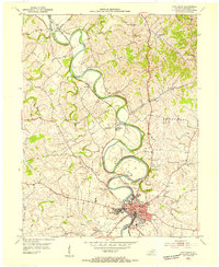
1953 Map of Breckinridge
USGS Topo · Published 1955About this map
The North Fork of Raven Creek winds through the dissected plateau of north-central Kentucky, defining the rural character of this 1950s landscape. Small agricultural communities such as Rutland, Renaker, and Breckinridge are connected by a network of unimproved and medium-duty roads, often following the winding ridgelines and valley floors. The presence of several rural meeting places, including Pleasant Green Ch, White Oak Ch, and Mt Hope Ch, reflects the social fabric of the era.
Find a feature on this map
24 named features on this map. Tap any name to fly to it.
Don’t see what you’re looking for? This feature index may not catch every label — zoom into the map to look around manually.
Map Details
Editions of this 1953 Breckinridge Map
This is the sole edition of this map. No revisions or reprints were ever made.
Other maps of this area

1929 · Cynthiana
USGS Topo · 1:48,000

1930 · Falmouth
USGS Topo · 1:48,000

1934 · Cynthiana
USGS Topo · 1:62,500

1936 · Falmouth
USGS Topo · 1:62,500

1939 · Sadieville
USGS Topo · 1:62,500

1950 · Mason
USGS Topo · 1:24,000

1953 · Sadieville
USGS Topo · 1:24,000

1953 · Berry
USGS Topo · 1:24,000

1953 · Kelat
USGS Topo · 1:24,000
1953 · Cynthiana
USGS Topo · 1:24,000