1900s (20th Century) Maps of Simpson County, Kentucky
Explore 23 historic maps of Simpson County from the 1900s (20th Century). These maps offer a rare glimpse into what life looked like during the 1900s — showing old roads, neighborhoods, homes, and landmarks that have changed or disappeared over time.
Whether you're researching your family's past, planning a metal detecting trip, or studying how Simpson County's landscape evolved across the 1900s, these high-resolution maps are a powerful tool for exploring the history of this region.
- Focus on a specific era: All maps on this page are from the 1900s, giving you a focused view of this time period.
- See what’s changed: Compare century-old streets, trails, and buildings to today's modern landscape using overlays and satellite layers.
- Research with precision: Use these maps for genealogy, historical research, land use analysis, or educational projects.
- View, download, or print: Maps are fully viewable online in high resolution, and can be downloaded or printed for your own records.
Start exploring Simpson County's history through authentic maps from the 1900s. This is your window into the past.
Simpson County, KY maps
(23)- 1921 Map of Bowling Green, 1955 Print
 1921 Bowling Green1955 Print · USGSBowling Green and its surrounding counties are shown here just after the Great War, when the Louisville and Nashville railroad fueled regional growth. Genealogists can trace hundreds of family landmarks, from Mussey Mill to schools like Cave Mill School and the remote Antioch Chapel.
 - 1923 Map of Bowling Green
 1923 Bowling Green1923 Print · USGSThe Bowling Green area in the early 1920s was a landscape defined by the winding Barren River and the busy Louisville and Nashville Railroad. Researchers can trace ancestral roots through dozens of rural sites like Cassadays Store, Massey Mill, and the Lost River.4 unique versions available
 - 1928 Map of Adolphus
 1928 Adolphus1928 Print · USGSThe Kentucky-Tennessee state line was a landscape of small schools and river crossings in the late twenties. Genealogists can locate family landmarks like Allen Cem, Reeders Sch, and the numerous crossings along Trammel Creek including Old Mill Ford.
 - 1931 Map of Adolphus
 1931 Adolphus1931 Print · USGSThe Kentucky-Tennessee state line was a landscape of river fords and country schoolhouses during the late Prohibition era. Genealogists can trace family footprints through dozens of local landmarks like Old Mill Ford, McKendree Chapel, and Pinkle Cem.2 unique versions available
 - 1942 Map of Gallatin
 1942 Gallatin1942 Print · USGSThe Tennessee-Kentucky borderlands were a crossroads of river and rail during the early war years. Genealogists and historians can trace family roots through dozens of named settlements like Bethpage, Prices Mill, and Mitchellville, or locate historic river crossings such as Kirkpatricks Ferry.
 - 1951 Map of Adairville, 1952 Print
 1951 Adairville1952 Print · USGSAdairville and the Kentucky-Tennessee borderlands are captured here in the early fifties, showing a landscape defined by the Red River and its South Fork. Local historians can trace family roots at Greenwood Cem or locate community hubs like Mortimer Sta and Townsend Sch.3 unique versions available
 - 1951 Map of Woodburn, 1952 Print
 1951 Woodburn1952 Print · USGSSouthern Kentucky at the dawn of the fifties shows a landscape of rail-side towns and winding waterways. Genealogists and local historians can trace the foundations of Woodburn, locate family-named sites like Stevenson Ch, and follow the old Louisville and Nashville line.2 unique versions available
 - 1951 Map of Franklin, 1952 Print
 1951 Franklin1952 Print · USGSThe Kentucky-Tennessee borderlands in the early fifties come to life on this detailed map of the Franklin area. Genealogists and historians can trace the Louisville and Nashville rail line and locate rural landmarks like Peden Mill and Union Chapel.2 unique versions available
 - 1951 Map of Prices Mill, 1952 Print
 1951 Prices Mill1952 Print · USGSThe Kentucky-Tennessee state line divides this 1950s farming landscape where the river and local mills defined rural commerce. Genealogists can locate family landmarks and community centers such as Prices Mill, White Hill Ch, and the Red River Sch.2 unique versions available
 - 1951 Map of Auburn, 1953 Print
 1951 Auburn1953 Print · USGSThe Logan and Simpson County line south of Auburn is captured here in the early fifties, showing a rural landscape anchored by rail and road. Researchers can trace historic local congregations like Bethel Grove Ch and schools such as Sand Bank Sch.3 unique versions available
 - 1951 Map of South Union, 1953 Print
 1951 South Union1953 Print · USGSSouth Union and the Gasper River valley appear here in the early fifties, showing a rural Logan County landscape defined by family farms and rail transport. Genealogists can locate several country churches and burial sites including Felts Cem, Liberty Ch, and the Gasper River Cem.2 unique versions available
 - 1952 Map of Rockfield, 1953 Print
 1952 Rockfield1953 Print · USGSWarren County in the early fifties is shown here at a peak of rail and resource activity. Genealogists can locate family landmarks like Millikens Chapel and Sumpter Cem, or trace the development of Rockfield and Rich Pond.2 unique versions available
 - 1954 Map of Drake, 1955 Print
 1954 Drake1955 Print · USGSSouthern Kentucky farmland and the winding Drakes Creek are captured here in the mid-fifties. Genealogists and local historians can trace small communities like Gold City and Drake P.O. or locate family landmarks such as Barnes Sch and Salem Ch.
 - 1954 Map of Hickory Flat, 1956 Print
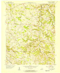 1954 Hickory Flat1956 Print · USGSThe Kentucky and Tennessee borderlands in the mid-1950s show a dense network of rural life organized around the Drakes Creek forks. Genealogists can trace family footprints through numerous small landmarks like Bethany Cem, Round Pond Sch, and the community of New Roe.
 - 1956 Map of Nashville, 1971 Print
 1956 Nashville1971 Print · USGSThe Tennessee-Kentucky borderlands come into focus in the mid-1960s as major reservoir projects transformed the Cumberland and Tennessee river valleys. Researchers can trace the rail networks of the Louisville and Nashville and visit sites like Fort Campbell and Fort Donelson National Military Park.2 unique versions available
 - 1959 Map of Nashville
 1959 Nashville1959 Print · USGSMiddle Tennessee and Southern Kentucky come into focus during the late fifties, showing the region's transition into a modern transportation and military hub. Researchers can trace the sprawling Fort Campbell Military Reservation or locate historic rail stops along the Tennessee Central Ry and Illinois Central RR.
 - 1967 Map of Hickory Flat, 1969 Print
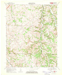 1967 Hickory Flat1969 Print · USGSThe Simpson and Allen County line at the Tennessee border was a network of rural hamlets and family farmsteads in the late sixties. Researchers can find numerous burial grounds and churches like Smyrna Ch, Loving Chapel Cem, and the Round Pond Sch.
 - 1968 Map of Franklin, 1969 Print
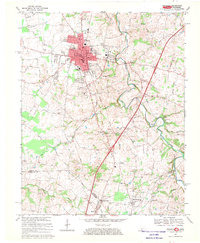 1968 Franklin1969 Print · USGSThe Kentucky and Tennessee borderlands come alive in this late 1960s survey, centered on the rail hub of Franklin. Researchers can trace the rural landscape from Green Lawn Cemetery down to the creek-side community of Mitchellville and the historic Peden Mill.4 unique versions available
 - 1968 Map of Drake, 1969 Print
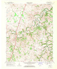 1968 Drake1969 Print · USGSThe rural borderlands of Warren and Simpson Counties are captured here in the late sixties, where small crossroads communities define the landscape. Researchers can locate family landmarks such as Marthas Chapel, the Barnes Sch, and the winding West Fork Drakes Creek.2 unique versions available
 - 1973 Map of Rockfield, 1974 Print
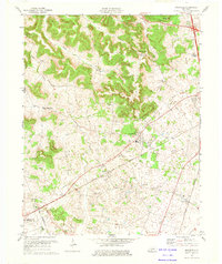 1973 Rockfield1974 Print · USGSWarren County in the 1970s is a landscape of active oil fields and traditional rural rail stops. Genealogists and historians can trace the foundations of local life through Rockfield Sch, Cedar Grove Ch, and the extensive network of Oil Wells surrounding Browning.
 - 1979 Map of Woodburn, 1984 Print
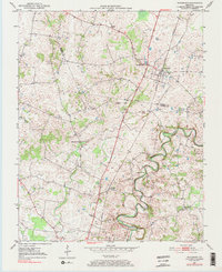 1979 Woodburn1984 Print · USGSWarren and Simpson County at the end of the seventies show a landscape of traditional crossroads communities and institutional foundations. Genealogists can locate family landmarks like Old Zion Ch, the County Home, and the railroad village of Woodburn.
 - 1979 Map of Rockfield, 1988 Print
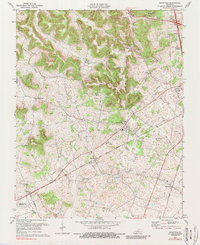 1979 Rockfield1988 Print · USGSWarren County’s rail and energy landscape comes into focus during the 1970s as the Louisville and Nashville line passes through small rural hubs. Genealogists and historians can trace local family landmarks like Millikens Chapel, Pleasant Hill Cem, and the community at Rockfield.
 - 1985 Map of Bowling Green
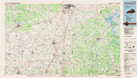 1985 Bowling Green1985 Print · USGSThe rolling borderlands of Kentucky and Tennessee are captured here in the mid-eighties, showing a landscape shaped by the Barren River and deep-rooted rail networks. Genealogists and researchers can trace local landmarks like Prices Mill, Highland Academy, and Green Lawn Cem.3 unique versions available
End of results
Showing maps 1-23 of 23
Top cities of Simpson County
Frequently asked questions
- What are the different types of historical maps available for Simpson County?
- What is the oldest map of Simpson County?
- Where can I purchase historical maps of Simpson County for my home or office?
- Where can I download high-res historical maps of Simpson County?
- Are there historical topographic maps available for Simpson County?
- Is there historical aerial imagery available for Simpson County?
- Where are historical maps of Simpson County sourced from?