Old Maps of Providence, Kentucky for Hiking & Exploration
Hike through history with 11 historic maps of Providence. Explore old trails, ghost towns, and forgotten backroads — perfect for outdoor adventurers and local explorers.
- Rediscover forgotten places: Map out old mining camps, roads, and footpaths that no longer exist on modern maps.
- Layer with modern tools: Combine with LiDAR or satellite views to plan hikes through historical terrain.
- Made for exploration: Popular among hikers, overlanders, and local history lovers.
Use these maps to find adventure and explore the hidden past of Providence.
Providence, KY maps
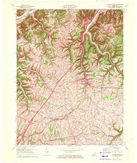
(11)- 1952 Map of Campbellsburg, 1954 Print
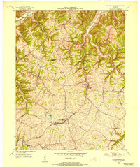 1952 Campbellsburg1954 Print · USGSThe Henry County highlands come alive in the early fifties, showing the interplay of rail and river near Campbellsburg. Genealogists can trace family footprints near Hopewell Ch or along the Louisville and Nashville line through Turners Station.
 - 1956 Map of Louisville, 1971 Print
 1956 Louisville1971 Print · USGSThe Ohio River valley and the Kentucky Bluegrass are captured here during a period of rapid mid-century growth and industrial activity. Genealogists and historians can trace rail-centered towns and military land use at Fort Knox and the Jefferson Proving Ground.2 unique versions available
 - 1964 Map of Louisville
 1964 Louisville1964 Print · USGSThe Ohio River valley and Kentucky Bluegrass are captured in the mid-1960s, showing a region balanced between industrial growth and its agrarian roots. Genealogists and historians can trace the development of county seats like Shelbyville and Paris, or locate established institutions such as Georgetown College and Bernheim Forest.
 - 1969 Map of Campbellsburg, 1972 Print
 1969 Campbellsburg1972 Print · USGSHenry County is captured in the late sixties as a landscape of ridge-top farms and busy rail corridors. Genealogists and local historians can trace family-named routes like Monfort Lane or locate centers of community like Hopewell Ch and Turners Station.
 - 1986 Map of Madison
 1986 Madison1986 Print · USGSSouthern Indiana and Northern Kentucky are shown here in the mid-eighties, centered on the river corridor and the sprawling Jefferson Proving Ground. Genealogists and historians can trace rail lines like the Seaboard System and locate river towns from Madison to Bethlehem.
 - 1990 Map of Madison, 1991 Print
 1990 Madison1991 Print · USGSThe Ohio River valley and the southern Indiana plains are documented here in the final decade of the twentieth century. Genealogists and historians can trace family-named crossroads and established rail towns like Dudleytown, Austin, and Crothersville along the P C RR line.
 - 2010 Map of Campbellsburg, 2010 Print
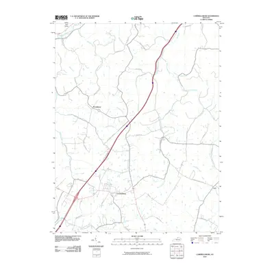 2010 Campbellsburg2010 Print · USGSCovers Providence, including Campbellsburg, Turners Station, and other nearby areas
 - 2013 Map of Campbellsburg, 2013 Print
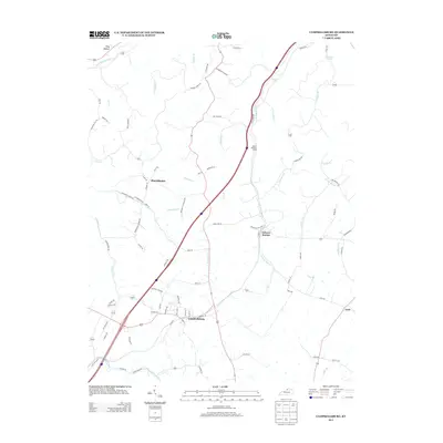 2013 Campbellsburg2013 Print · USGSCovers Providence, including Campbellsburg, Turners Station, and other nearby areas
 - 2016 Map of Campbellsburg, 2016 Print
 2016 Campbellsburg2016 Print · USGSCovers Providence, including Campbellsburg, Turners Station, and other nearby areas
 - 2019 Map of Campbellsburg, 2019 Print
 2019 Campbellsburg2019 Print · USGSCovers Providence, including Campbellsburg, Turners Station, and other nearby areas
 - 2022 Map of Campbellsburg, 2022 Print
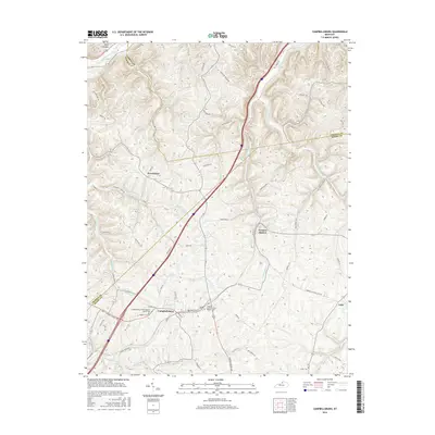
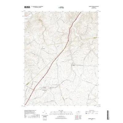
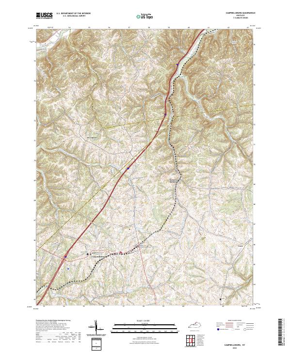 2022 Campbellsburg2022 Print · USGSCampbellsburg and the surrounding rural uplands are shown in the early twenty-first century as the landscape maintains its traditional rail-and-road character. Genealogists can locate family sites like Antill Cem and Sulphur-Fork Primitive Baptist Cem or trace the CSX line through Turners Station.
End of results
Showing maps 1-11 of 11
Top cities near Providence
- Louisville historical maps
- Madison historical maps
- La Grange historical maps
- Carrollton historical maps
- Eminence historical maps
- Vevay historical maps
See more
Frequently asked questions
- What are the different types of historical maps available for Providence?
- What is the oldest map of Providence?
- Where can I purchase historical maps of Providence for my home or office?
- Where can I download high-res historical maps of Providence?
- Are there historical topographic maps available for Providence?
- Is there historical aerial imagery available for Providence?
- Where are historical maps of Providence sourced from?