Old Maps of Sturgis, Kentucky for Academic Research
Study the evolution of Sturgis with 31 high-resolution historic maps. Whether you're teaching, researching, or modeling changes in land use, these maps provide essential visual documentation of urban, environmental, and geographic change.
- Analyze long-term change: Track patterns in development, transportation, and natural features.
- Ideal for environmental or urban studies: Support academic projects with primary historical map data.
- Use in the classroom or lab: Educators and researchers rely on these maps to bring historical context to life.
These maps are a powerful tool for teaching, research, and visualizing how Sturgis has changed over the decades.
Sturgis, KY maps
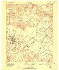
(31)- 1907 Map of Morganfield
 1907 Morganfield1907 Print · USGSUnion County during the first decade of the twentieth century shows a landscape transitioning between its agrarian roots and a growing rail economy. Genealogists can locate family landmarks like Waggoner Church, the remote Topeka Crossroads, and the settlement at Seven Gums.3 unique versions available
 - 1916 Map of Shawneetown
 1916 Shawneetown1916 Print · USGSThe Illinois-Kentucky borderlands thrived as a river-and-rail corridor during the early twentieth century. Genealogists and historians can trace the foundations of local life through dozens of rural schools and industrial sites like Saline Mines, Caseyville, and Westwood Cemetery.5 unique versions available
 - 1949 Map of Paducah
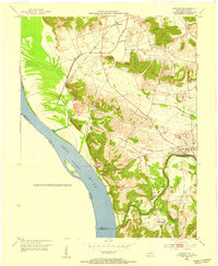
 1949 Paducah1949 Print · USGSThe confluence of the Ohio, Mississippi, Tennessee, and Cumberland rivers at the close of the 1940s reveals a region bound by water and rail. Researchers can trace historic river landings, timberlands in the Shawnee National Forest, and the coal-mining infrastructure around West Frankfort and Herrin.2 unique versions available
 - 1950 Map of Paducah
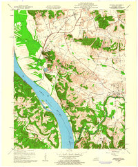
 1950 Paducah1950 Print · USGSThe confluence of the great midwestern rivers defines this mid-century landscape at the intersection of Illinois, Kentucky, and Missouri. Genealogists and historians can trace the rail-and-river economy through the hubs of Paducah, Cairo, and Metropolis or locate family roots near the Wildcat Hills.
 - 1951 Map of Sturgis
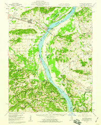
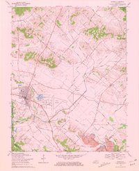
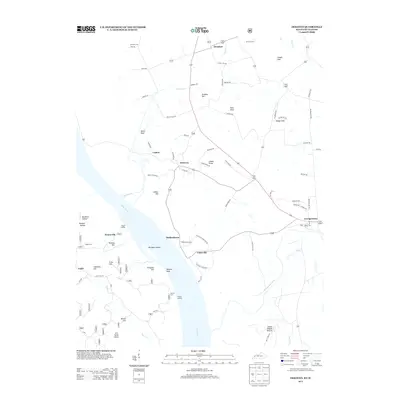
 1951 Sturgis1951 Print · USGSThe coal and rail hub of Sturgis thrives in the early fifties at the meeting of the Illinois Central and Western Kentucky lines. Trace local heritage through the Poplar Ridge Mine, Pythian Ridge Cem, and Bethany Church.
 - 1953 Map of Dekoven, 1954 Print
 1953 Dekoven1954 Print · USGSWestern Kentucky coal and river culture meet in the early fifties along the Ohio River. Researchers can trace the rail networks of the West Kentucky Coal Company and locate old sites like Caseyville, Dekoven, and St Ambrose Ch.
 - 1954 Map of Evansville
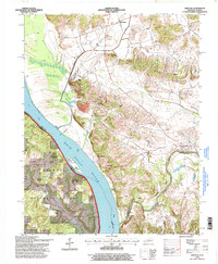
 1954 Evansville1954 Print · USGSThe Ohio River borderlands between Indiana and Kentucky appear here during a period of robust industrial and military growth. Genealogists and researchers can trace the rail corridors of the Illinois Central and find landmarks like US Lock and Dam No 48 or Camp Breckinridge.
 - 1954 Map of Paducah
 1954 Paducah1954 Print · USGSSouthern Illinois and Western Kentucky intersect at the great river confluences during this mid-century era of rail and river industry. Genealogists and historians can trace family roots and commerce through river towns like Cairo, Metropolis, and Golconda, or along the tracks of the Illinois Central Railroad.2 unique versions available
 - 1957 Map of Evansville, 1969 Print
 1957 Evansville1969 Print · USGSIndiana and Kentucky meet along the Ohio River in this mid-century survey of a vital industrial and transport corridor. Genealogists and historians can trace the development of river towns like Owensboro and Newburgh or locate old rail lines like the Southern Ry.3 unique versions available
 - 1959 Map of Dekoven, 1960 Print
 1959 Dekoven1960 Print · USGSThe riverfront and rail corridors of Union County were bustling during the late fifties, defined by the Ohio River border. Researchers can trace historic family locations at Bells Mines, the Odd Fellows Cem, and the rural community of Henshaw.3 unique versions available
 - 1959 Map of Shawneetown, 1960 Print
 1959 Shawneetown1960 Print · USGSSouthern Illinois and western Kentucky meet along the Ohio River in the late 1950s, a period defined by river commerce and coal mining. Researchers can trace the dual centers of Old Shawneetown and New Shawneetown or locate family sites like Zion Ch and Saline Mines.2 unique versions available
 - 1961 Map of Evansville
 1961 Evansville1961 Print · USGSThe Ohio River valley and its surrounding coalfields are captured here during the late fifties and early sixties. Trace the industrial rail networks of the Illinois Central RR and explore regional landmarks like Mammoth Cave National Park and Angel Mounds State Memorial.2 unique versions available
 - 1961 Map of Paducah
 1961 Paducah1961 Print · USGSThe Lower Ohio Valley at mid-century is a landscape defined by its great rivers and newly formed reservoirs. Researchers can trace the riverfronts of Paducah and Metropolis, or locate smaller settlements like Old Shawneetown and Cave in Rock along the banks.2 unique versions available
 - 1964 Map of Paducah
 1964 Paducah1964 Print · USGSThe river-and-rail corridor of Southern Illinois and Western Kentucky is captured here during the height of the mid-century industrial era. Genealogists and researchers can trace local landmarks across several counties, from the rail yards of Paducah to the waters of Crab Orchard Lake and Kentucky Reservoir.2 unique versions available
 - 1969 Map of Sturgis, 1970 Print
 1969 Sturgis1970 Print · USGSUnion County and the Sturgis area are captured here in the late sixties, showcasing a landscape defined by coal mining and rural community life. Genealogists can locate family landmarks like Pythian Ridge Cem, Waller School, and the community of Pride.2 unique versions available
 - 1984 Map of West Frankfort, 1985 Print
 1984 West Frankfort1985 Print · USGSSouthern Illinois at the peak of late-century coal and oil production reveals a complex landscape of industry and conservation. Genealogists and historians can trace rail-served mining hubs like Orient No. 3 Mine and the historic riverfront at Old Shawneetown.
 - 1986 Map of Evansville
 1986 Evansville1986 Print · USGSThe Ohio River valley thrives in the mid-1980s as a hub of river commerce, industry, and natural preservation spanning the Indiana-Kentucky border. Genealogists and historians can locate remote landmarks like Dead Mans Cem, Lippe Church, and the riverside community of Scuffletown.
 - 1987 Map of West Frankfort
 1987 West Frankfort1987 Print · USGSSouthern Illinois in the late eighties shows a landscape defined by the coal and river economies. Researchers can trace the extensive Strip Mine works and historic settlements like Shawneetown and Carriers Mills along the Illinois Central Railroad.
 - 1987 Map of Paducah, 1988 Print
 1987 Paducah1988 Print · USGSThe Lower Ohio Valley and the Illinois Ozarks come alive in this late twentieth-century regional survey. Genealogists and local historians can trace river-town roots and state park landmarks from Metropolis to Cape Girardeau and Trail of Tears State Park.
 - 1991 Map of Evansville
 1991 Evansville1991 Print · USGSThe tri-state region of Indiana and Kentucky was a hub of river commerce and rail transport in the early nineties. Researchers can trace the industrial corridor between Evansville and Owensboro, locating landmarks like Angel Mounds State Memorial and the Seaboard System railroad.
 - 1996 Map of Dekoven, 1998 Print
 1996 Dekoven1998 Print · USGSThe Kentucky-Illinois borderlands along the Ohio River are shown here as they appeared in the mid-1990s. Researchers can trace the riverfront history of Caseyville or locate family sites like Hobbs Cem and Saint Ambrose Ch.
 - 2010 Map of Sturgis, 2010 Print
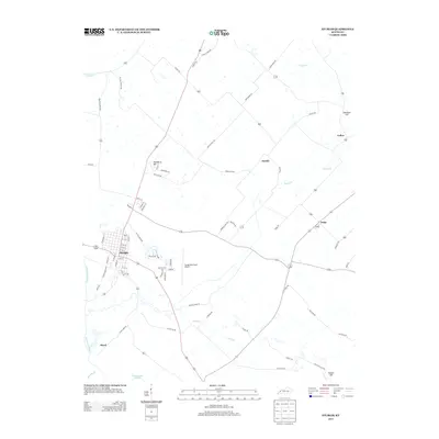
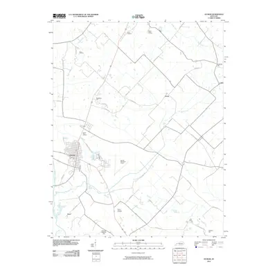 2010 Sturgis2010 Print · USGSCovers Sturgis, including Hazel, Pride, and other nearby areas
 - 2011 Map of Dekoven, 2011 Print
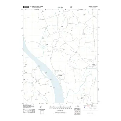 2011 Dekoven2011 Print · USGSCovers Sturgis, including Curlew, Henshaw, and other nearby areas
 - 2013 Map of Dekoven, 2013 Print
 2013 Dekoven2013 Print · USGSCovers Sturgis, including Curlew, Henshaw, and other nearby areas
 - 2013 Map of Sturgis, 2013 Print
 2013 Sturgis2013 Print · USGSCovers Sturgis, including Hazel, Pride, and other nearby areas
Showing maps 1-25 of 31
Top cities near Sturgis
- Providence historical maps
- Morganfield historical maps
- Marion historical maps
- Clay historical maps
- Shawneetown historical maps
- Uniontown historical maps
See more
Frequently asked questions
- What are the different types of historical maps available for Sturgis?
- What is the oldest map of Sturgis?
- Where can I purchase historical maps of Sturgis for my home or office?
- Where can I download high-res historical maps of Sturgis?
- Are there historical topographic maps available for Sturgis?
- Is there historical aerial imagery available for Sturgis?
- Where are historical maps of Sturgis sourced from?