Old Maps of Cooterville, Louisiana for Metal Detecting
Plan your next treasure hunt with 14 historic maps of Cooterville. Find old homesites, ghost towns, trails, and gathering spots that may be lost to time — perfect for identifying promising metal detecting locations.
- Locate forgotten sites: Uncover places like long-lost settlements, abandoned rail lines, or gathering spots.
- Plan better hunts: Use map overlays combined with LiDAR or satellite views to narrow in on historically rich areas.
- Made for detectorists: Thousands of hobbyists use these maps to discover relics, coins, and hidden history.
Use these historic maps to boost your research and find new opportunities beneath the surface of Cooterville.
Cooterville, LA maps
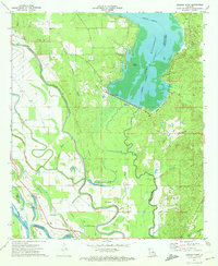
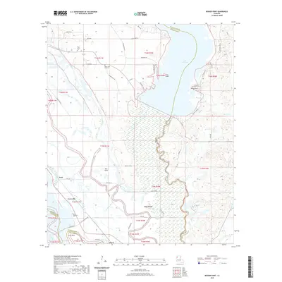
(14)- 1941 Map of Bossier Point
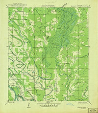 1941 Bossier Point1941 Print · USGSThe marshlands and bottomlands of Bossier Parish come alive in the early 1940s, showing a landscape defined by the shifting waters of Lake Bistineau. Genealogists can trace family footprints at Fairview Cem or locate rural landmarks like Bear Island Sch and the Burkett Bridge.
 - 1947 Map of Ringgold
 1947 Ringgold1947 Print · USGSNorthwestern Louisiana comes to life in the 1940s, centered on the growing town of Ringgold and the expansive waters of LAKE BISTINEAU. Trace local roots through rural landmarks like the NEW SALT WORKS, St Johns Ch, and the Ogden Spur railroad line.
 - 1955 Map of Shreveport
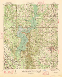
 1955 Shreveport1955 Print · USGSNorthern Louisiana in the mid-fifties is captured here as a landscape of military bases, vast oil fields, and burgeoning college towns. Genealogists and historians can trace the rail-and-river economy through the Monroe Gas Field, Grambling College, and Barksdale Air Force Base.3 unique versions available
 - 1956 Map of Shreveport
 1956 Shreveport1956 Print · USGSNorthern Louisiana during the mid-fifties presents a complex landscape of booming oil fields and strategic military installations. Genealogists and historians can trace the infrastructure of the Monroe Gas Field and family-named locales from Cotton Valley to Jonesboro.
 - 1956 Map of Ringgold, 1957 Print
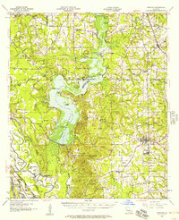 1956 Ringgold1957 Print · USGSThe Lake Bistineau region of northern Louisiana flourished in the mid-fifties as a hub of timber, gas extraction, and lakeside recreation. Genealogists and local historians can trace family-named landmarks such as Peggys Island, St Pauls Cem & Ch, and the settlement of Woodardville.2 unique versions available
 - 1972 Map of Ringgold, 1974 Print
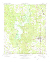 1972 Ringgold1974 Print · USGSThe Louisiana parishes of Bossier, Webster, and Bienville are shown here in the early 1970s as industrial gas fields and lakeside recreation shaped the land. Genealogists can locate several local burial sites including Tooke Cem and Gilmer Cem, or trace the rail lines of the Kansas City Southern.
 - 1972 Map of Bossier Point, 1974 Print
 1972 Bossier Point1974 Print · USGSNorthwest Louisiana in the early seventies reveals a landscape of winding river bends and lake shorelines at the meeting of three parishes. Genealogists and local historians can locate family landmarks like Mt Nebo Ch and the Mary Magdalene Cem, or trace the rail lines through Cooterville and Ninock.2 unique versions available
 - 1984 Map of Shreveport
 1984 Shreveport1984 Print · USGSNorthern Louisiana at the peak of the 1980s reveals a landscape of massive water management projects and Cold War military hubs. Trace the rail lines of the Kansas City Southern Ry past Barksdale Air Force Base and the high ground of Driskill Mountain.2 unique versions available
 - 1985 Map of Shreveport South
 1985 Shreveport South1985 Print · USGSNorthwest Louisiana in the mid-eighties shows a landscape defined by the Red River and a transition from urban centers to deep timberland. Researchers can trace the rail-and-river economy through landmarks like Barksdale Air Force Base, the Sligo Oil and Gas Field, and Lake Bistineau.2 unique versions available
 - 2012 Map of Bossier Point, 2012 Print
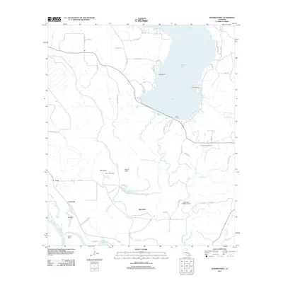 2012 Bossier Point2012 Print · USGSCovers Cooterville, including High Island, Poole, and other nearby areas
 - 2015 Map of Bossier Point, 2015 Print
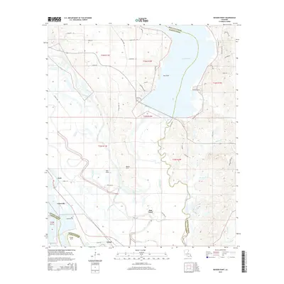 2015 Bossier Point2015 Print · USGSCovers Cooterville, including High Island, Poole, and other nearby areas
 - 2018 Map of Bossier Point, 2018 Print
 2018 Bossier Point2018 Print · USGSCovers Cooterville, including High Island, Poole, and other nearby areas
 - 2020 Map of Bossier Point, 2020 Print
 2020 Bossier Point2020 Print · USGSCovers Cooterville, including High Island, Poole, and other nearby areas
 - 2024 Map of Bossier Point, 2024 Print
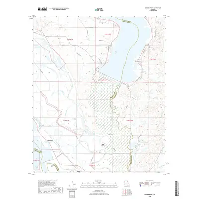
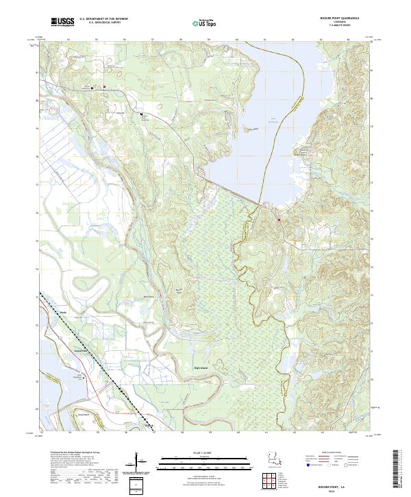 2024 Bossier Point2024 Print · USGSLouisiana's river country comes into focus in this recent survey of the Bossier and Bienville parish border. Genealogists and local historians can trace family burial sites at Sutton Cem and Mary Magdalene Cem or locate the community at Ninock near Lock & Dam 5.
End of results
Showing maps 1-14 of 14
Top cities near Cooterville
- Shreveport historical maps
- Bossier City historical maps
- Mansfield historical maps
- Haughton historical maps
- Coushatta historical maps
- Ringgold historical maps
See more
Frequently asked questions
- What are the different types of historical maps available for Cooterville?
- What is the oldest map of Cooterville?
- Where can I purchase historical maps of Cooterville for my home or office?
- Where can I download high-res historical maps of Cooterville?
- Are there historical topographic maps available for Cooterville?
- Is there historical aerial imagery available for Cooterville?
- Where are historical maps of Cooterville sourced from?