Old Maps of Edna, Louisiana
Explore 11 old maps of Edna, spanning from 1947 to today. These high-resolution historic maps reveal how streets, neighborhoods, landmarks, and natural features evolved over time — perfect for genealogy, metal detecting, research, and local history exploration.
What you can do with these maps:
- See how Edna changed over time: Compare historical maps to modern-day views to trace roads, homesites, rail lines & more.
- View detailed metadata: Each map includes creators, publishers, year, scale, and archive source.
- Overlay maps with satellite & LiDAR: Visualize the past alongside modern tools to explore terrain & human change.
- Trusted historical sources: Maps sourced from the USGS, Library of Congress, and other archives.
- Access maps your way: View online, download high-res files, or order prints for personal or research use.
Start exploring old maps of Edna to uncover forgotten places, hidden landmarks, and the deep history beneath your feet.
Edna, LA maps
(11)- 1947 Map of Edna
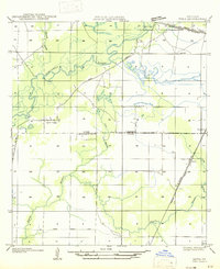 1947 Edna1947 Print · USGSSouthwest Louisiana in the mid-1930s is a landscape of shifting bayous and expanding rail lines. Genealogists and historians can trace the early footprints of Indian Village, the community of Edna, and remnants of the Old Logging Railroad Grade.
 - 1952 Map of Lake Charles
 1952 Lake Charles1952 Print · USGSSouthwest Louisiana is captured here in the mid-fifties, showing a landscape defined by the rise of the petrochemical industry and deep-water navigation. Researchers can trace family roots through numerous small-town settlements and oil developments like Nibletts Bluff, the Lockport Oil Field, and Starks.
 - 1954 Map of Lake Charles, 1964 Print
 1954 Lake Charles1964 Print · USGSSouthwest Louisiana in the mid-fifties is defined by its massive petroleum industry and its complex network of bayous and rail lines. Researchers can trace the development of the Sulphur Mines Oil Field or locate historic settlements like Longville and De Quincy.3 unique versions available
 - 1959 Map of Kinder, 1960 Print
 1959 Kinder1960 Print · USGSSouthwest Louisiana is captured here in the late fifties as timber, rail, and oil industries converged across the parish lines. Genealogists and historians can trace the foundations of Kinder and Welsh or locate rural sites like Sacred Heart Ch and McGee Cem.4 unique versions available
 - 1985 Map of Indian Village
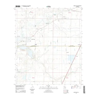
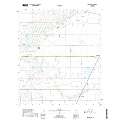
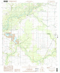 1985 Indian Village1985 Print · USGSThe Calcasieu River valley and the parish boundary between Allen and Jefferson Davis are captured in the mid-1980s. Local history researchers can trace the small settlements of Indian Village and Edna or locate rural landmarks like Nevills Bluff and the local Sand Pit.
 - 1985 Map of Crowley, 1986 Print
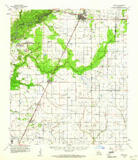
 1985 Crowley1986 Print · USGSCoastal prairie and bayou country are captured in the mid-eighties as the rice-and-rail economy defined South Louisiana life. Genealogists and researchers can trace family lands and rural hubs from Crowley to Jennings, following the paths of the Southern Pacific Railroad and the winding Mermentau River.2 unique versions available
 - 2012 Map of Indian Village, 2012 Print
 2012 Indian Village2012 Print · USGSCovers Edna, including Fontenot, Gravel Point, and other nearby areas
 - 2015 Map of Indian Village, 2015 Print
 2015 Indian Village2015 Print · USGSCovers Edna, including Fontenot, Gravel Point, and other nearby areas
 - 2018 Map of Indian Village, 2018 Print
 2018 Indian Village2018 Print · USGSCovers Edna, including Fontenot, Gravel Point, and other nearby areas
 - 2020 Map of Indian Village, 2020 Print
 2020 Indian Village2020 Print · USGSCovers Edna, including Fontenot, Gravel Point, and other nearby areas
 - 2024 Map of Indian Village, 2024 Print
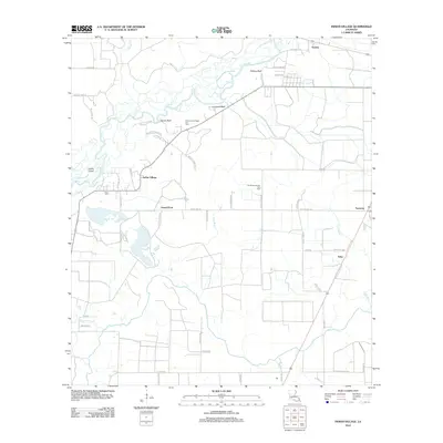
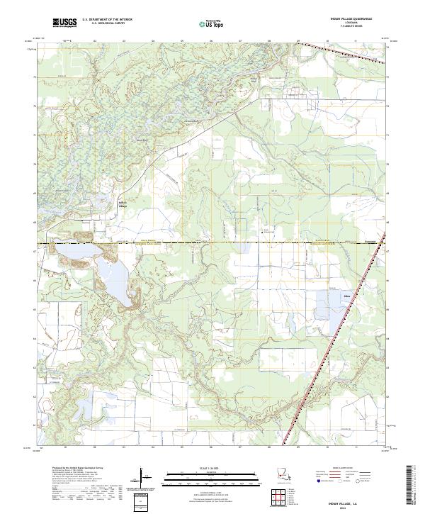 2024 Indian Village2024 Print · USGSThe river bluffs and bayous of southwestern Louisiana are captured here in the contemporary era. Trace local genealogy and history through family-named landmarks like Nevils Bluff, Nevil Cem, and the rural settlements of Indian Village and Edna.
End of results
Showing maps 1-11 of 11
Top cities near Edna
- Jennings historical maps
- Welsh historical maps
- Iowa historical maps
- Kinder historical maps
- Oberlin historical maps
- Elton historical maps
See more
Frequently asked questions
- What are the different types of historical maps available for Edna?
- What is the oldest map of Edna?
- Where can I purchase historical maps of Edna for my home or office?
- Where can I download high-res historical maps of Edna?
- Are there historical topographic maps available for Edna?
- Is there historical aerial imagery available for Edna?
- Where are historical maps of Edna sourced from?