Old Maps of Historic District, Natchitoches for Genealogy
Trace your family roots with 13 historic maps of Historic District. These high-res maps reveal old neighborhoods, homesites, landmarks, and streets — helping you uncover where your ancestors lived and how the area evolved over time.
- Explore historic neighborhoods: Identify where your relatives may have lived in the 1800s or 1900s.
- Compare maps over time: Trace the changes in streets, buildings, and landmarks for multi-generational research.
- Perfect for genealogy & ancestry research: Used by family historians and researchers to map out lineage and migration.
These maps are an incredible resource for exploring your personal connection to Historic District's past.
Historic District, Natchitoches maps
(13)- 1937 Map of Campti SE
 1937 Campti SE1937 Print · USGSIn the late 1930s, the historic city of Natchitoches sat at the heart of a vibrant river-and-rail economy along the Cane River. Researchers can trace old family sites and rural landmarks like Debleux Cem, St Savior Ch, and the high bluffs at Grand Ecore.
 - 1944 Map of Campti, 1955 Print
 1944 Campti1955 Print · USGSNatchitoches and the Red River valley are shown here during the mid-1940s, highlighting a landscape of river bends and rail-dependent settlements. Researchers can trace family roots through numerous country landmarks like Bethlehem Sch, St Lukes Cem, and the river port at Grand Ecore.
 - 1948 Map of Campti
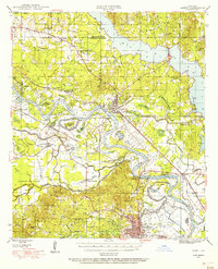
 1948 Campti1948 Print · USGSNatchitoches Parish and the Red River valley are captured in the late 1940s, showing a landscape defined by oxbows and rural life. Researchers can trace historic schools and churches from Campti to Powhatan, including Bethel Cem and Grappes Bluff.2 unique versions available
 - 1953 Map of Alexandria, 1963 Print
 1953 Alexandria1963 Print · USGSCentral Louisiana during the early fifties is mapped here at the intersection of the piney woods and the Red River valley. Genealogists and historians can trace the rail-and-river network connecting towns like Alexandria, Natchitoches, and the grounds of Camp Beauregard.3 unique versions available
 - 1955 Map of Alexandria
 1955 Alexandria1955 Print · USGSCentral Louisiana in the mid-fifties is a landscape of river-port cities, sprawling timberlands, and massive military reservations. Genealogists and historians can trace the rail networks of the Texas & Pacific RR and locate sites like Camp Polk Military Reservation and Natchitoches.
 - 1957 Map of Campti, 1958 Print
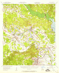 1957 Campti1958 Print · USGSThe Red River Valley in the late fifties was a maze of shifting river bends, bayous, and rail towns like Campti and Powhatan. Researchers can trace the era's local geography through landmarks like N W State College and numerous rural sites like Black Lake Sch.5 unique versions available
 - 1983 Map of Natchitoches North, 1984 Print
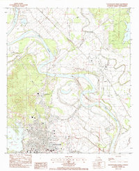 1983 Natchitoches North1984 Print · USGSNatchitoches and the Red River valley are captured in the early eighties as significant river re-channeling was underway. Researchers can locate Northwestern State Univ, family burial sites like De Blieux Cem, and the old settlement of Grand Ecore.2 unique versions available
 - 1986 Map of Natchitoches
 1986 Natchitoches1986 Print · USGSNorthwestern Louisiana during the mid-eighties shows a landscape shaped by major water projects and timberlands. Researchers can trace historic routes like the Old Spanish Trail or locate rural communities such as Fort Jesup, Fairview Alpha, and Grappes Bluff.2 unique versions available
 - 2012 Map of Natchitoches North, 2012 Print
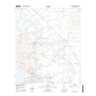
 2012 Natchitoches North2012 Print · USGSCovers Historic District, including Natchitoches, Clarence, and other nearby areas
 - 2015 Map of Natchitoches North, 2015 Print
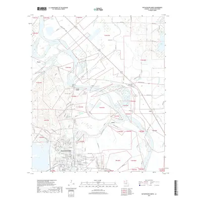
 2015 Natchitoches North2015 Print · USGSCovers Historic District, including Natchitoches, Clarence, and other nearby areas
 - 2018 Map of Natchitoches North, 2018 Print
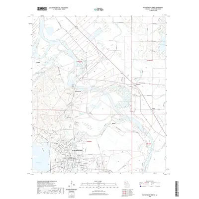
 2018 Natchitoches North2018 Print · USGSCovers Historic District, including Natchitoches, Clarence, and other nearby areas
 - 2020 Map of Natchitoches North, 2020 Print
 2020 Natchitoches North2020 Print · USGSCovers Historic District, including Natchitoches, Clarence, and other nearby areas
 - 2024 Map of Natchitoches North, 2024 Print
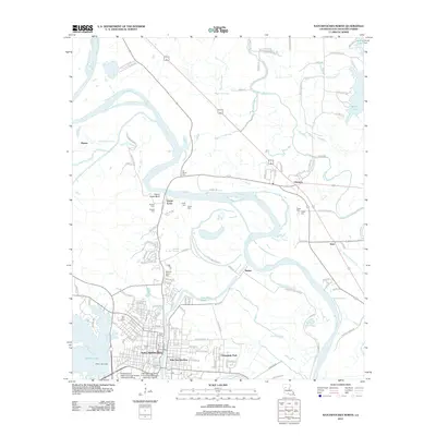
 2024 Natchitoches North2024 Print · USGSNatchitoches and the Red River valley are captured in this recent survey, showcasing the historic city's modern footprint and institutional growth. Researchers can trace local lineage through American Cem and De Blieux Cem, or locate landmarks like the Natchitoches Parish Courthouse.
End of results
Showing maps 1-13 of 13
Frequently asked questions
- What are the different types of historical maps available for Historic District?
- What is the oldest map of Historic District?
- Where can I purchase historical maps of Historic District for my home or office?
- Where can I download high-res historical maps of Historic District?
- Are there historical topographic maps available for Historic District?
- Is there historical aerial imagery available for Historic District?
- Where are historical maps of Historic District sourced from?