Old Maps of Pleasant Hill, Louisiana for Metal Detecting
Plan your next treasure hunt with 12 historic maps of Pleasant Hill. Find old homesites, ghost towns, trails, and gathering spots that may be lost to time — perfect for identifying promising metal detecting locations.
- Locate forgotten sites: Uncover places like long-lost settlements, abandoned rail lines, or gathering spots.
- Plan better hunts: Use map overlays combined with LiDAR or satellite views to narrow in on historically rich areas.
- Made for detectorists: Thousands of hobbyists use these maps to discover relics, coins, and hidden history.
Use these historic maps to boost your research and find new opportunities beneath the surface of Pleasant Hill.
Pleasant Hill, LA maps
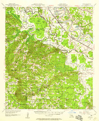
(12)- 1938 Map of Chemard Lake
 1938 Chemard Lake1938 Print · USGSIn the late 1930s, the De Soto Parish riverlands were a complex world of winding bayous and small rural schoolhouses. Genealogists and historians can trace the foundations of local life at Rambin Store, Ajax, and country schools like Egypt Sch and Summer Hill Sch.
 - 1947 Map of Hanna
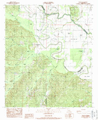
 1947 Hanna1947 Print · USGSRed River Parish and Natchitoches Parish are shown in the late 1940s, a period when the river valley remained a landscape of ferries, rural schools, and bayous. Genealogists can trace family landmarks like the Rambin Store, Jordon Ferry, and St James Cem.
 - 1953 Map of Alexandria, 1963 Print
 1953 Alexandria1963 Print · USGSCentral Louisiana during the early fifties is mapped here at the intersection of the piney woods and the Red River valley. Genealogists and historians can trace the rail-and-river network connecting towns like Alexandria, Natchitoches, and the grounds of Camp Beauregard.3 unique versions available
 - 1955 Map of Alexandria
 1955 Alexandria1955 Print · USGSCentral Louisiana in the mid-fifties is a landscape of river-port cities, sprawling timberlands, and massive military reservations. Genealogists and historians can trace the rail networks of the Texas & Pacific RR and locate sites like Camp Polk Military Reservation and Natchitoches.
 - 1957 Map of Hanna, 1958 Print
 1957 Hanna1958 Print · USGSThe Red River valley in the late fifties was a maze of shifting waterways and emerging oil interests. Researchers can trace rural lineages through the Rambin Store, Jordan Ferry, and dozens of country churches like Zion Rest Church.3 unique versions available
 - 1986 Map of Natchitoches
 1986 Natchitoches1986 Print · USGSNorthwestern Louisiana during the mid-eighties shows a landscape shaped by major water projects and timberlands. Researchers can trace historic routes like the Old Spanish Trail or locate rural communities such as Fort Jesup, Fairview Alpha, and Grappes Bluff.2 unique versions available
 - 1989 Map of Evelyn
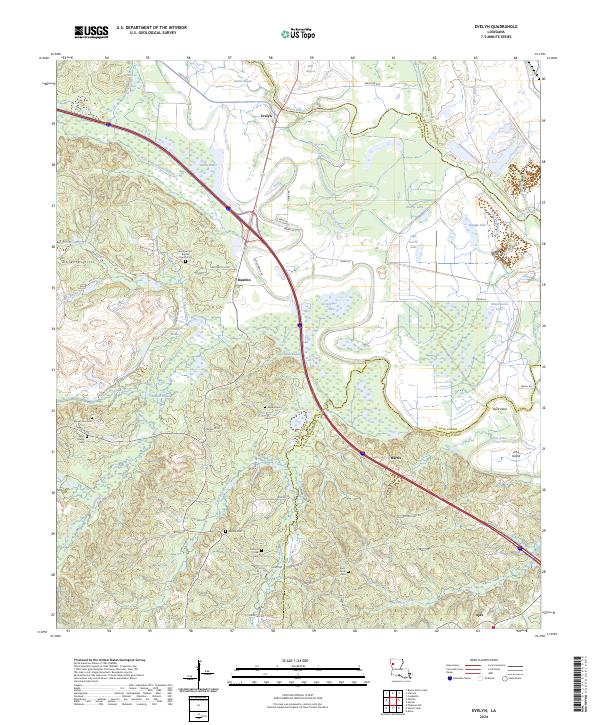
 1989 Evelyn1989 Print · USGSDe Soto Parish and the surrounding lowlands are captured here in the late twentieth century, showing a landscape defined by timber and energy. Genealogists can trace family roots through settlements like Evelyn and Harris or locate rural Cem sites near Rambin.2 unique versions available
 - 2012 Map of Evelyn, 2012 Print
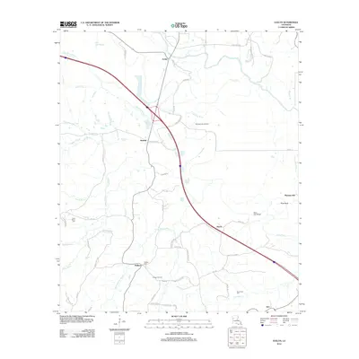 2012 Evelyn2012 Print · USGSCovers Pleasant Hill, including Rambin, Ajax, and other nearby areas
 - 2015 Map of Evelyn, 2015 Print
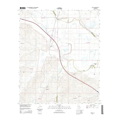 2015 Evelyn2015 Print · USGSCovers Pleasant Hill, including Rambin, Ajax, and other nearby areas
 - 2018 Map of Evelyn, 2018 Print
 2018 Evelyn2018 Print · USGSCovers Pleasant Hill, including Rambin, Ajax, and other nearby areas
 - 2020 Map of Evelyn, 2020 Print
 2020 Evelyn2020 Print · USGSCovers Pleasant Hill, including Rambin, Ajax, and other nearby areas
 - 2024 Map of Evelyn, 2024 Print
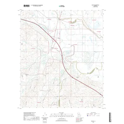
 2024 Evelyn2024 Print · USGSSettlements and family cemeteries are scattered across the parish lines of De Soto and Natchitoches in this 2024 survey. Trace local heritage at Summer Hill Baptist Church Cem or find old landmarks like Dolette Hills and Evelyn.
End of results
Showing maps 1-12 of 12
Top cities near Pleasant Hill
- Natchitoches historical maps
- Coushatta historical maps
- Pleasant Hill historical maps
- Martin historical maps
- Ashland historical maps
- Edgefield historical maps
See more
Frequently asked questions
- What are the different types of historical maps available for Pleasant Hill?
- What is the oldest map of Pleasant Hill?
- Where can I purchase historical maps of Pleasant Hill for my home or office?
- Where can I download high-res historical maps of Pleasant Hill?
- Are there historical topographic maps available for Pleasant Hill?
- Is there historical aerial imagery available for Pleasant Hill?
- Where are historical maps of Pleasant Hill sourced from?