1980s Maps of Covington, Louisiana
Explore 4 historic maps of Covington from the 1980s. These maps offer a rare glimpse into what life looked like during the 1980s — showing old roads, neighborhoods, homes, and landmarks that have changed or disappeared over time.
Whether you're researching your family's past, planning a metal detecting trip, or studying how Covington's landscape evolved across the 1980s, these high-resolution maps are a powerful tool for exploring the history of this region.
- Focus on a specific era: All maps on this page are from the 1980s, giving you a focused view of this time period.
- See what’s changed: Compare century-old streets, trails, and buildings to today's modern landscape using overlays and satellite layers.
- Research with precision: Use these maps for genealogy, historical research, land use analysis, or educational projects.
- View, download, or print: Maps are fully viewable online in high resolution, and can be downloaded or printed for your own records.
Start exploring Covington's history through authentic maps from the 1980s. This is your window into the past.
Covington, LA maps
(4)- 1983 Map of Amite
 1983 Amite1983 Print · USGSThe Florida Parishes and southern Mississippi are captured here in the early 1980s, centered on the Illinois Central Gulf rail corridor. Genealogists and historians can trace family-named sites like the Camp Moore Confederate Cem, Magnolia Ch, and the Idlewild Plantation (State University).
 - 1983 Map of Waldheim, 1984 Print
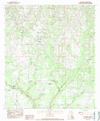 1983 Waldheim1984 Print · USGSSt. Tammany Parish in the early eighties centers on rural communities and spiritual landmarks along the Bogue Falaya. Genealogists and historians can trace family roots at Fivemile Still Cem, visit St Scholastica Priory, or locate the old Lee Road Sch.
 - 1983 Map of Martinville, 1984 Print
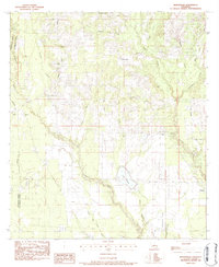 1983 Martinville1984 Print · USGSSt. Tammany Parish in the early 1980s remains a landscape of quiet communities and numerous winding waterways. Genealogists and local historians can locate many rural landmarks, from the St Johns Cem and Wilke Cem to Camp Covington and Lake Ramsay.3 unique versions available
 - 1983 Map of Ponchatoula, 1984 Print
 1983 Ponchatoula1984 Print · USGSThe Lake Pontchartrain Basin and the River Parishes come into focus during the early 1980s, showcasing the region's complex water-dependent geography. Researchers can trace the rail routes of the Illinois Central Gulf Railroad and explore landmarks from Pass Manchac to Donaldsonville.2 unique versions available
End of results
Showing maps 1-4 of 4
Top cities near Covington
- Mandeville historical maps
- Abita Springs historical maps
- Madisonville historical maps
- Folsom historical maps
- Sun historical maps
Frequently asked questions
- What are the different types of historical maps available for Covington?
- What is the oldest map of Covington?
- Where can I purchase historical maps of Covington for my home or office?
- Where can I download high-res historical maps of Covington?
- Are there historical topographic maps available for Covington?
- Is there historical aerial imagery available for Covington?
- Where are historical maps of Covington sourced from?