Old Maps of Spring Hill Neighborhood, St. Tammany Parish for Hiking & Exploration
Hike through history with 15 historic maps of Spring Hill Neighborhood. Explore old trails, ghost towns, and forgotten backroads — perfect for outdoor adventurers and local explorers.
- Rediscover forgotten places: Map out old mining camps, roads, and footpaths that no longer exist on modern maps.
- Layer with modern tools: Combine with LiDAR or satellite views to plan hikes through historical terrain.
- Made for exploration: Popular among hikers, overlanders, and local history lovers.
Use these maps to find adventure and explore the hidden past of Spring Hill Neighborhood.
Spring Hill Neighborhood, St. Tammany Parish maps
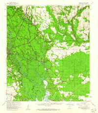
(15)- 1914 Map of Nicholson, 1957 Print
 1914 Nicholson1957 Print · USGSCovers Spring Hill Neighborhood, including Slidell, Picayune, and other nearby areas2 unique versions available
 - 1921 Map of Nicholson
 1921 Nicholson1921 Print · USGSCovers Spring Hill Neighborhood, including Slidell, Picayune, and other nearby areas
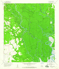
 - 1950 Map of Haaswood
 1950 Haaswood1950 Print · USGSCovers Spring Hill Neighborhood, including Slidell, Pearl River, and other nearby areas
 - 1953 Map of Mobile, 1968 Print
 1953 Mobile1968 Print · USGSCovers Spring Hill Neighborhood, including New Orleans, Mobile, and other nearby areas3 unique versions available
 - 1954 Map of Haaswood
 1954 Haaswood1954 Print · USGSCovers Spring Hill Neighborhood, including Slidell, Pearl River, and other nearby areas
 - 1957 Map of Mobile
 1957 Mobile1957 Print · USGSCovers Spring Hill Neighborhood, including New Orleans, Mobile, and other nearby areas3 unique versions available
 - 1959 Map of Nicholson, 1960 Print
 1959 Nicholson1960 Print · USGSCovers Spring Hill Neighborhood, including Slidell, Picayune, and other nearby areas3 unique versions available
 - 1959 Map of Haaswood, 1960 Print
 1959 Haaswood1960 Print · USGSCovers Spring Hill Neighborhood, including Slidell, Pearl River, and other nearby areas4 unique versions available
 - 1960 Map of Mobile
 1960 Mobile1960 Print · USGSCovers Spring Hill Neighborhood, including New Orleans, Mobile, and other nearby areas
 - 1963 Map of Mobile
 1963 Mobile1963 Print · USGSCovers Spring Hill Neighborhood, including New Orleans, Mobile, and other nearby areas
 - 1965 Map of Mobile
 1965 Mobile1965 Print · USGSCovers Spring Hill Neighborhood, including New Orleans, Mobile, and other nearby areas
 - 1982 Map of Gulfport, 1983 Print
 1982 Gulfport1983 Print · USGSCovers Spring Hill Neighborhood, including New Orleans, Gulfport, and other nearby areas2 unique versions available
 - 1984 Map of Mobile
 1984 Mobile1984 Print · USGSCovers Spring Hill Neighborhood, including New Orleans, Mobile, and other nearby areas3 unique versions available
 - 1993 Map of Haaswood, 1995 Print
 1993 Haaswood1995 Print · USGSCovers Spring Hill Neighborhood, including Slidell, Pearl River, and other nearby areas2 unique versions available
 - 1998 Map of Haaswood, 2000 Print
 1998 Haaswood2000 Print · USGSCovers Spring Hill Neighborhood, including Slidell, Pearl River, and other nearby areas
End of results
Showing maps 1-15 of 15
Frequently asked questions
- What are the different types of historical maps available for Spring Hill Neighborhood?
- What is the oldest map of Spring Hill Neighborhood?
- Where can I purchase historical maps of Spring Hill Neighborhood for my home or office?
- Where can I download high-res historical maps of Spring Hill Neighborhood?
- Are there historical topographic maps available for Spring Hill Neighborhood?
- Is there historical aerial imagery available for Spring Hill Neighborhood?
- Where are historical maps of Spring Hill Neighborhood sourced from?