Old Maps of Marceaux, Louisiana for Hiking & Exploration
Hike through history with 15 historic maps of Marceaux. Explore old trails, ghost towns, and forgotten backroads — perfect for outdoor adventurers and local explorers.
- Rediscover forgotten places: Map out old mining camps, roads, and footpaths that no longer exist on modern maps.
- Layer with modern tools: Combine with LiDAR or satellite views to plan hikes through historical terrain.
- Made for exploration: Popular among hikers, overlanders, and local history lovers.
Use these maps to find adventure and explore the hidden past of Marceaux.
Marceaux, LA maps
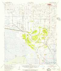
(15)- 1946 Map of Schooner Bayou NW
 1946 Schooner Bayou NW1946 Print · USGSCoastal Vermilion Parish in the mid-1940s reveals a landscape defined by marsh management and early infrastructure. Genealogists and local historians can locate Marceaux Sch and trace the paths of Warren Trail and the Intracoastal Waterway.
 - 1954 Map of Schooner Bayou NW
 1954 Schooner Bayou NW1954 Print · USGSCoastal Vermilion Parish is shown here during the mid-1950s, a period defined by the expansion of marshland waterways and local infrastructure. Researchers can locate the rural Marceaux Sch, trace the path of the Warren Trail, and see the early route of the Intracoastal Waterway.
 - 1954 Map of Port Arthur
 1954 Port Arthur1954 Print · USGSThe Texas and Louisiana coastlines meet here in the mid-fifties, showing the industrial rise of Port Arthur alongside vast wildlife preserves. Researchers can trace remote coastal settlements and infrastructure like Pecan Island, the Sabine Pass Lighthouse, and the North Island School.
 - 1955 Map of Forked Island, 1956 Print
 1955 Forked Island1956 Print · USGSCoastal Vermilion Parish marshlands come to life in the 1950s, showing the intersection of new industry and old maritime routes. Genealogists can trace family roots through sites like St Davids Ch, Hebert Cem, and the private airstrips at Kaplan.2 unique versions available
 - 1956 Map of Port Arthur, 1965 Print
 1956 Port Arthur1965 Print · USGSThe Texas and Louisiana coastlines meet here in the mid-fifties, showing a landscape of sprawling marshes and growing refinery towns. Genealogists and historians can trace ridge settlements like Grand Cheniere or find the Sabine Pass Lighthouse and Pecan Island.3 unique versions available
 - 1958 Map of Port Arthur
 1958 Port Arthur1958 Print · USGSThe Texas and Louisiana coastlines meet in the late fifties at the busy industrial port of Port Arthur. Historians and genealogists can trace the early rail networks of the Southern Pacific and locate coastal settlements like Cameron, Pecan Island, and Abbeville.
 - 1959 Map of Port Arthur
 1959 Port Arthur1959 Print · USGSThe Texas and Louisiana coastlines meet in this late-fifties study of a landscape defined by industry and wildlife preserves. Trace the Intracoastal Waterway past Pecan Island and Abbeville, or locate the shipping channels at Sabine Pass.
 - 1973 Map of Port Arthur, 1974 Print
 1973 Port Arthur1974 Print · USGSThe Texas-Louisiana borderlands in the early seventies reveal an intricate landscape of coastal marshes and heavy industry. Trace the growth of Port Arthur, the extent of the oil and gas fields, and old ridge settlements like Pecan Island.
 - 1979 Map of Forked Island NW, 1980 Print
 1979 Forked Island NW1980 Print · USGSCoastal Vermilion Parish in the late seventies is shown as a complex grid of water management and energy extraction. Genealogists and local historians can trace family landmarks like Broussard Cem, the Sonnier Landing Field, and a Ferry crossing the Intracoastal Waterway.
 - 1983 Map of White Lake
 1983 White Lake1983 Print · USGSCoastal Louisiana at the start of the 1980s reveals a world of remote chenier settlements and vast marshlands. Genealogists and historians can trace family locations along Grand Chenier Ridge or explore the hubs of Abbeville and Intracoastal City.2 unique versions available
 - 2012 Map of Forked Island NW, 2012 Print
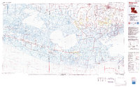
 2012 Forked Island NW2012 Print · USGSCovers Marceaux, including Vermilion Parish, United States, and other nearby areas
 - 2015 Map of Forked Island NW, 2015 Print
 2015 Forked Island NW2015 Print · USGSCovers Marceaux, including Vermilion Parish, United States, and other nearby areas
 - 2018 Map of Forked Island NW, 2018 Print
 2018 Forked Island NW2018 Print · USGSCovers Marceaux, including Vermilion Parish, United States, and other nearby areas
 - 2020 Map of Forked Island NW, 2020 Print
 2020 Forked Island NW2020 Print · USGSCovers Marceaux, including Vermilion Parish, United States, and other nearby areas
 - 2024 Map of Forked Island NW, 2024 Print
 2024 Forked Island NW2024 Print · USGSCoastal Vermilion Parish comes into focus during this 2020s survey, showing a landscape defined by industrial waterways and family homesteads. Researchers can trace land ties through local burial sites like Saint Davids Chapel Cem and family-named routes such as Len Guidry Rd.
End of results
Showing maps 1-15 of 15
Top cities near Marceaux
- Kaplan historical maps
- Gueydan historical maps
- Estherwood historical maps
- Mermentau historical maps
- Morse historical maps
Frequently asked questions
- What are the different types of historical maps available for Marceaux?
- What is the oldest map of Marceaux?
- Where can I purchase historical maps of Marceaux for my home or office?
- Where can I download high-res historical maps of Marceaux?
- Are there historical topographic maps available for Marceaux?
- Is there historical aerial imagery available for Marceaux?
- Where are historical maps of Marceaux sourced from?