Old Maps of Cravens, Louisiana
Explore 13 old maps of Cravens, spanning from 1947 to today. These high-resolution historic maps reveal how streets, neighborhoods, landmarks, and natural features evolved over time — perfect for genealogy, metal detecting, research, and local history exploration.
What you can do with these maps:
- See how Cravens changed over time: Compare historical maps to modern-day views to trace roads, homesites, rail lines & more.
- View detailed metadata: Each map includes creators, publishers, year, scale, and archive source.
- Overlay maps with satellite & LiDAR: Visualize the past alongside modern tools to explore terrain & human change.
- Trusted historical sources: Maps sourced from the USGS, Library of Congress, and other archives.
- Access maps your way: View online, download high-res files, or order prints for personal or research use.
Start exploring old maps of Cravens to uncover forgotten places, hidden landmarks, and the deep history beneath your feet.
Cravens, LA maps
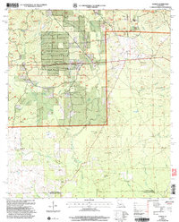
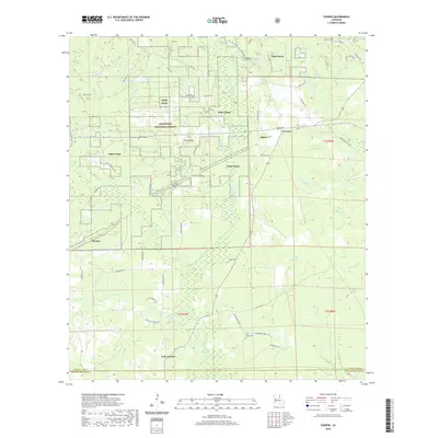
(13)- 1947 Map of Sugrue
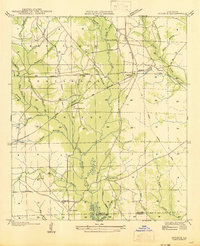 1947 Sugrue1947 Print · USGSCentral Louisiana's pine woods and logging country are shown in the late 1940s, featuring the early roads and rail lines of Vernon Parish. Researchers can trace rural life via Gravel Hill Ch, Cravens, and the extensive Old Logging Railroad.
 - 1952 Map of Lake Charles
 1952 Lake Charles1952 Print · USGSSouthwest Louisiana is captured here in the mid-fifties, showing a landscape defined by the rise of the petrochemical industry and deep-water navigation. Researchers can trace family roots through numerous small-town settlements and oil developments like Nibletts Bluff, the Lockport Oil Field, and Starks.
 - 1954 Map of Sugrue
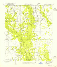 1954 Sugrue1954 Print · USGSLouisiana's timber country is captured here in the mid-1950s, showing a landscape defined by the Kisatchie National Forest and active rail lines. Researchers can trace rural life through landmarks like Gravel Hill Ch, Cole Center, and the winding Whisky Chitto Creek.
 - 1954 Map of Lake Charles, 1964 Print
 1954 Lake Charles1964 Print · USGSSouthwest Louisiana in the mid-fifties is defined by its massive petroleum industry and its complex network of bayous and rail lines. Researchers can trace the development of the Sulphur Mines Oil Field or locate historic settlements like Longville and De Quincy.3 unique versions available
 - 1961 Map of Sugartown, 1963 Print
 1961 Sugartown1963 Print · USGSCentral Louisiana in the early sixties was a landscape of timber stands and winding creek bottoms along the Vernon and Beauregard Parish border. Genealogists and historians can trace rural life through landmarks like Lone Star Sch, Wisby Memorial Ch Cem, and the Sugartown Lookout Tower.2 unique versions available
 - 1986 Map of Sugrue
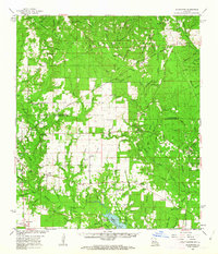
 1986 Sugrue1986 Print · USGSWithin the pine woods of Vernon Parish in the mid-1980s, these forest lands reveal scattered settlements and rural landmarks. Researchers can trace local homesteads and industry through labels for Cole Central, the Gravel Pit, and the winding Whisky Chitto Creek.2 unique versions available
 - 1986 Map of DeRidder
 1986 DeRidder1986 Print · USGSThe Louisiana-Texas borderlands come to life in the mid-eighties, showcasing the timber country and rail corridors of the Sabine River valley. Researchers can trace the legacy of small communities and transit lines through Merryville, Holly Springs, and the Missouri Pacific railroad.2 unique versions available
 - 2004 Map of Sugrue, 2005 Print
 2004 Sugrue2005 Print · USGSThe Vernon Parish pinewoods and creek bottoms are documented here at the turn of the twenty-first century. Researchers can locate remote rural landmarks including Cravens, the Wisby Memorial Cem, and the Lone Star Ch near Horse Branch.
 - 2012 Map of Sugrue, 2012 Print
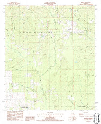
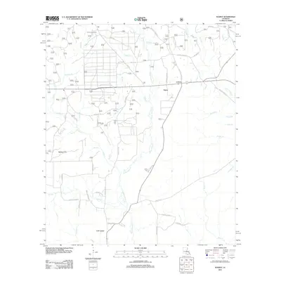 2012 Sugrue2012 Print · USGSCovers Cravens, including Cole Central, Sugrue, and other nearby areas
 - 2015 Map of Sugrue, 2015 Print
 2015 Sugrue2015 Print · USGSCovers Cravens, including Cole Central, Sugrue, and other nearby areas
 - 2018 Map of Sugrue, 2018 Print
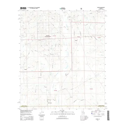
 2018 Sugrue2018 Print · USGSCovers Cravens, including Cole Central, Sugrue, and other nearby areas
 - 2020 Map of Sugrue, 2020 Print
 2020 Sugrue2020 Print · USGSCovers Cravens, including Cole Central, Sugrue, and other nearby areas
 - 2024 Map of Sugrue, 2024 Print
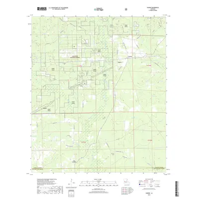
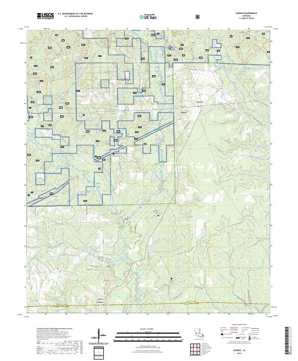 2024 Sugrue2024 Print · USGSThe pine forests of Vernon Parish are captured here during the recent expansion of military and forestry land use. Genealogists and historians can trace family sites at Gravel Hill Cem and Wisby Memorial Cem or locate the Old Railroad Gr near Sugrue.
End of results
Showing maps 1-13 of 13
Top cities near Cravens
Frequently asked questions
- What are the different types of historical maps available for Cravens?
- What is the oldest map of Cravens?
- Where can I purchase historical maps of Cravens for my home or office?
- Where can I download high-res historical maps of Cravens?
- Are there historical topographic maps available for Cravens?
- Is there historical aerial imagery available for Cravens?
- Where are historical maps of Cravens sourced from?